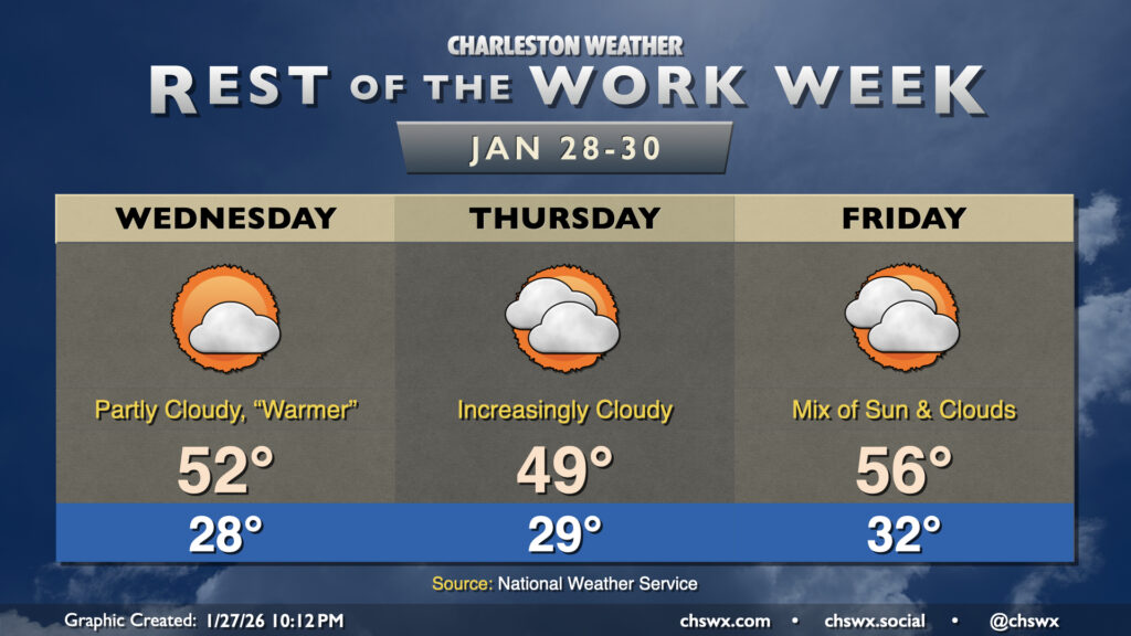
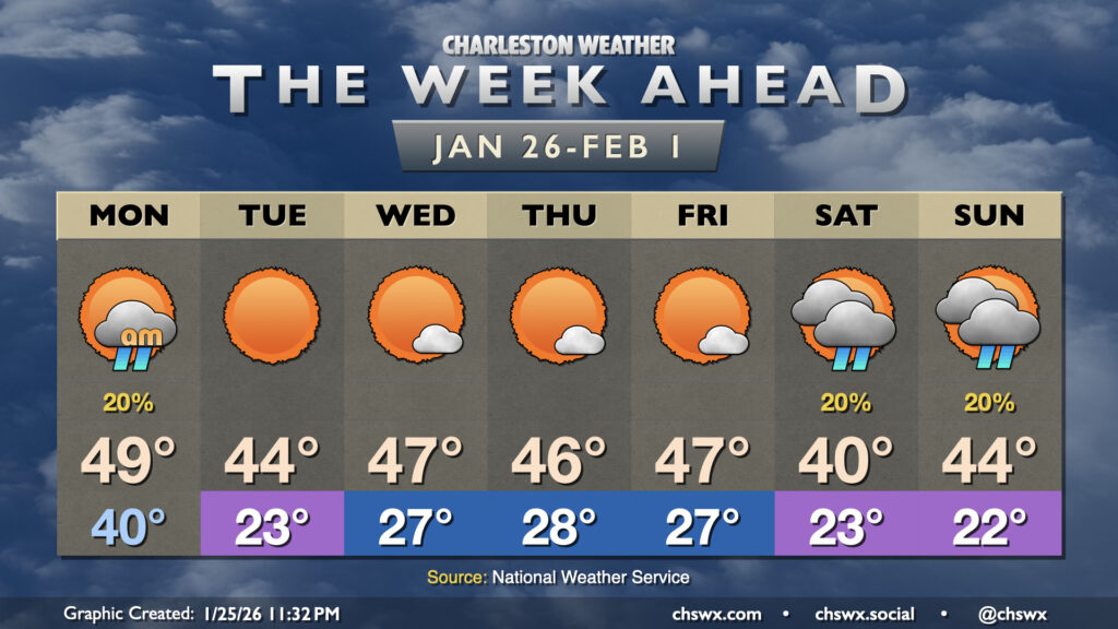
While it won’t be quite as chilly as Tuesday was, the rest of the week will continue to feature below-normal temperatures as Arctic air continues its residence across the area. Wednesday starts in the upper 20s, warming to the low 50s in the afternoon under a mix of sun and clouds. A dry front will sag south across the area Thursday, which will cool things off and cloud up the skies a little bit. Temperatures Thursday once again start in the upper 20s, warming to the upper 40s to about 50° in the afternoon. The cloud cover insulates us a bit overnight Thursday into Friday, with lows only dropping to the low 30s (and staying above freezing toward the coast). Highs Friday warm to the mid-50s as more onshore flow takes over.
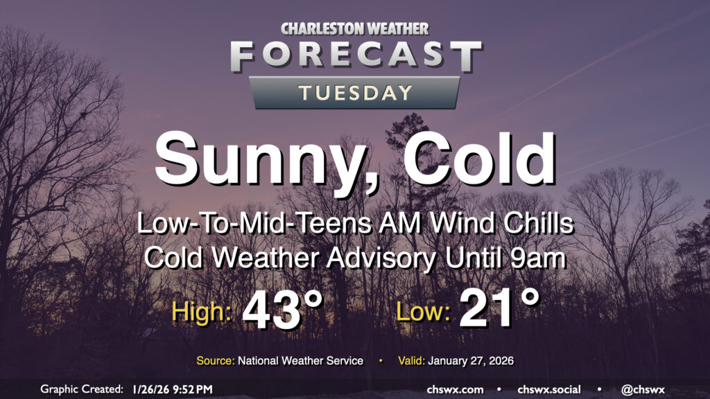
Tuesday will get off to a very cold start across the area as Arctic air continues to spill in, sending air temperatures to the low 20s and maybe even some upper teens further inland. Northerly winds around 5-10 MPH will make it feel closer to the low-to-mid-teens in the morning, prompting a Cold Weather Advisory that will run until 9am. Bundle up carefully and with plenty of layers for heading out to work or school as this is bitter cold for this part of the world. With cold air continuing to blow in, highs on Tuesday only peak in the low-to-mid-40s despite plenty of sunshine. This is well below normal for late January — climatological average high temperatures are around 61° at this point in the still-young year. Stay warm!