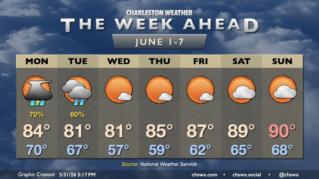
Meteorological summer begins on Monday, but it isn’t going to feel much like it for a few days with unsettled weather to start and cool high pressure for midweek before temperatures rebound toward 90° by the weekend.
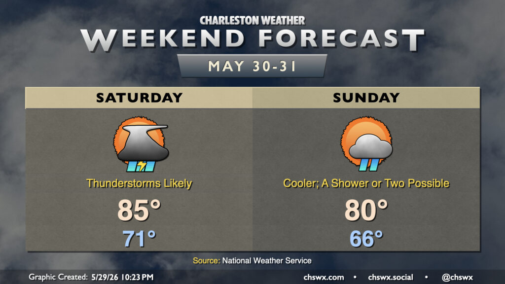
Rain spreads back into the Lowcountry on Saturday as a stationary front buckles back northward across the area. A bit of upper-level energy will also kick in some lift, and that’ll result in scattered to numerous showers and thunderstorms at times on Saturday. Right now it looks like the best chances will be found in the morning through early afternoon hours, but a shower or storm just can’t be ruled out during any part of the day. Temperatures will start in the low 70s, warming to the mid-80s in the afternoon at best.
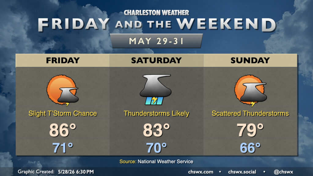
A cold front pushing southward overnight will stall out to our southwest, pushing some drier air into the area in the meantime and cooling things off a few degrees compared to the past few days. Friday still starts in the low 70s, but still a few degrees cooler than Thursday. Temperatures will head to the mid-80s in the afternoon with a few showers or storms possible midday, but otherwise, expect a quieter weather day compared to Thursday’s rambunctious thunderstorms which brought some much-needed rain to the Highway 17 corridor and points east.