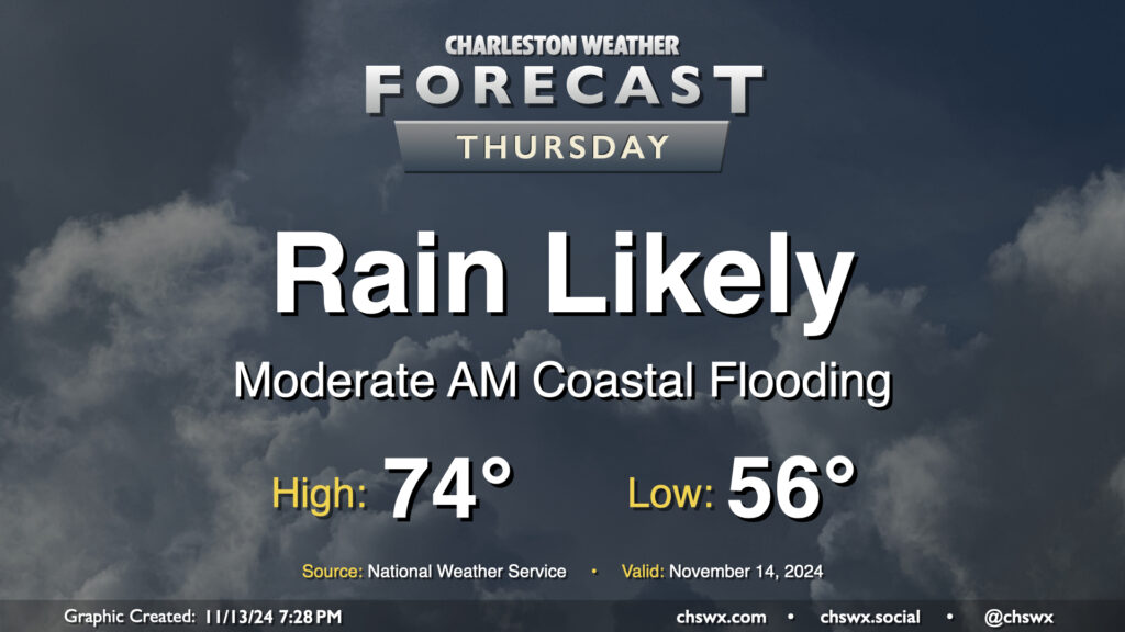
Thursday figures to be a somewhat wet day at times across the Lowcountry, starting with salt water flooding downtown and ending up with showers across much of the area by evening.
First, the salt water flooding: Water levels around 7.9′ MLLW are expected with the 6:07am high tide Thursday. This will produce fairly widespread coastal flooding in downtown Charleston, and should also affect Long Point Road and parking areas around Shem Creek in Mt. Pleasant. Expect numerous road closures early on in the commute, with improving conditions heading into 8-9am. Be alert to detours around the aforementioned road closures, and never cross through floodwaters even if a road is closed — remember, this is all going to be salt water and that is incredibly not good for your car’s undercarriage!
The risk for showers should, thankfully, miss the worst of the salt water flooding. It will begin to kick up around mid-morning to midday, with the best chance of showers on Thursday afternoon into the early evening hours. Rainfall amounts should generally stay under a half-inch in most spots, but locally higher amounts are possible where heavier showers develop. Temperatures start in the mid-50s, topping out in the mid-70s early in the afternoon.
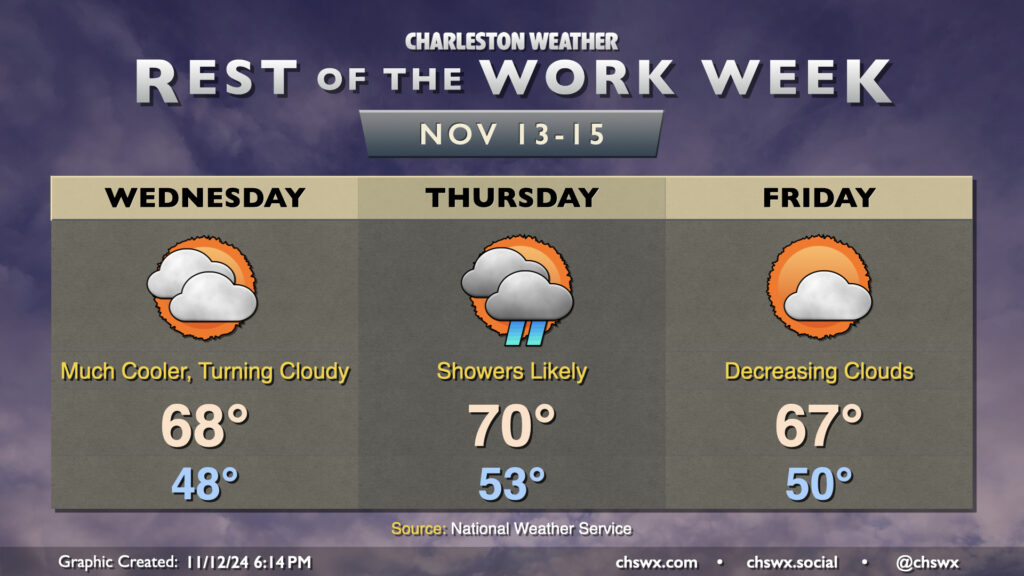
Cooler and drier air will push in overnight as high pressure wedges into the area from the north. This will make for a much cooler day on Wednesday than we’ve had in quite some time, with lows in the upper 40s in many spots away from the coast expected in the morning. High temperatures should only peak in the upper 60s as cooler air moves in. Increasing cloud cover as the day will also assist in keeping temperatures a little lower, too.
High pressure will break down Thursday as a cold front approaches, driving up the risk for showers particularly from midday into early evening. We’ll start the day in the low 50s, warming to around 70° in the afternoon. Rain should generally be on the light side, though some pockets of heavier rain can’t be totally ruled out, either.
The front clears the area for Friday, and cloud cover scours out during the day as a result. Temperatures, though, will once again struggle to the mid-to-upper 60s as cool air behind the front continues to push in. This sets the stage for a seasonably nice weekend, though, with lots of sunshine expected. Expect highs in the upper 60s Saturday, with low 70s returning for Sunday, right around where we should be at the midpoint of November.
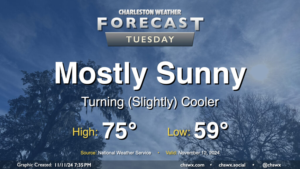
A front swinging through tonight will help start a cooldown across the area that will bring temperatures more in line with where they should be for this point in the year. Lows on Tuesday start in the upper 50s to around 60°, with highs only heading to about the mid-70s despite mostly sunny skies. Drier air will be moving in throughout the day, especially as winds start to go around to the northeast, and it should overall feel pretty nice especially given the recent swampiness that’s characterized November thus far.
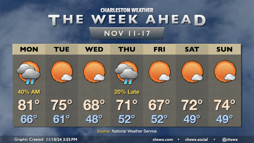
A couple fronts this week will finally restore some order to temperatures that have been well above normal to start November. But first, we’ll get one more day in the 80s on Veterans Day with scattered showers to start the day, which will gradually taper by evening as a cold front moves through the area. This front helps knock temperatures back down to the low 60s Tuesday morning, warming to about the mid-70s in the afternoon under mostly sunny skies.
High pressure to the north will then shift a little eastward, allowing for a wedge pattern with northeasterly winds to start to take shape. This will drive temperatures down to — if not slightly below — normal for Wednesday. We’ll start the day sharply cooler — think upper 40s to around 50° — before warming to the upper 60s, once again under mostly sunny skies.
Another front swings through on Thursday. We’ll turn a little warmer ahead of it, and there may be a few showers associated with it. We start Thursday in the low 50s, warming to the low 70s in the afternoon.
Cooler and drier air behind the front moves in for Friday, and we see highs once again running a touch below normal (upper 60s). The airmass moderates a bit heading into the weekend, which looks quite seasonable and nice with lows in the upper 40s yielding to highs in the low 70s each afternoon under mostly sunny skies.