Tuesday: Turning a little cooler (and sunnier)
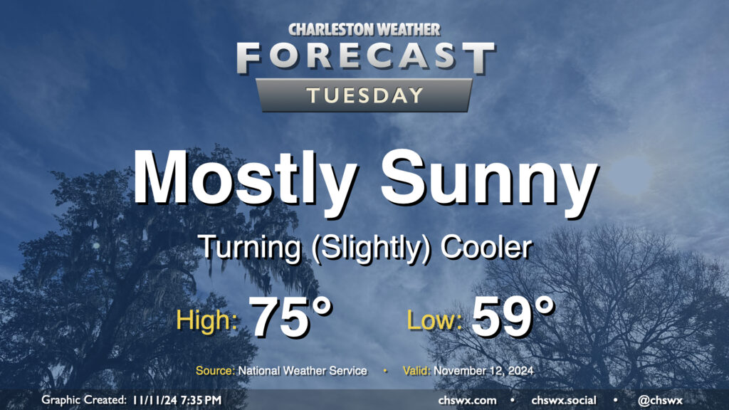
A front swinging through tonight will help start a cooldown across the area that will bring temperatures more in line with where they should be for this point in the year. Lows on Tuesday start in the upper 50s to around 60°, with highs only heading to about the mid-70s despite mostly sunny skies. Drier air will be moving in throughout the day, especially as winds start to go around to the northeast, and it should overall feel pretty nice especially given the recent swampiness that’s characterized November thus far.
Rest of the work week: Temperatures dip below normal; showers late Thursday
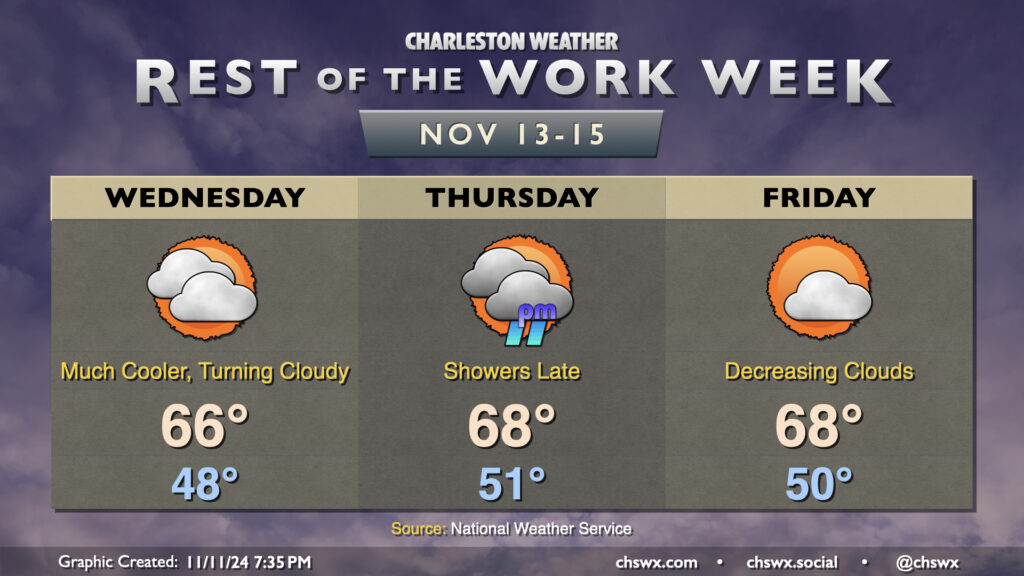
We wake up on Wednesday another 10° cooler than we did on Tuesday, with lows in the upper 40s — right around where we should be for this point in the year. Persistent northeasterly winds — which will be a little breezy at times — will combine with an increase in cloud cover to help keep temperatures pinned to the mid-60s in the afternoon. A hoodie or somesuch ain’t a bad idea (and will be quite a change!)
Cloud cover persists on Thursday ahead of another front, which may squeeze out some showers Thursday evening into very early Friday morning. Temperatures don’t change a whole lot — expect lows around 50° to warm to the upper 60s in the afternoon.
The front gets through Friday morning, and we’ll see cloud cover decrease throughout the day. Temperatures will remain seasonable and within striking distance of normal, with lows around 50° yielding to highs in the upper 60s once again for Friday. This will continue for Saturday as well before we start to see temperatures moderate a little (back to the low 70s) for Sunday, with plenty of sunshine throughout.
Follow my Charleston Weather updates on Mastodon, Bluesky, Instagram, Facebook, or directly in a feed reader. Do you like what you see here? Please consider supporting my independent, hype-averse weather journalism and become a supporter on Patreon for a broader look at all things #chswx!