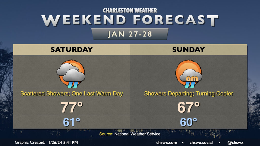
After setting a daily high temperature record and tying the monthly high temperature record for January today, we have one more warm day for Saturday before a front brings temperatures back down to earth on Sunday. We start Saturday in the low 60s once again before warming to the mid-to-upper 70s in the afternoon. Scattered showers should be a factor ahead of the aforementioned front, but coverage won’t really amount to much until we get into the overnight as the front moves by. Showers will taper off early Sunday morning, and as cooler and drier air moves in behind the cold front, cloud cover will break up. Temperatures will be held to the mid-to-upper 60s as gusty west winds — perhaps with gusts approaching 30 MPH in the early afternoon — blow into the area. More normal temperatures return for next week, with a stretch of quiet weather expected to close January and start February.
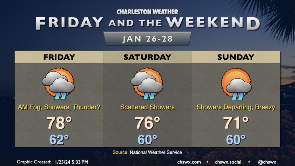
More warm and occasionally unsettled weather is on the way for Friday and the weekend. Lows will continue to run where January normal highs should be, and highs will still run well above normal, especially Friday and Saturday. In fact, Friday’s forecast high of 78° gets close to the record high of 80° set in 1950. The warm starts will lend themselves nicely to fog potential in the mornings, and sea fog may be persistent throughout the day as the warmer air overtops the much cooler waters.
Showers remain in the forecast as well as we stay within the warm sector of a stalled out frontal system. Friday could even feature a few thunderstorms, but severe weather is not anticipated. Saturday will once again feature a scattering of showers and maybe a rumble of thunder as well. A stronger front will push into the area on Sunday, pushing through later in the day to clear us out and cool us off. Showers and a few thunderstorms will be possible ahead of this front as well early in the day, but once the front is through — generally thinking early to mid-afternoon — the shower threat will end, cloud cover will decrease, and dewpoints will begin to fall.
Much more seasonable weather returns to the area starting Monday, with generally quiet conditions through at least Thursday.