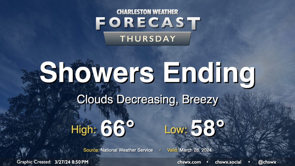
Showers will be coming to an end Thursday morning, yielding a quiet and increasingly warm period for Good Friday and Easter weekend. We should see the rain exit the area by midday, and from there, cloud cover will diminish. It’ll be a cool day in the wake of a cold front; expect highs to only top out in the mid-60s in the afternoon. The breeze will kick up at times as cooler air moves into the area behind the front as well, but it shouldn’t be too terribly gusty, either.
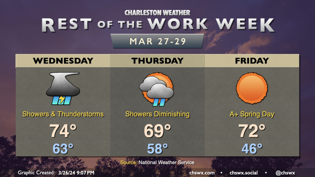
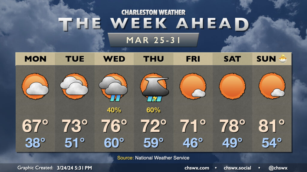
Rain chances peak on Wednesday as a front stalls nearby before moving through overnight. Showers and a few thunderstorms will generally be the rule for much of the day, though it may not rain all day at any one spot. Cloud cover will be prevalent, which will keep lows in the low 60s in the morning. Warm air pumping in ahead of the front will allow temperatures to top out in the mid-70s despite the thick cloud cover and rain in the area. The best chance of any heavier rain looks to be later Wednesday evening into the overnight as the front presses in. Right now, a major flooding threat doesn’t seem to be in the cards, but some ponding of water is certainly possible in spots.
Showers diminish as we head through Thursday, and we should be mostly clear by the end of the day. Post-cold front, temperatures will peak just in the upper 60s, a few degrees below normal for late March. This yields an absolutely beautiful Good Friday across the Lowcountry — we start in the mid-40s and warm to the low 70s in the afternoon under full sunshine. A warming trend follows into Easter weekend, and we should be in the low 80s for a spell starting Easter Sunday.
The final week of March gets off to a chilly start, followed by another round of showers and thunderstorms, before an Easter weekend warmup that should find us getting back into the 80s before it’s over.