Turning unsettled for Christmas into Tuesday
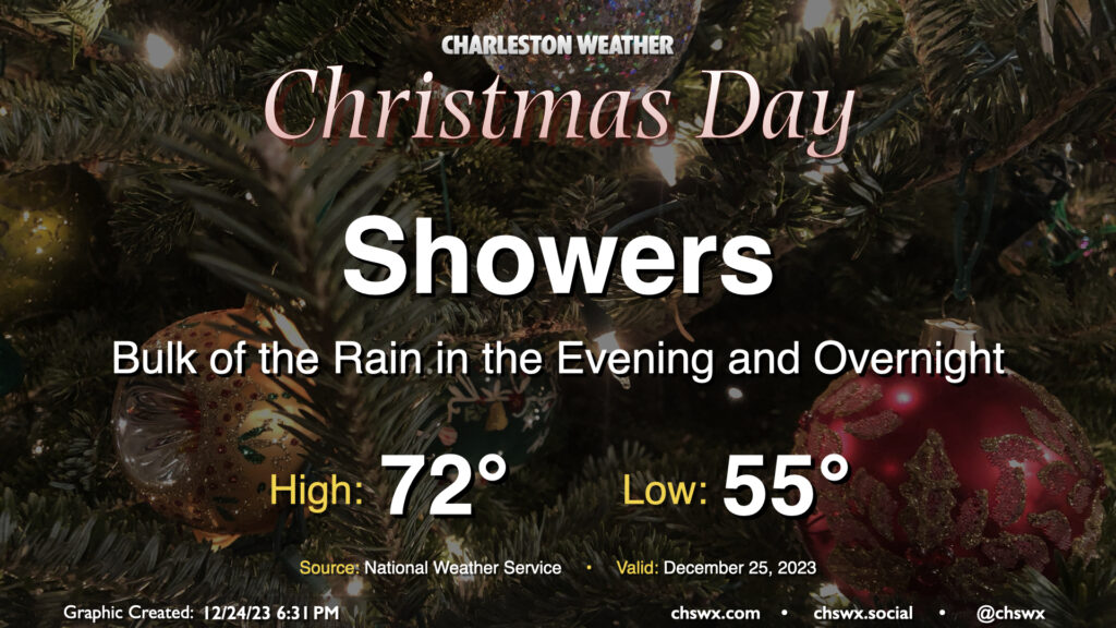
Unsettled weather arrives for Christmas as a complex and sprawling storm system begins to affect the area. We should see a few scattered showers in the morning through early afternoon, but expect shower coverage and intensity to tick up as we get further into the afternoon and evening hours. Temperatures on Christmas will run much warmer than climatology, though not into record territory. Expect lows in the mid-50s to yield to the low 70s in the afternoon before rain starts to kick in.
Water levels in Charleston Harbor look to reach flood stage (7′ MLLW) with the 6:30am high tide. This will put some salt water on some of the more vulnerable roads in Downtown Charleston, but no rain is expected to coincide, limiting the breadth of any flooding threat.
After Christmas: Heavy rain, flooding possible Tuesday; quieting down and cooling off thereafter

Showers and thunderstorms will be ongoing overnight Monday into much of Tuesday with periods of heavy rain possible as low pressure develops along the Gulf Coast and starts to move northeast across Georgia and eventually the Carolinas. Onshore flow on Tuesday morning will once again push tidal departures into flood stage, with a peak tide of 7.1′ expected around 7:14am. We’ll need to keep a close eye on where rain is setting up around that time as heavy rain on top of that tide could broaden and worsen flooding impacts in Downtown Charleston. While a repeat of last Sunday’s nor’easter water levels is extraordinarily unlikely, there will be the potential for some travel disruption downtown. Stay tuned to forecast updates for your Tuesday morning commute.
Off and on downpours along with some embedded thunderstorms will continue for much of Tuesday before tapering down well after sunset. We’ll warm to about 70° in the afternoon as warm and humid air persists across the area. Slow improvement begins Wednesday as some drier air in the wake of the low begins to work into the area, bringing cloud cover down a notch. It’ll remain quite unseasonably warm, though, with lows in the mid-to-upper 50s yielding to highs near 70° in the afternoon. A secondary front will come through Thursday, and this will begin to knock temperatures down closer to normal. Expect lows in the upper 40s and highs in the low 60s in the afternoon. Friday turns even cooler, with lows in the upper 30s expected to yield to just highs in the mid-50s as a cutoff mid-level low meanders into the area. This cool air will hang around as we head into New Year’s celebrations over the weekend — fortunately, devoid of precipitation.
Follow my Charleston Weather updates on Mastodon, Bluesky, Instagram, Facebook, or directly in a feed reader. Do you like what you see here? Please consider supporting my independent, hype-averse weather journalism and become a supporter on Patreon for a broader look at all things #chswx!