Sunday’s forecast: More warmth, some fog, and maybe some showers
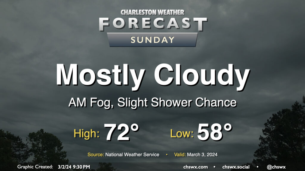
Clouds will continue to hang around on Sunday with the specter of a shower or two remaining in the forecast. We’ll likely start the day with patches of potentially dense fog at times, so be ready for low visibility in the morning. The fog’s expected to mix out shortly after daybreak, leaving behind generally overcast to mostly cloudy skies for the remainder of the day. It’ll be a warm start, with temperatures in the upper 50s yielding to highs in the low 70s in the afternoon. As mentioned, a few showers are possible, but it’s quite possible that much of us get the day in rain-free. Still not a terrible idea to keep rain gear handy, though, just in case.