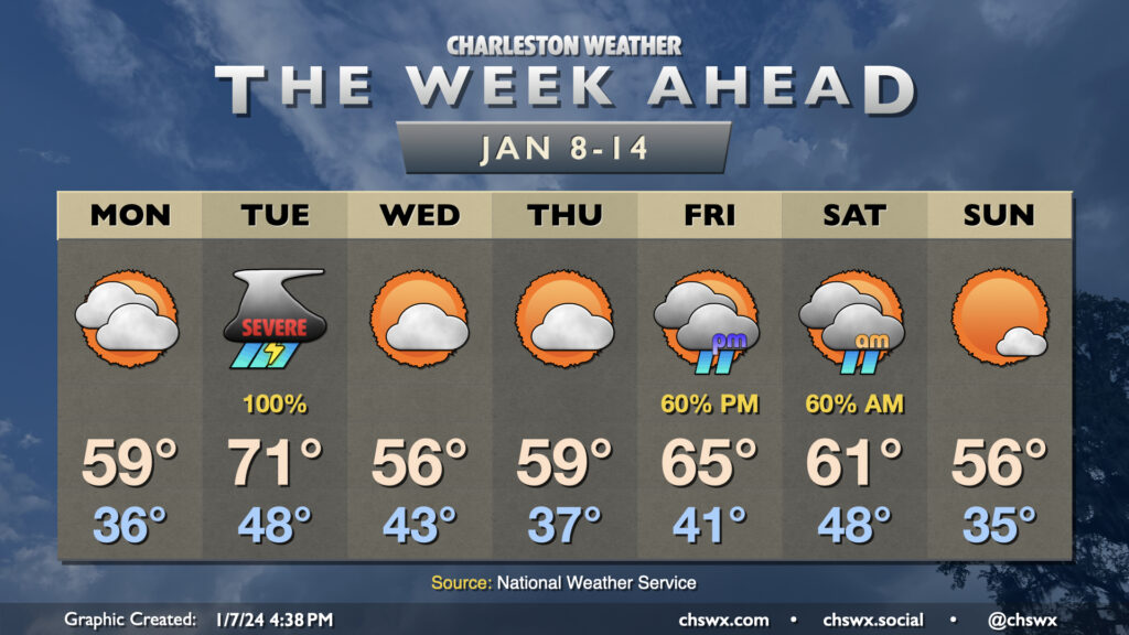
The active weather pattern we’ve found ourselves in for the start of the year continues this week as we’ll see at least two storm systems visit the area, with quiet and generally cool weather days interspersed between them.
Monday will feature increasing clouds and a steady east to northeast breeze as high pressure wedges southward. We start the day in the mid-30s and warm to around 60° in the afternoon with clouds steadily increasing ahead of Tuesday’s storm system. Late Monday, a warm front will lift north of the area, which may bring some scattered showers along with it, but we should get much of the daylight hours, if not all of them, in rain-free.
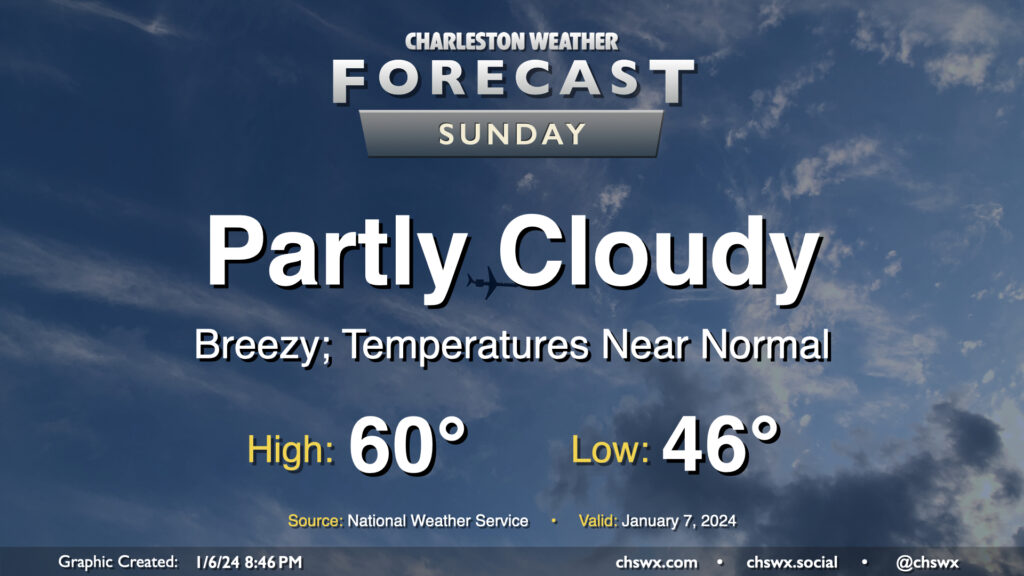
After a rather warm Saturday — the warmest day of the young year so far with a high of 75° — temperatures return to normal on Sunday as cooler and drier air blows in behind a cold front. We start the day in the mid-40s, but the ongoing cool air advection will hold highs to around 60° in the afternoon despite partly cloudy to mostly sunny skies. It’ll be another breezy day; expect winds generally 10-15 MPH out of the west with gusts approaching 25-30 MPH once again.
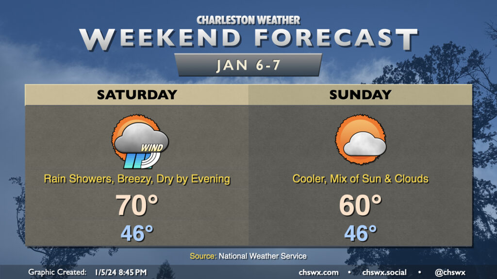
We’ll likely be waking up to rain Saturday morning as a storm system moves through the area. Rain could be heavy at times, with a half-inch to an inch of rain possible in many spots. It’ll be windy, too: gusts to 30-35 MPH will be possible, so batten down the hatches if you have rain-or-shine outdoor events. The bulk of the rain should exit by early afternoon, though guidance does suggest some wrap-around moisture may keep a few showers around through early evening. From there, we should dry out. Temperatures during the day will be as warm as they’ve been so far in the small sample size of 2024: expect lows in the mid-40s to yield to highs near 70° in the afternoon as warm air advects into the area.
Sunday will be a quieter weather day, with cooler and somewhat drier air working into the area in the wake of Saturday’s storm system. Expect to start the day in the mid-40s with breezy westerly winds keeping highs capped to around 60° in the afternoon under a mix of sun and clouds.
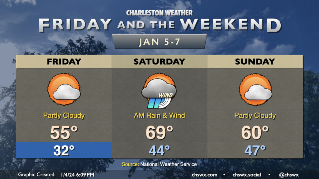
The recent spate of quick-hitting storms continues over the weekend. Friday will get off to a chilly start, with lows around freezing in the metro and likely lower further inland. Highs head to the mid-50s under mostly sunny to partly cloudy skies. Clouds will be increasing late as a Gulf storm system approaches the area, but we get the vast majority of Friday in rain-free.
Showers look to begin around midnight and will last through Saturday morning. Many spots should see an inch or more of rain, with a few spots pushing 1.5-2″. There will be the risk for a few rumbles of thunder, but no severe weather is expected. Rain should depart by mid-afternoon, so it’s not an all-day washout. Saturday will also be notable for how warm it will be: we start the day in the mid-40s and warm to near 70° in the afternoon as we remain in the warm sector of the storm system, about as warm as we’ve been in 2024’s short time.
The storm system’s cold front swings through late Saturday/early Sunday and yields a quiet end to the weekend. Lows in the mid-to-upper 40s will yield to highs around 60° in the afternoon under partly cloudy skies. Quiet weather continues Monday, though a potent storm system looks to affect the area on Tuesday with strong, gusty winds, heavy rain, and maybe some severe weather — stay tuned.
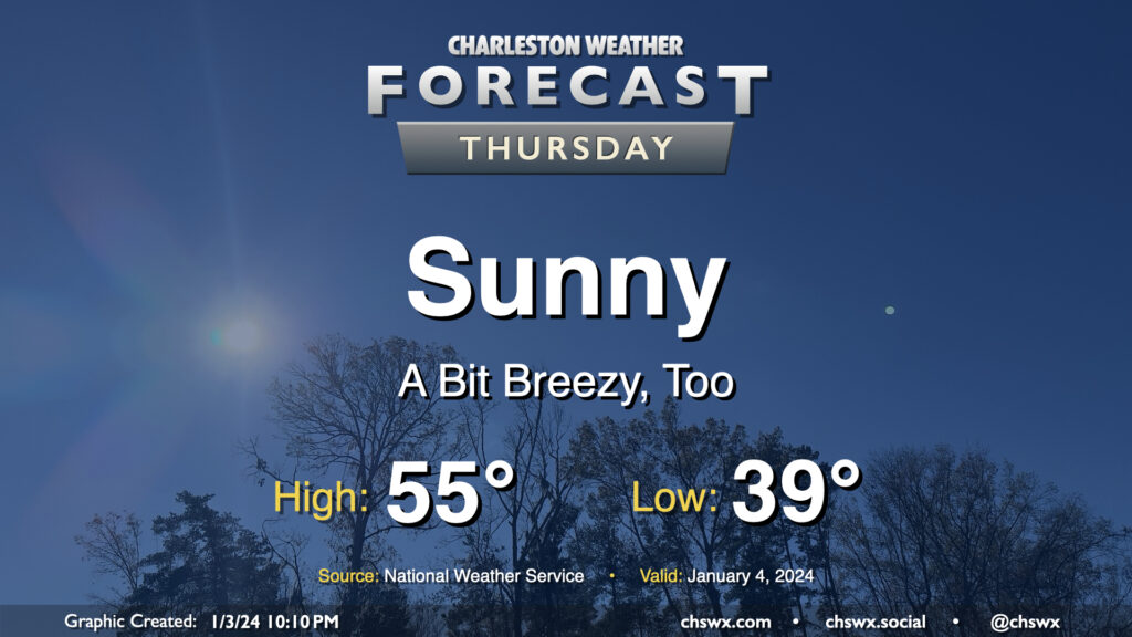
A brief round of rain on Wednesday night will depart the area by daybreak Thursday, leaving behind a little bit cooler air as well as unfettered sunshine. We start the day in the upper 30s to around 40° before warming to the mid-50s in the afternoon — a few degrees below early January normals (60°). It’ll be a little breezy, with winds out of the north and northwest around 10-15 MPH, which will be a contributor to keeping high temperatures below normal despite all the sunshine.