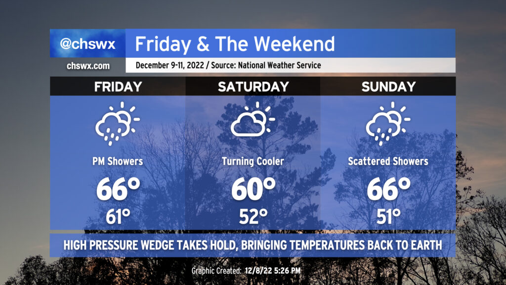
Alas: Gray days are here again for the weekend as a wedge of high pressure drives southward across the area on Friday. We’ll see a few showers push through the area Friday morning as the wedge settles in, then more moisture will move by in the afternoon to bring another round of generally light rain. Temperatures won’t move too much beyond the morning low of 61°, with highs only in the mid-60s anticipated as cooler air moves in throughout the day (and rainfall into the wedge helps reinforce said wedge).
We’ll have a lull in the rain on Saturday, but high temperatures will generally run below normal under mostly cloudy skies, with the air struggling to warm to 60° in the afternoon. Then, another round of showers will roll through Sunday. We should see the wedge erode on Sunday as another front approaches from the north, but the degree to which this happens during the day makes the temperature forecast interesting. For now, mid-60s are in the forecast for the Charleston metro, but don’t be surprised to see this revised lower with later updates. I also wouldn’t be surprised for temperatures to not make it out of the 50s further north into Berkeley County around the Francis Marion and Lake Moultrie. Stay tuned!
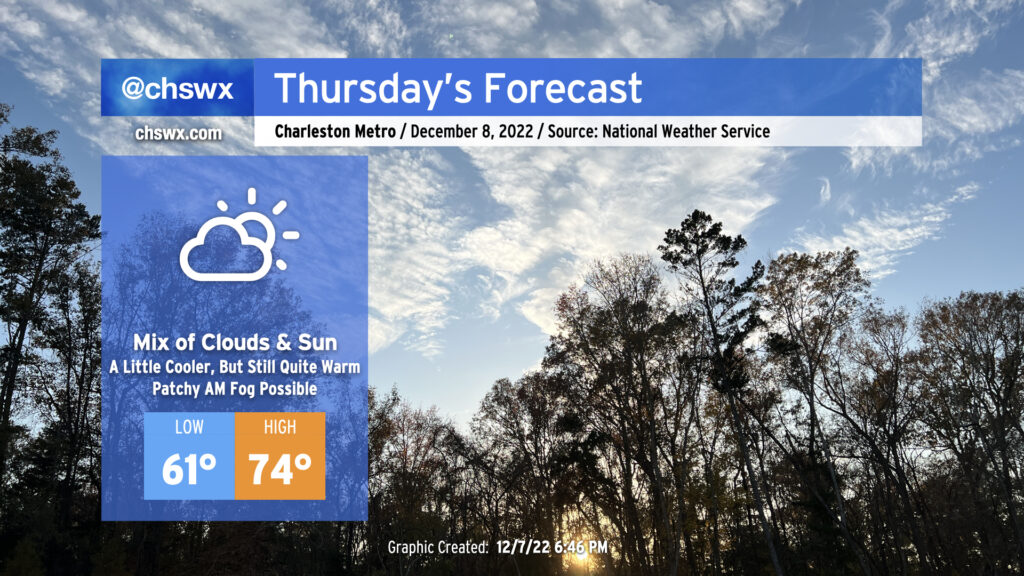
After tying a record high on Wednesday (81°!), we’ll see a cold front approach our area for Thursday. The associated cloud cover will help prevent us from getting back to record warmth, but we’ll still see highs peak in the mid-70s — perhaps higher if the front struggles to get further south. We should remain rain-free, however.
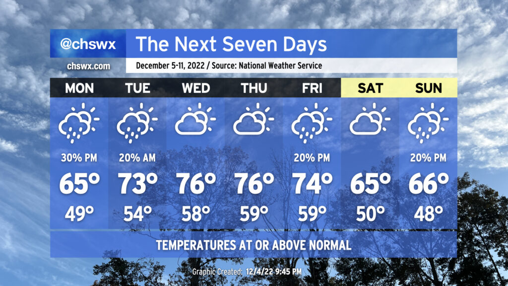
Temperatures will generally run around 10° above normal for the remainder of the work week as ridging pokes in from the south and we await our next front, which will cool things back to normal for the weekend.
Wednesday should start with a fair amount of fog, perhaps dense fog, blanketing the area. Be ready for delays in your commute tomorrow morning, and be sure to allow extra time and patience to get where you’re going. The fog should mix out by mid-morning, and temperatures will head toward the mid-70s under partly cloudy skies as a result. Warm and rain-free conditions continue for Thursday into Friday, and another round of morning fog or two is probably not off the table, either. A front will get through later Friday, but it should pass with just a few showers at most. This will knock temperatures back into the 60s for the weekend with a mix of clouds and sun.
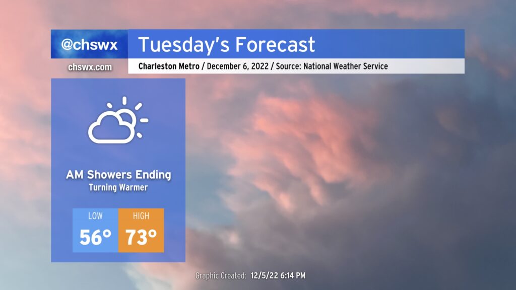
Showers will continue overnight into early Tuesday morning, but rain should be departing the area around sunrise. As high pressure to the north moves eastward, winds turn more southerly, pushing a front back north as a warm front. This will help temperatures start relatively mild for this point in the year (mid-50s) and finish downright warm (low-to-mid 70s) under partly cloudy skies. From here, we should see a few days of rain-free and unusually warm conditions, with temperatures running 10°+ above normal through Friday, when another front gets through and knocks temperatures back to a more standard September reality for the weekend.
The main weather story of the week ahead will be how non-December-like it will feel, with highs running some 10°+ above normal for much of the work week as we sit between fronts.
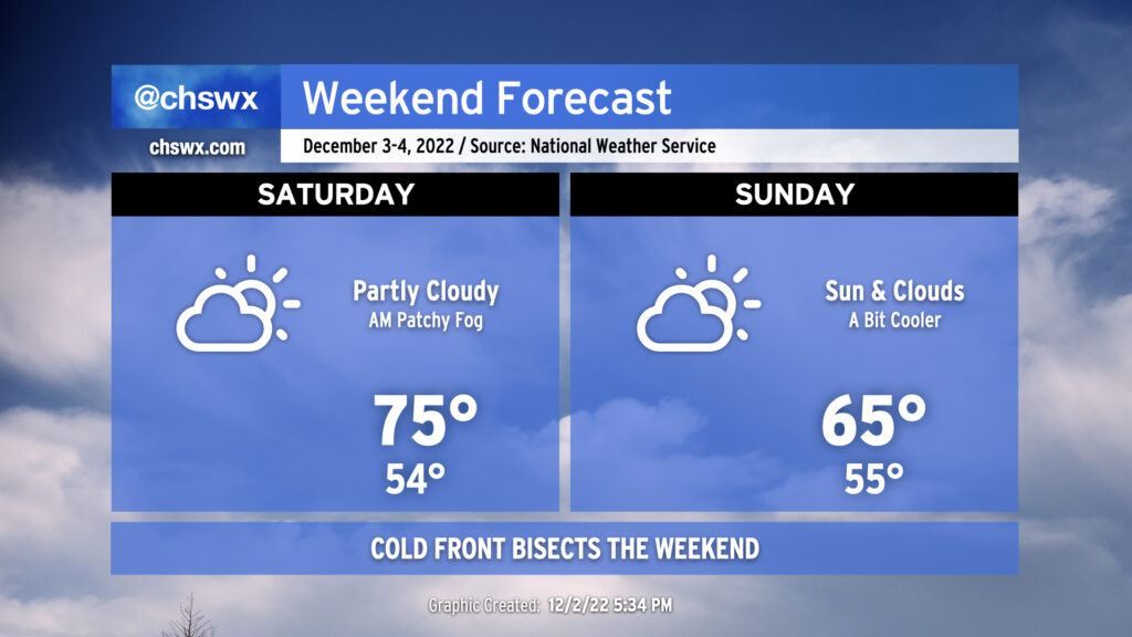
Expect generally quiet weather this weekend despite a cold front sinking southward halfway through. Saturday will start much warmer than Friday did, with lows in the mid-50s as opposed to the upper 30s. Watch out for some patches of fog to develop in the morning potentially having brief impacts on visibility. Any fog that develops will scour out shortly after sunrise, yielding partly cloudy skies for the balance of the day. Highs will top out in the mid-70s, generally about 5° warmer than Friday despite some additional cloud cover. There’s an outside shot of a few sprinkles later in the day on Saturday as the front gets closer, but the vast majority of us should remain rain-free with measurable rainfall not expected.
The aforementioned frontal zone passes through the area overnight Saturday and stalls out to our south. We’ll see an uptick in cloud cover (though some sun should still break through) with highs likely struggling a bit to the mid-60s at best. (This evening’s guidance suggests even cooler high temperatures are possible, so stay tuned for revisions.) We should remain generally rain-free, though I wouldn’t be shocked to see sprinkles get introduced into the forecast if some of the colder solutions with a stronger high pressure wedge verify.
All in all, though, it won’t be too bad of a weekend. Warm weather fans will enjoy Saturday, while the sweater-inclined amongst us will likely prefer Sunday. So it goes in December as the seasons continue their tug-of-war.
We’ll see a mix of clouds and sun this weekend with a bit of a temperature rollercoaster as a front looks to sag south of the area on Sunday.
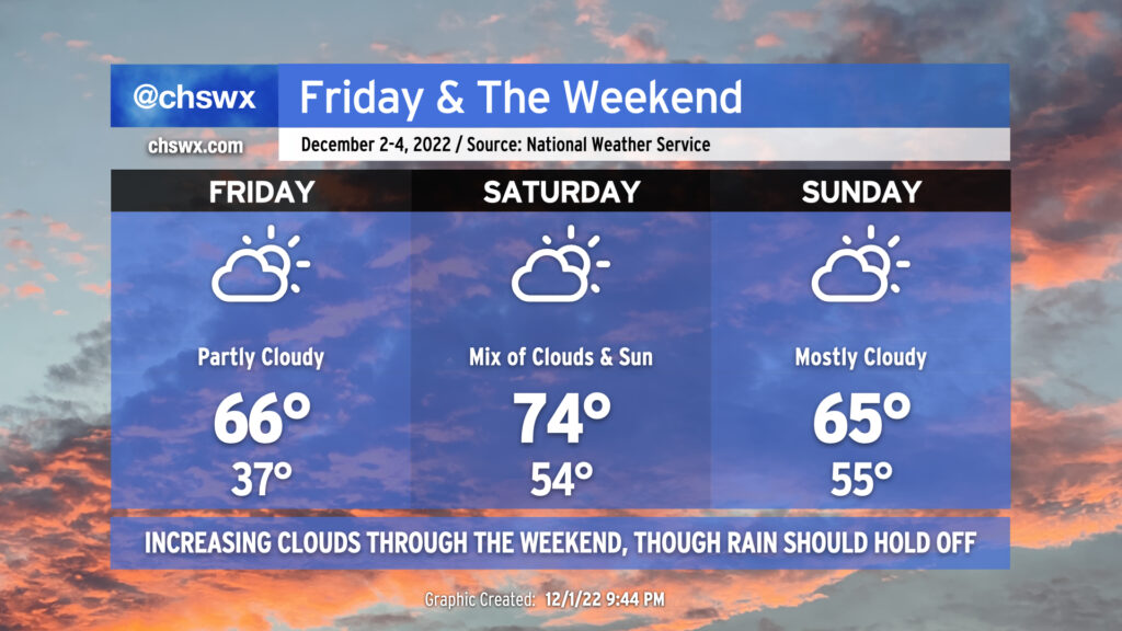
Friday will bring a very chilly start — lows in the mid-30s across much of the metro, with colder temperatures perhaps approaching freezing in some spots. Light northeast winds will make it feel a few degrees cooler, too. (Make sure pets and plants are inside tonight.) Highs in the afternoon will rebound to the mid-60s, about 5° or so warmer than we saw on Thursday. Expect scattered to broken cloud cover.
Saturday will turn warmer ahead of the aforementioned front, as highs will peak in the mid-70s. We’ll see a mix of clouds and sun continue with showers generally dissipating before they arrive.
The front should sag south of the area by Sunday, knocking temperatures back down about 10° in the afternoon with highs only peaking in the mid-60s. Showers are unlikely, though we’ll want to keep an eye out Sunday night given some model disagreement. That being said, the bulk of the weekend should get in generally rain-free, and while we might want to see more in the way of sunshine, it won’t be too bad at all.