The week ahead: Potentially rambunctious Monday leads to a sharp, but short-lived, cooldown
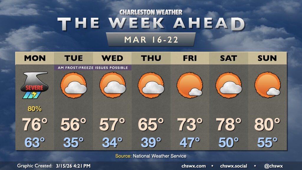
The week ahead gets off to a bit of a rough start as a potent cold front moves through the area Monday, bringing the first significant severe weather threat of 2026 to the Lowcountry. From there, temperatures fall off drastically, with some frost and freeze issues possible especially inland. We’ll warm back up heading into the weekend, though.
Read more »