Sunday: One more Heat Advisory, then another round of strong storms possible
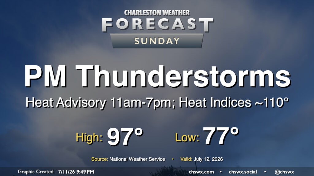
A slower frontal progression from the north will allow air temperatures to head back into the mid-to-upper 90s on Sunday, prompting another round of Heat Advisories and juicing up the atmosphere for another round of strong to potentially severe thunderstorms in the afternoon and evening.
Read more »