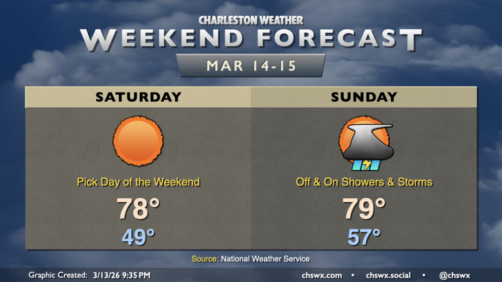
A bifurcated weekend of weather awaits, with a gorgeous day ahead on Saturday followed by a more unsettled day on Sunday ahead of a cold front that could bring about some strong storms Monday.
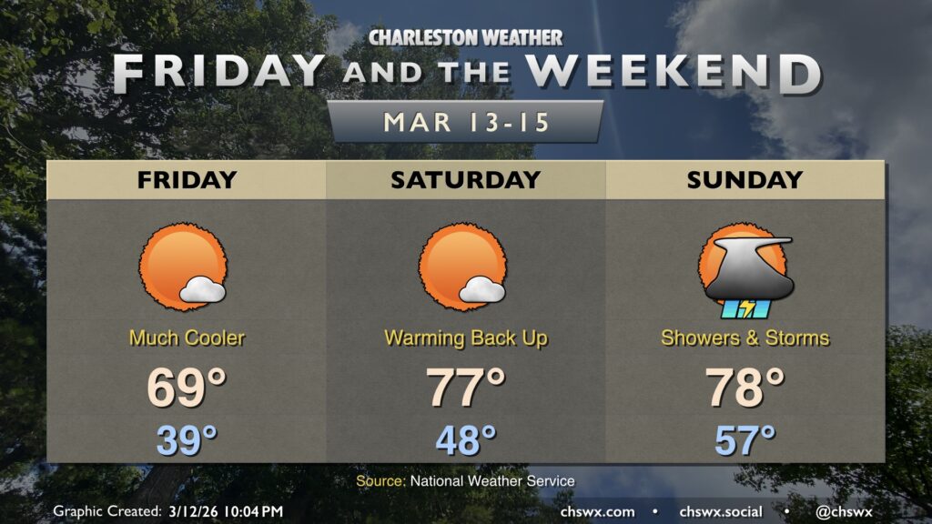
Friday will feel a lot different than much of the past week has, courtesy of a cold front that came through and put a chill back in the air Thursday afternoon and evening. Temperatures Friday start in the 30s across much of the metro away from the immediate coast, warming to the upper 60s to around 70° in the afternoon under mostly sunny skies. These high temperatures are much more in line with what we should normally see in mid-March.
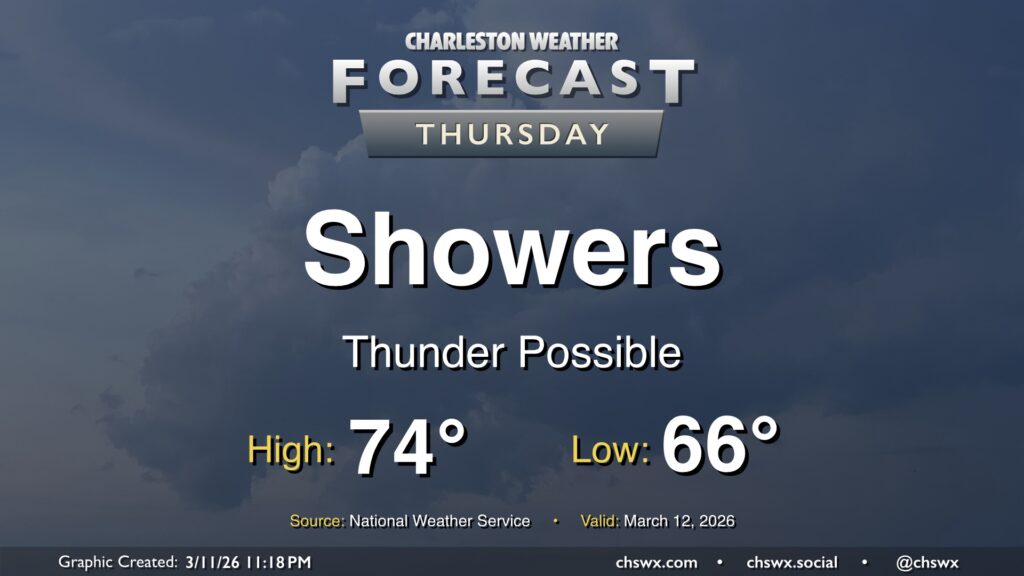
After a new daily record high of 89° was set at the airport on Wednesday, changes are forthcoming as we head into Thursday as a cold front approaches the area. We will start the day quite warm — record warm low temperatures are not out of the question — with lows in the mid-60s at coolest. Temperatures will then head into the mid-70s before a band of showers and thunderstorms approaches the area by mid-morning. Brief periods of heavy rain are possible, but storms will be moving quickly, so no concerns about too much rain in one location. Any rain we can get remains helpful as severe drought continues across the Lowcountry. There could be some thunder, too, and a few strong thunderstorm wind gusts can’t be totally ruled out as the line gets through.
The front will sweep the moisture and warm airmass offshore by evening, and temperatures will drop quickly into the 50s in its wake. If you are out and about Thursday evening, keeping a light jacket close by may not be the worst idea!