Weekend forecast: Hot start, unsettled finish
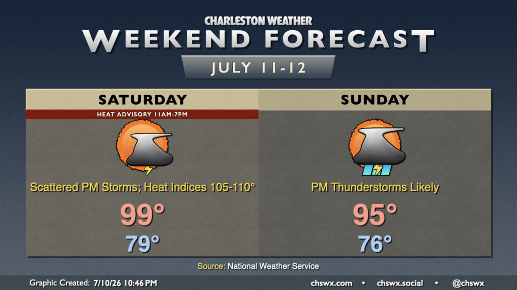
After another 99° day at the airport, we’ll take one more run at the century mark on Saturday before a front drops toward the area on Sunday, bringing about more unsettled weather that will keep temperatures a little more in check.
Read more »