The week ahead: Feeling much more like January
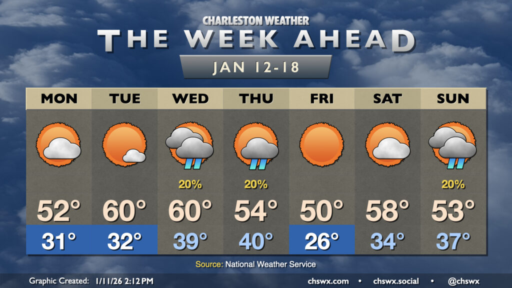
This week will have a much different (and more seasonally-appropriate) feel than last week did as multiple shots of cold air are queued up for our neck of the woods.
Read more »Forecast explanations, atmospheric science, and other cool weather-related stuff for Charleston, SC
This week will have a much different (and more seasonally-appropriate) feel than last week did as multiple shots of cold air are queued up for our neck of the woods.
Read more »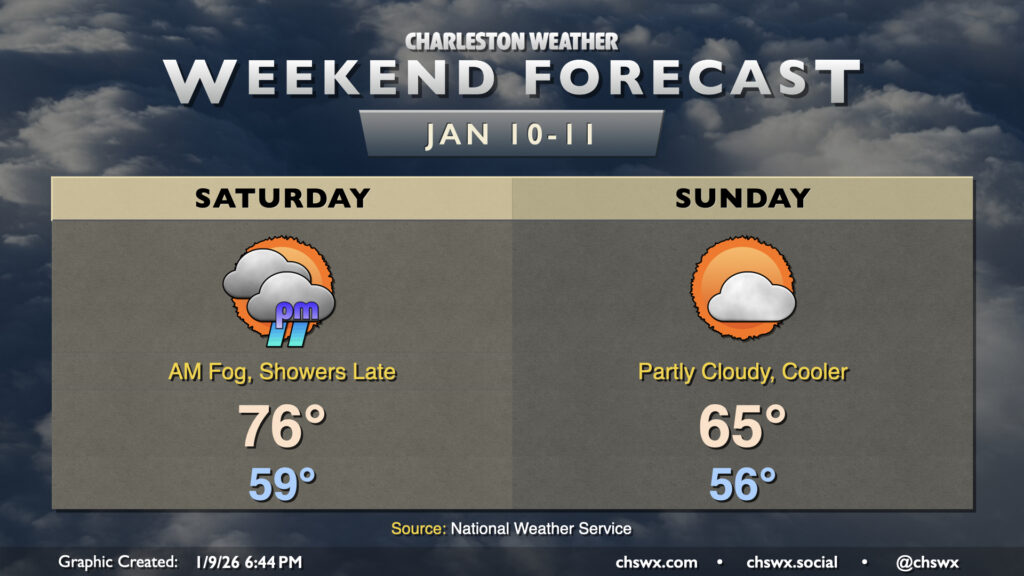
After a record high on Friday, we’ve got one more warm day ahead before a cold front begins to make things feel a little more like January for Sunday and especially the start of the new work week.
Read more »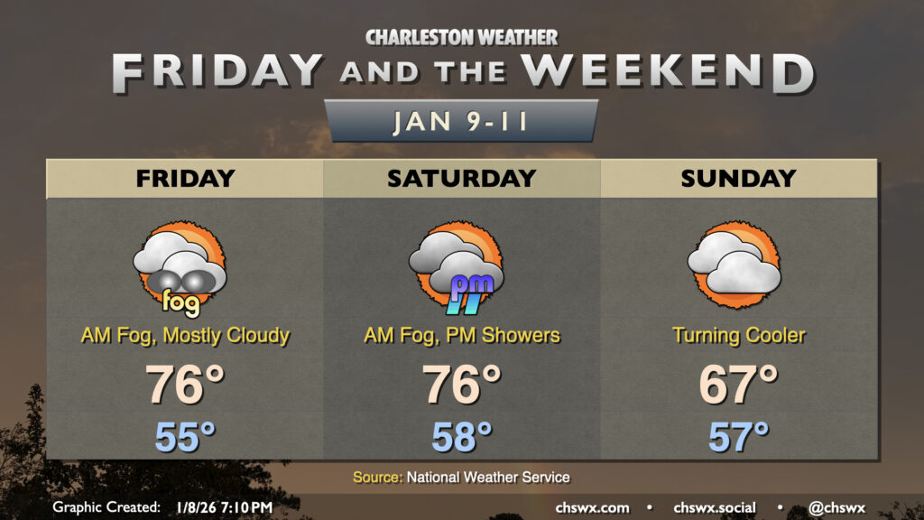
Another round of fog is expected overnight into Friday morning as abnormally warm temperatures continue across the Lowcountry. Lows will fall into the mid-50s, reaching the dewpoint with relatively calm winds. Once again, be prepared for low visibility and delays due to fog as you commute Friday morning. Like Thursday, the fog should mix out by mid-morning, and from there, temperatures will head to the mid-to-upper 70s. We’ll challenge the record high of 78° set in 2012 with a mix of sun and clouds in the afternoon.
Read more »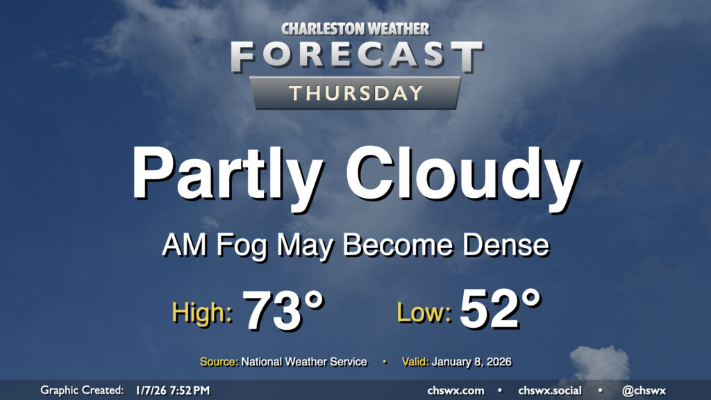
We may get another abnormally warm January day off to a foggy start across a good bit of the area as winds go calm and temperatures fall to right around their dewpoints in the low-to-mid-50s. It’s not a slam dunk that we’ll run into fog, but better to be ready for it and the associated commute delays that may come along with it.
If it develops, fog should eventually mix out by mid-morning as temperatures head into the low 70s once again under generally partly cloudy skies. It’ll be a much warmer-than-normal day — a normal January 8 should only see highs peaking around 60° — but at least the record of 81° set in 2005 will remain unchallenged.
Read more »