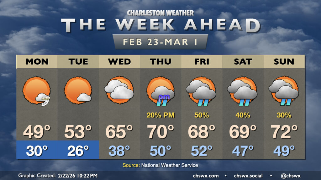
High pressure wedging down from the northeast overnight will set up a cool and mostly cloudy Monday across the Lowcountry — another dip on the temperature rollercoaster after an already up-and-down weekend. Temperatures start in the upper 40s with some fog possible (especially near the coast, where sea fog has been an issue), but the persistent northeast breeze and cloud cover courtesy of some moisture overrunning the wedge will keep temperatures pinned to the low 60s in the afternoon.
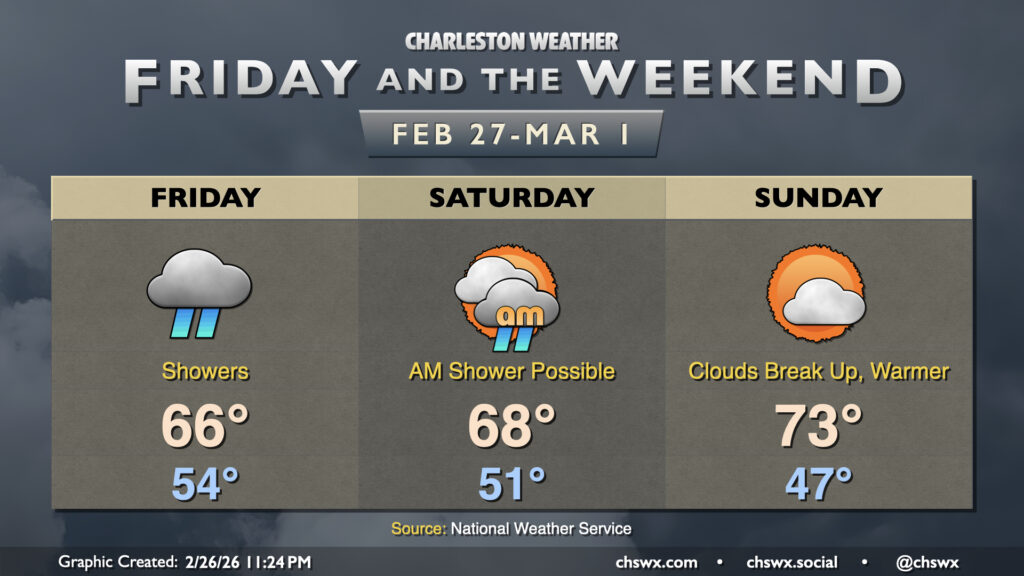
Showers have arrived in the Lowcountry and will be hanging around through much of Friday into early Saturday as a cold front lumbers through the area. We certainly could use the rain as severe drought continues over the Lowcountry, and 1-1.5″ of rain should fall in most spots through Saturday morning.
Lows on Friday will run on the warm side of normal; expect generally mid-50s across the area, while highs peak near normal in the mid-60s.
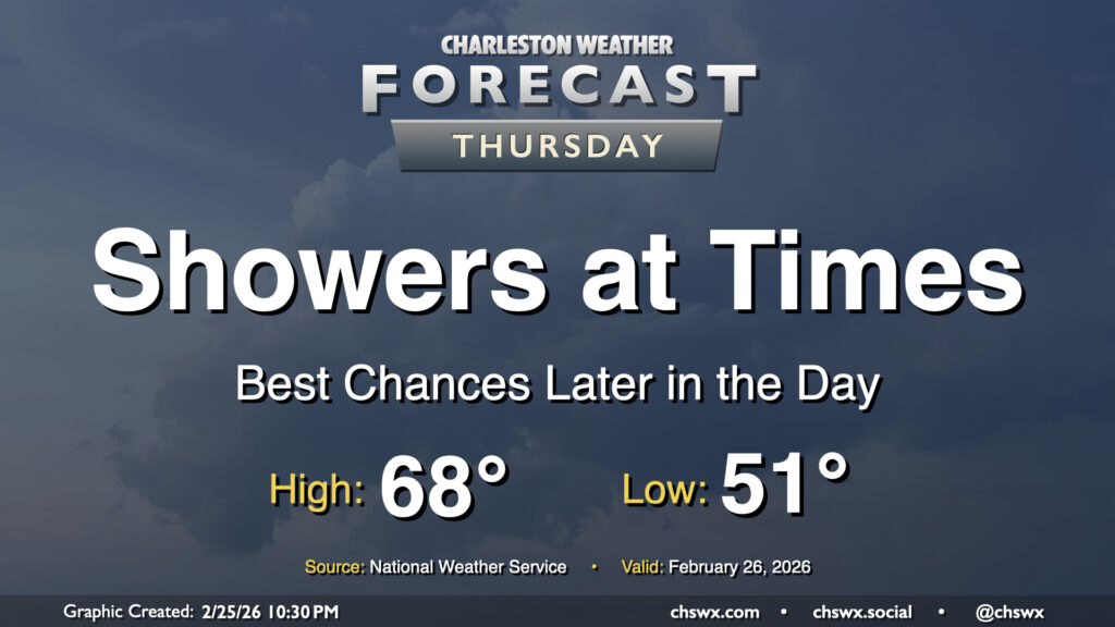
Showers return to the area on Thursday as energy aloft moves across the region ahead of a slow-moving cold front. The best chance for rain will arrive later in the day, and will stick with us into Friday. Temperatures Thursday start on a much more mild note — generally expect lows to fall to the low 50s in the morning, with highs peaking in the upper 60s in the afternoon.
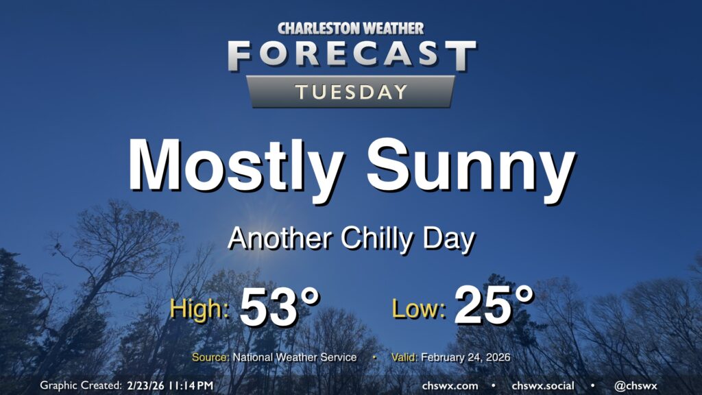
Our cold snap continues Tuesday as lows bottom out in the mid-20s in the morning. Winds will remain a touch elevated with the lingering pressure gradient between the high to our west and the nor’easter pulling away from New England, so wind chills will be a factor, perhaps briefly dipping into the teens (but not long enough for a Cold Weather Advisory, per NWS). Temperatures will run a few degrees warmer than they did on Monday, but that’s not saying much as Monday’s high only peaked around 48°. We can at least expect another day of mostly sunny skies with the cool and dry airmass still in place. Temperatures turn back up starting Wednesday as a cold front approaches the area; we should be in the 70s again by Thursday, and shower chances return for Friday.
Winter makes a brief return to the Lowcountry to start the final week of February, but temperatures look to rebound for the second half of the week, albeit with some shower chances.