Wintry night of weather ahead with sleet and snow still expected
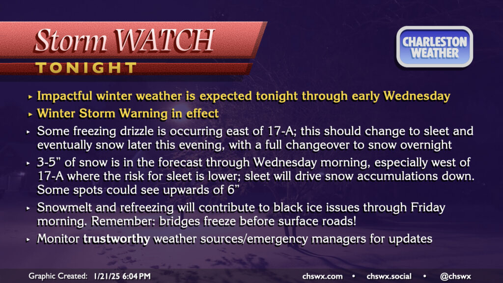
A Winter Storm Warning continues through noon Wednesday as winter weather is beginning to affect the area this evening. So far, we’ve seen some freezing drizzle primarily in the US-17 coastal corridor and points east, with trace accretion reported in places like James Island, Mt. Pleasant, and even at my home in West Ashley. Some bursts of sleet have been reported to be mixing in at times, particularly around Johns Island. Ice pellets have also been reported at the airport, and so we officially have a trace of snow so far today in North Charleston (sleet and snow are functionally considered the same accumulation in the historical climate record).
A special evening weather balloon release continued to indicate a pocket of warmer air aloft that is contributing to primarily freezing rain and sleet so far. The atmospheric column should continue to cool, though, and a changeover to all snow is still expected overnight into early Wednesday morning. By the time all is said and done, many spots should have between 3-5″ of snow. Areas closer to the coast may see accumulations impacted if more sleet falls, while others who stay in the snow longer could see upwards of 6″. This is a pretty stark upward revision from previous forecasts, but thus far all we’ve seen this storm do to our west is overperform. We’ll see how things shake out. Regardless of how much falls, we can still expect some tough road conditions tonight into Wednesday morning even after snow ends. The best course of action is to stay put tonight if at all possible, leaving roads open for essential and emergency workers.
Read more »