Thursday: A little cooler as high pressure settles in
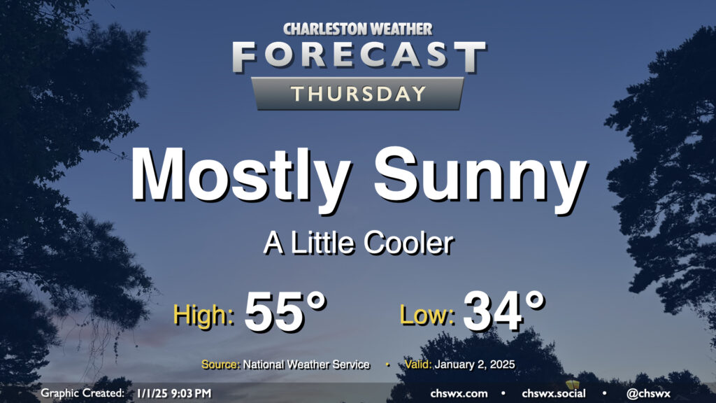
High pressure will be settling into the area overnight into Thursday, and this will drive a mostly sunny but seasonably cool day across the area. Expect lows in the mid-30s (with perhaps some freezing values in rural locations) to start Thursday, warming to just the mid-50s in the afternoon despite all the sunshine. Generally, temperatures will be running a few degrees below early January normals (normal high of 60°, normal low of 39°), but nothing terribly out of bounds.
Friday & the weekend: Below-normal temperatures get even more below normal
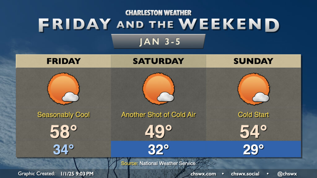
Expect Friday to be essentially a carbon copy of Thursday’s weather, with seasonably cool temperatures continuing. We start the day in the mid-30s, warming to the mid-to-upper 50s in the afternoon with just a few clouds from time to time.
A reinforcing dry cold front comes through late Friday/early Saturday, and with it comes another shot of even cooler air. Saturday will be particularly chilly, with temperatures in the metro starting around freezing and struggling to the upper 40s despite mostly sunny skies. Sunday starts even cooler, with lows in the upper 20s before winds start to go more southerly with a northward-moving warm front, sending temperatures into the mid-50s in the afternoon. This is still a few degrees below normal, but will be about 5° or so warmer than Saturday.
Looking ahead: Chill to continue
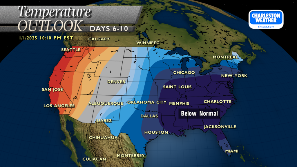
We’ll be in the warm sector of a storm system during the day Monday that will bring us some showers and maybe a rumble of thunder along with a brief return to normal temperatures. This will be short-lived, though, as temperatures next week will remain fairly strongly below early January normals. The Climate Prediction Center is favoring below-normal temperatures for at least the next two weeks, and this may continue for much of the rest of the month. Whether this means any wintry precipitation impacts in the next few weeks remains to be seen; the probability isn’t zero, but is still very, very low — certainly not enough to be remotely confident about what might happen, regardless of what some hype merchants might say. One thing I won’t do is give y’all false hope for a snow day, so stay tuned.
Follow my Charleston Weather updates on Mastodon, Bluesky, Instagram, Facebook, or directly in a feed reader. Do you like what you see here? Please consider supporting my independent, hype-averse weather journalism and become a supporter on Patreon for a broader look at all things #chswx!