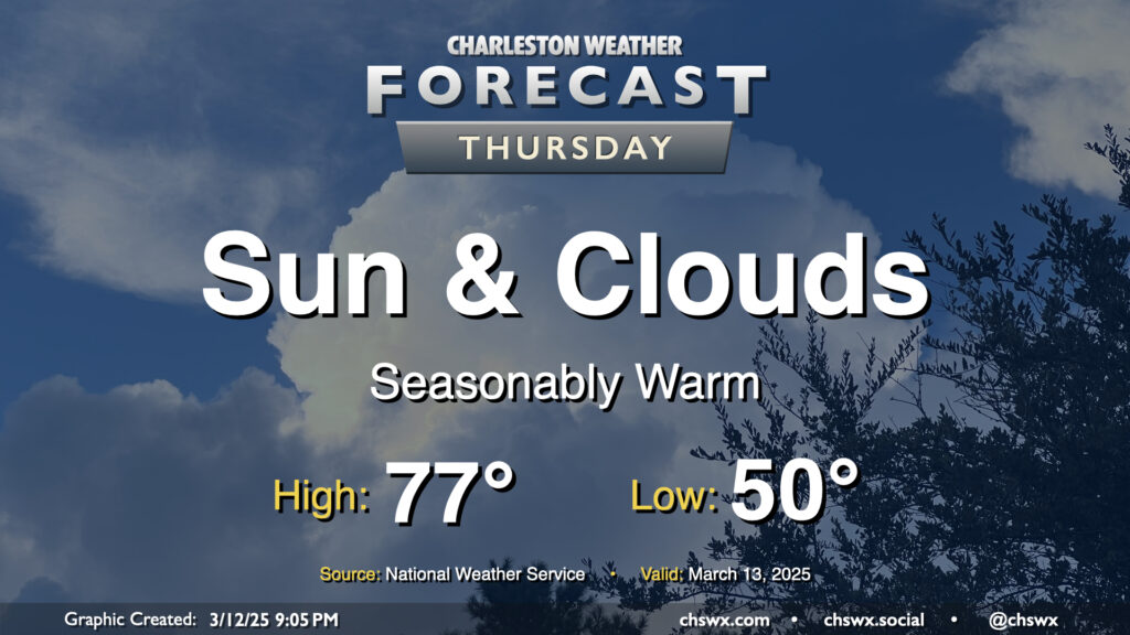
We’ll see a few more clouds on Thursday as a shortwave trough swings through aloft, but other than a slight downtick in temperatures compared to Wednesday’s highs in the low 80s, we’ll remain seasonably warm as surface high pressure remains anchored in the Atlantic for one more day. We’ll keep an eye on the moisture profiles to make sure that no showers try to overachieve with the upper-level energy moving by, but the expectation is that it’ll just be too dry for much more than the enhanced cloud cover.
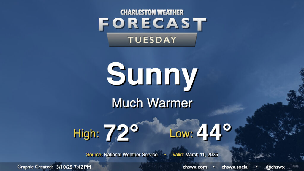
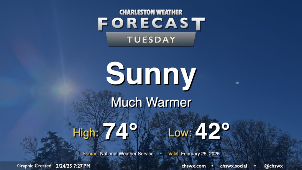
Much more sunshine is in store for Tuesday as low pressure pulls away from the area at the surface and aloft. This will help warm things up, too — after a mid-40s start, downslope winds out of the northwest and the aforementioned sunshine will push highs to the low 70s in the afternoon, a couple degrees above normal for March 11. Overall, a much nicer day than Monday (weather-wise, anyway).
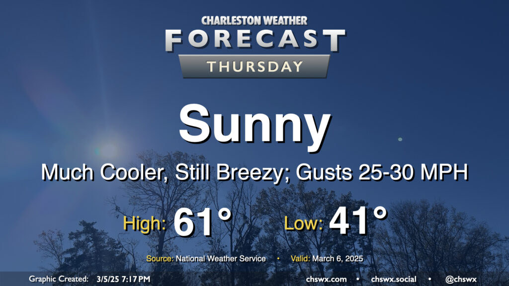
After a windy and occasionally rainy Wednesday that, thankfully, didn’t result in any severe weather, we will turn much cooler and sunnier for Thursday. Temperatures start in the low 40s, warming to just the low 60s in the afternoon with breezy conditions featuring gusts 25-30 MPH at times, particularly in the morning through the early afternoon as high pressure builds in. We’ll see that high pressure settle in a little more later Thursday night, and that will help winds go a little calmer and start to cool us off for potential frost and freeze issues inland for Thursday overnight into Friday morning.
After a sunny but chilly Monday, temperatures begin to warm up ahead of Wednesday’s cold front as we get into Tuesday. We’ll also see cloud cover begin to thicken up as well, and there could even be a few showers at times as Atlantic moisture builds in. We start the day in the low 40s — about 10° warmer than the frosty start we felt on Monday morning — and head back to the low 70s in the afternoon. It’s going to be breezy as well — winds will generally run between 10-15 MPH, but could gust to 20-25 MPH at times.
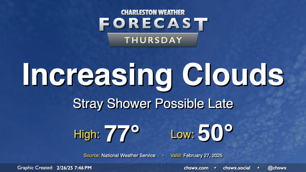
After reaching 79° on Wednesday, some 13° above normal for this point in the year, we’re back in the mid-to-upper 70s on Thursday but with some increasing cloud cover ahead of an approaching cold front. Moisture ahead of the front won’t be the best, but a few showers will be possible later Thursday into the overnight as it gets by, so be aware for the potential for a little rain. It’ll also be a bit of a breezy day, with winds 15-20 MPH possible out of the southwest particularly in the afternoon.
A cloudy and cool Monday will give way to a much sunnier and warmer Tuesday. After starting in the low 40s, expect highs to peak in the mid-70s in the afternoon, several degrees warmer than the 68° we peaked at on Monday. This is well above normal for the end of February; the normal high for February 25 is 66°.
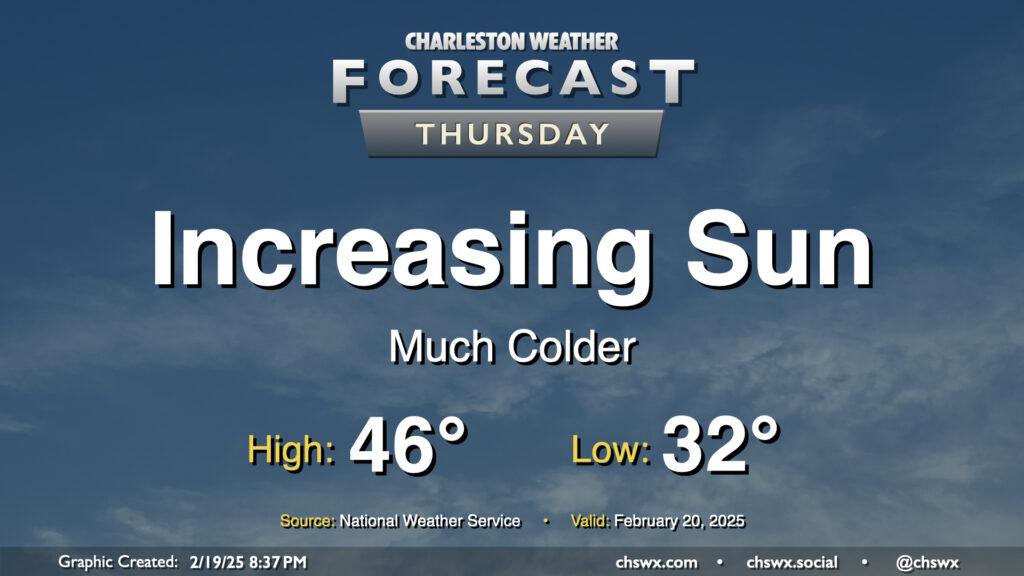
Clouds will thin out throughout the day Thursday as colder and drier air pours into the area from the northwest. We’ll start the day around freezing, warming to just the mid-40s in the afternoon despite the increasingly sunny skies. The last time we had a high temperature this cold was January 24, when the high was only 47° courtesy of 2″ of snow still on the ground from the 1/22 snowstorm. (The record cold high temperature of 39°, set in 2015, will remain intact, thankfully.)
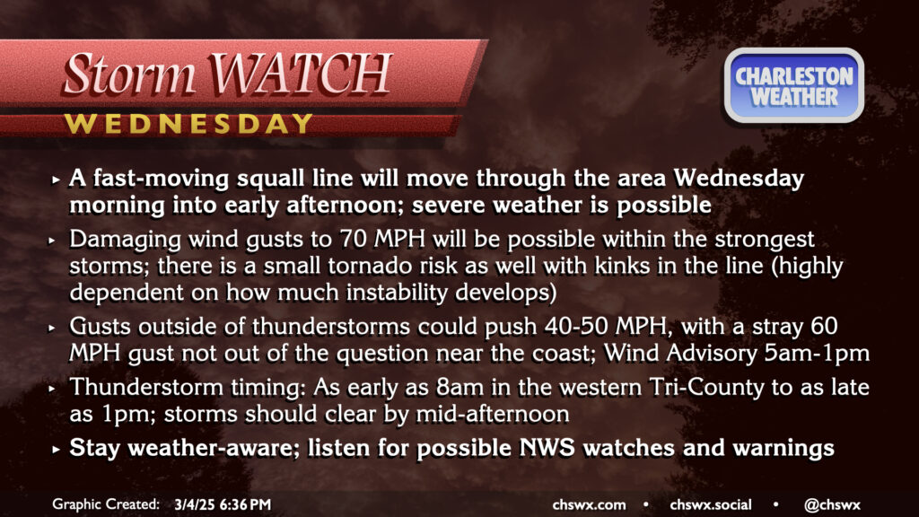
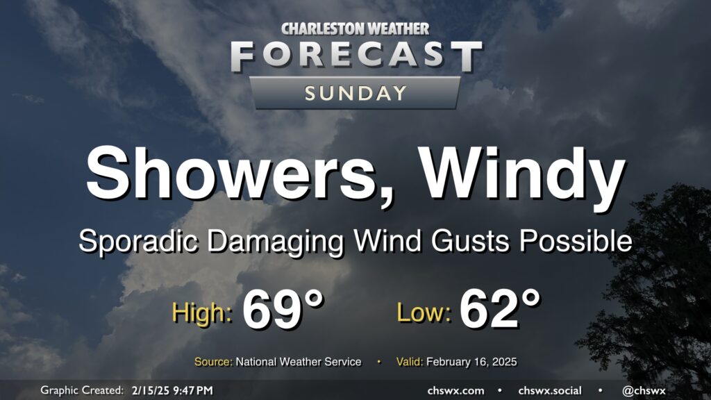
Sunday will be a very breezy day as a highly dynamic storm system moves across the eastern half of the continental United States. Showers and a few thunderstorms should set up in a line ahead of a cold front which will come through generally between 11am and 1pm, according to NWS. The line of showers and storms could produce damaging wind gusts to 60 MPH, which could prompt some Severe Thunderstorm Warnings for tree damage and possible power outages. Even outside of storms, gusts 40+ MPH will be possible, especially on bridges and overpasses. A Wind Advisory goes into effect overnight through about 5PM.
Rain will be offshore by evening, and winds will die down as the front clears the area. This will set up a much cooler week ahead, with a mid-week secondary front likely to send us back below freezing for the first time since the January snow later in the week.
A warm front will lift north of the area overnight, scouring out some dense fog and sending much warmer and more humid air into the area ahead of an approaching cold front. Within the warm sector, we’ll start in the mid-50s, warming to the mid-70s early on before a line of showers and maybe a few thunderstorms approaches the area, generally affecting the metro between 10am-4pm. Severe weather is unlikely this far north where instability is a bit more meager, but a rumble of thunder or two with a strong wind gust is still not totally out of the question. You won’t need the rain gear all day, though, as storms should be offshore by evening with the front following thereafter.