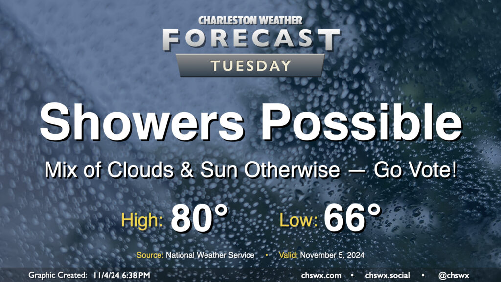
A few showers will be in the cards as we head to the polls for Election Day on Tuesday, but it won’t be a washout and should be minimally disruptive to voting. We start the day about 15° above normal with lows in the mid-60s, warming to 80° in the afternoon. We’ll see some peeks of sun from time to time as well. Go out and make your voice heard!
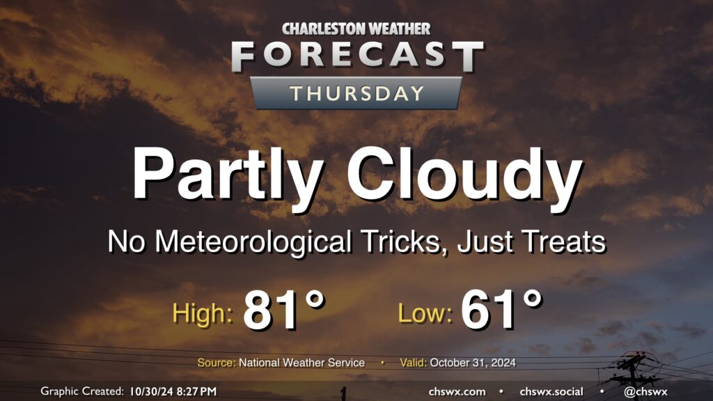
Expect quiet weather for Halloween this go-around as high pressure remains the dominant weather feature across the Lowcountry. It’ll be a mild one this year as temperatures start in the low 60s, warming to the low 80s in the afternoon under partly cloudy skies. The only concern may be if costumes run a little warm!
We’ll keep this going into the weekend. Maybe a shower Friday, but otherwise quiet weather continues with upper 70s to low 80s for highs each afternoon.
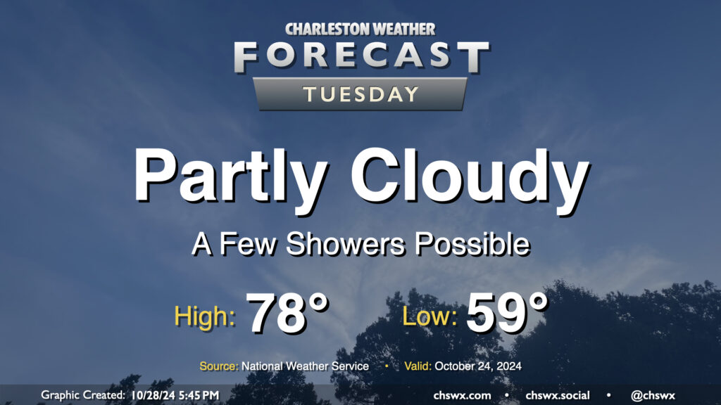
A surface trough will push inland Tuesday, and this could spread a few showers ashore throughout the day. Rain chances are pretty small, though, given the continued dry conditions, and any rain that does fall probably will not amount to a whole heck of a lot. Rain chances diminish by evening. Otherwise, expect partly cloudy skies. Temperatures will begin to trend back above normal, with upper 50s in the morning yielding to highs in the upper 70s in the afternoon.
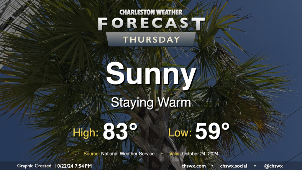
Warmer-than-normal temperatures prevail on Thursday as skies once again stay on the sunny side. A slightly chilly start in the upper 50s yields to the low 80s in the afternoon; dewpoints in the mid-50s yield relative humidity values around 40% in the afternoon, so it should be comfortable. We keep this going into Friday and Saturday as well, with a bit of a cooldown Sunday with a dry cold front that kicks up cloud cover but little else.
If you’re looking for rain, the news isn’t great in the next seven days as dry weather looks to prevail. There’s a meager shot (10%) for precipitation on Monday in association with the front, but the vast majority of rain will stay offshore. The current forecast keeps us dry through next Wednesday. However, the Climate Prediction Center is giving us slightly above-average odds for above-normal precipitation as we head into November. We’ll see how that pans out; for now, even though it seems silly getting this late into Fall, seems like watering remains the order of the day for the plants you want to keep going.
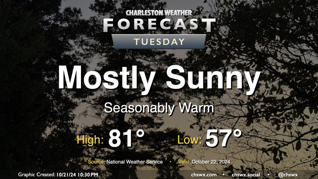
The status quo continues for our weather on Tuesday, and with the way things have been going, that’s not necessarily a bad thing. Expect to start the day in the mid-to-upper 50s (warmer near the coast), warming to the low 80s in the afternoon under mostly sunny skies. (The normal high for October 22 is 76°, so we’ll be running a few degrees above climatology.) We’ll have a little bit of a northeast breeze once again, but nothing too bad.
The high tide at 12:45 PM should fall short of the 7′ flood stage in Charleston Harbor, though it’ll be a bit of a close call. We may still see some salt water encroach onto some of the more vulnerable roads as a result. Otherwise, that’ll do it for this cycle of coastal flooding. The next new moon arrives November 2, and we’ll watch around that time for additional coastal flooding concerns.
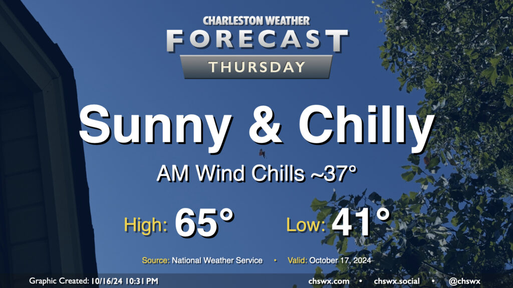
Temperatures reminiscent of November rather than mid-October continue on Thursday despite unfettered sunshine. We’ll start the day in the low 40s in the metro, with some upper 30s possible further inland. The wind chill will feel closer to the mid-to-upper 30s, so once again, layers are a good idea tomorrow morning. Temperatures head to the mid-60s in the afternoon, so keeping some sort of long sleeves around for when you’re not in sunlight is a smart play. Northerly winds will once again be breezy, generally 10-15 MPH in the afternoon with higher gusts.
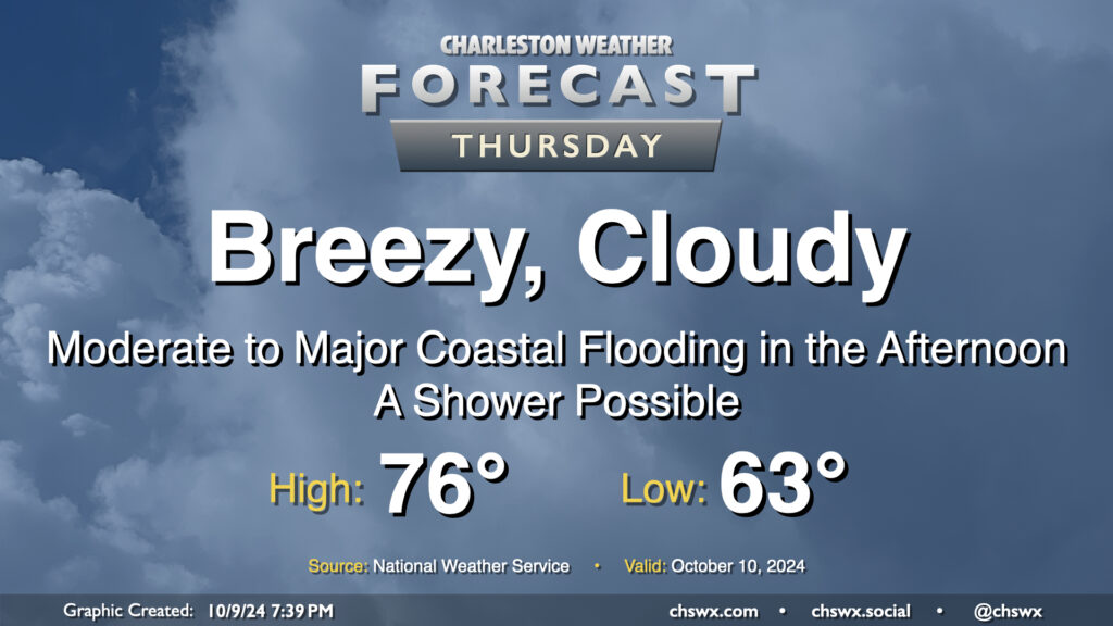
We’ll also need to watch for minor coastal flooding during the Thursday morning commute. Water levels are expected to peak around 7.1-7.3′ with the 8:13 AM high tide. The more northerly component of wind will minimize coastal flood impacts a little, but we can still expect a few road closures in the more vulnerable locations of downtown Charleston. Be ready to reroute.
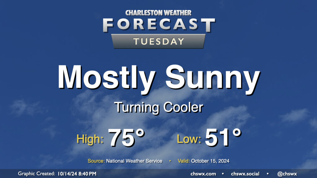
Tuesday’s temperatures, despite plenty of sunshine, will run a little below normal for this point in October. We start the day in the low 50s, warming to the mid-70s in the afternoon. Clouds will be hard to come by, though they should begin to increase after midnight. That being said, it should be another solid evening of stargazing in the western sky as Comet Tsuchinshan–ATLAS continues to appear in the night sky after sunset.
Our brush with Milton arrives on Thursday. The Tropical Storm Watch was dropped as tropical storm conditions are not expected on land (though a Tropical Storm Warning is in effect for the coastal waters). However, that doesn’t change the forecast: It’ll still be a breezy day, with a Wind Advisory in effect for the area from 6 AM to 8 PM as the gradient between high pressure to the north and Milton to the south pinches and drives gusts upwards of 40 MPH across the area. Moderate to major coastal flooding is also expected during the afternoon, with some salt water flooding possibly persisting into early evening depending on how high the tidal departure ends up being. Right now, moderate flooding is forecast as the harbor should peak at 7.8′ MLLW with high tide just before 2 PM. This will close roads in downtown Charleston and parts of Mt. Pleasant, especially around Long Point Road. Be ready to reroute in case you encounter a flooded road.
The rain threat, however, is minimal. We may see a few showers sneak in from time to time, but we will miss out on Milton’s rainfall. In fact, we can expect skies to start to clear as we get further into the afternoon and evening. Temperatures will start in the low-to-mid-60s, warming to the mid-70s in the afternoon.
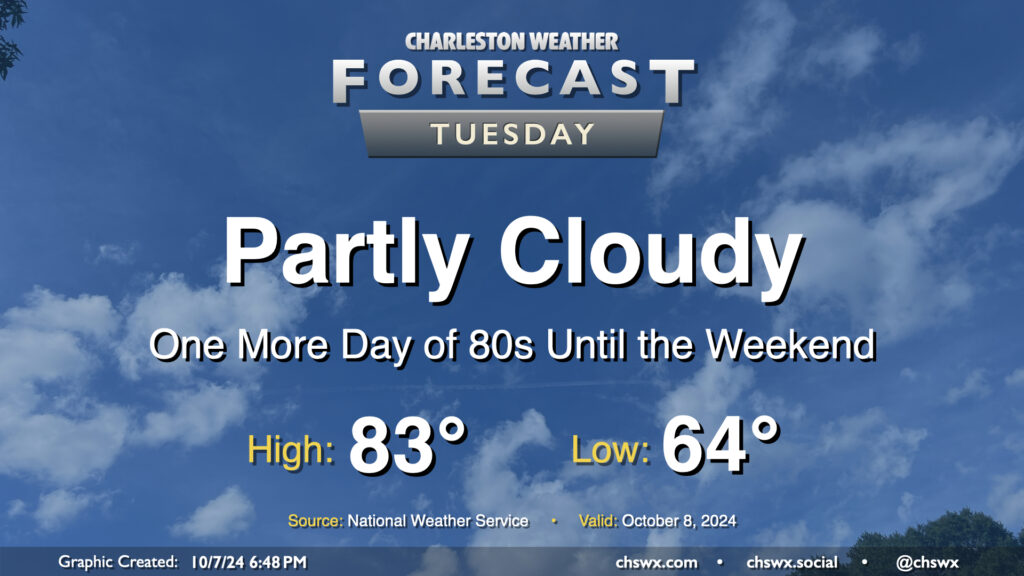
Quiet and warm weather continues Tuesday as we continue to monitor Hurricane Milton in the Gulf of Mexico for possible peripheral impacts on the Lowcountry as we get into Wednesday night and Thursday. Expect a comfortable start in the mid-60s on Tuesday, with temperatures warming to the low-to-mid-80s in the afternoon under partly cloudy skies (though clouds will be increasing as the day goes on). Northeast winds will generally run 10-15 MPH across the metro.
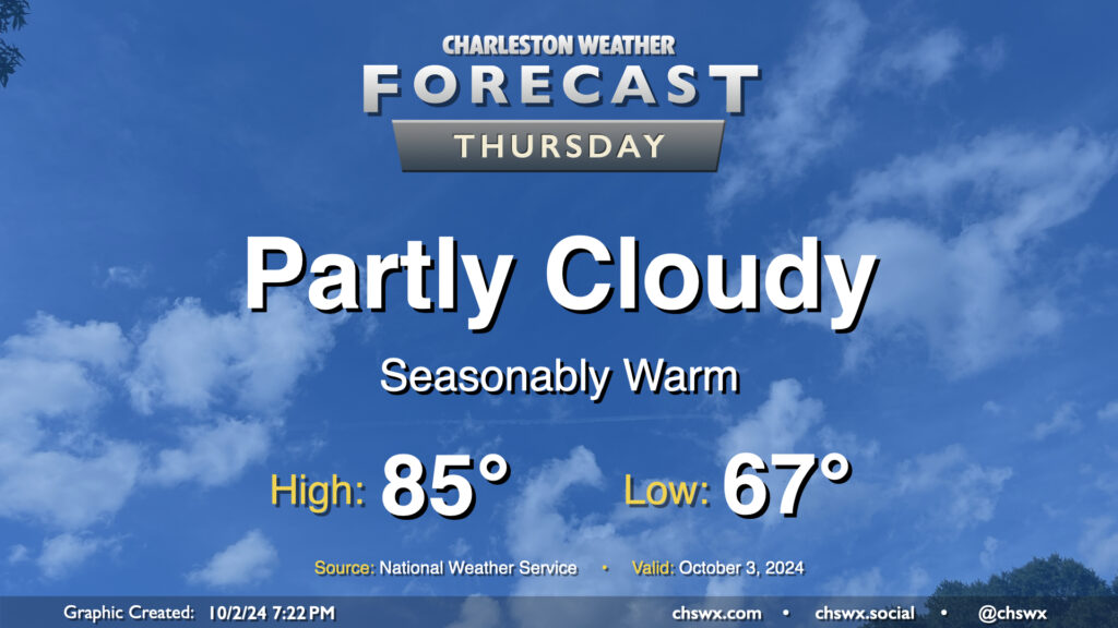
Quiet and seasonably warm weather continues for Thursday. We’ll start the day in the mid-to-upper 60s, warming to the mid-80s in the afternoon under partly cloudy skies. Dewpoints will run in the upper 60s, so it’ll still feel a touch humid, but it won’t be too bad overall. The only weather-related issue we could run into tomorrow would be a little bit of salt water on the roads around the 9:01am high tide. Water levels should peak around 7′, which is right where we generally start to see coastal flooding occur. Widespread impacts aren’t expected, but the usual trouble spots may once again be troublesome, particularly around Hagood and Fishburne.