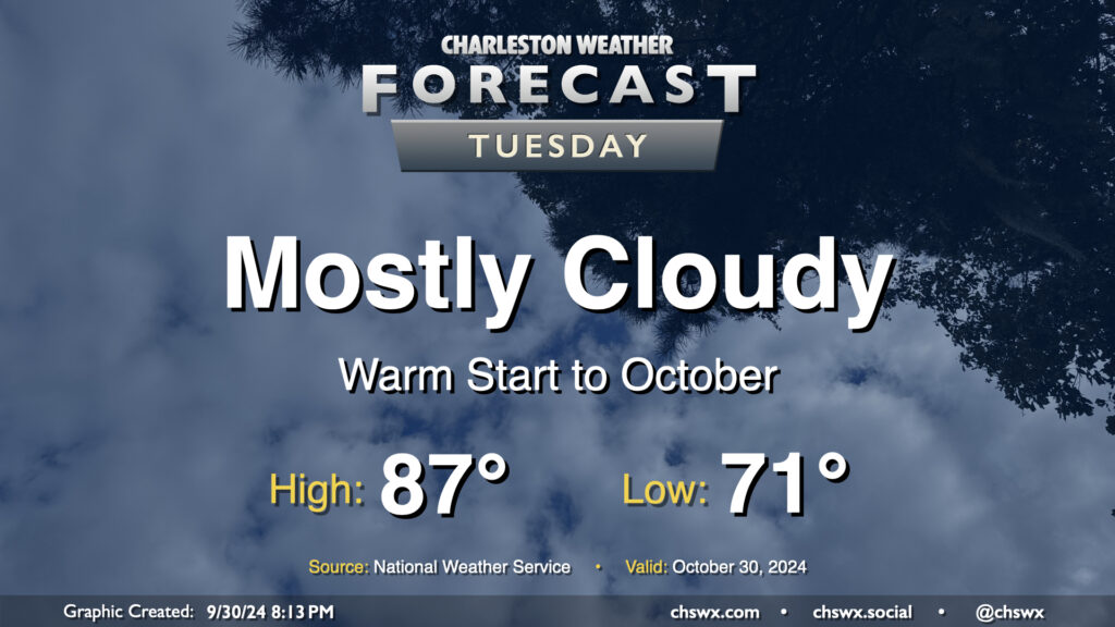
We’ll get October off to a warm but somewhat cloudy start before a cold front starts to regulate temperatures a bit more beginning Wednesday. We start the day rather mild for this time of year once again, with low 70s generally across the metro (and warmer toward the coast). Cloud cover does persist, but despite that, we’ll still warm into the upper 80s. Rain is not expected.
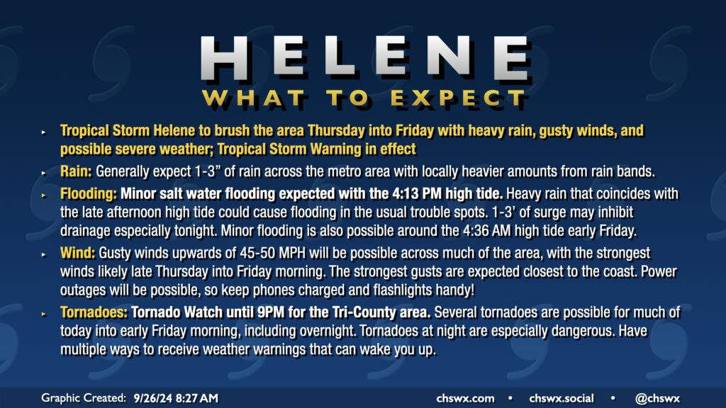
A potentially busy weather day awaits as Hurricane Helene strengthens again on approach to landfall late tonight on the Big Bend of Florida. A Tornado Watch is now in effect until at least 9PM, though I expect this to be extended overnight, as conditions continue to improve for the development of tornadoes. There has already been one tornado warning this morning in Beaufort County, likely with more to come. Tornadoes are the main concern with Helene, though heavy rain and gusty winds could still cause flooding and power outage issues.
Hurricane Helene’s outer fringes will begin to affect the area on Thursday, with impacts peaking Thursday afternoon through Friday morning. Gusty winds, heavy rain, and a risk for tornadoes are the main concerns. A Tropical Storm Warning is in effect for the Lowcountry, including the entirety of the Charleston Tri-County area.
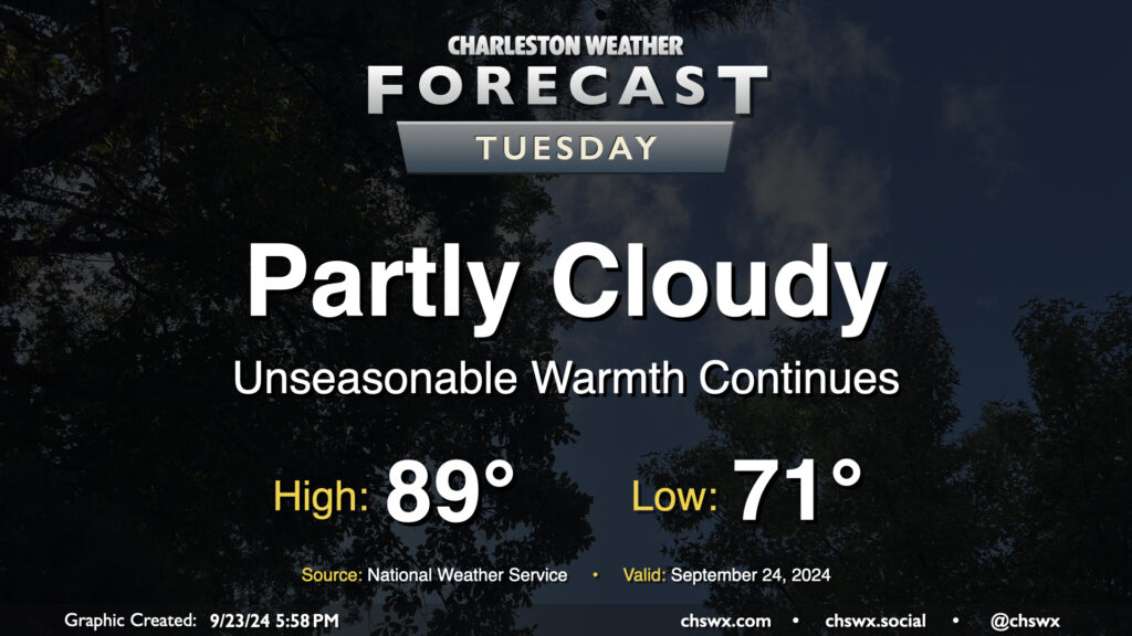
Quiet and unseasonably warm weather continues on Tuesday. Expect to start the day in the low 70s, warming to the upper 80s to around 90° in the afternoon. Dewpoints in the low 70s will yield heat indices in the mid-90s — not necessarily oppressive but certainly unpleasant considering where we are on the calendar. The ridge aloft will keep a lid on any shower activity, so no concerns there as we start to look ahead toward impacts from what is currently Potential Tropical Cyclone Nine later this week.
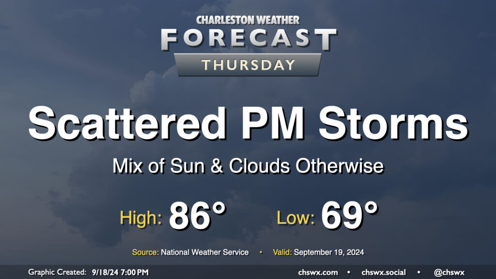
We’ve got one more day of unsettled weather as low pressure aloft and at the surface mosey their way on out of here ahead of what should be a nice weekend. After a generally nice start in the upper 60s, a mix of sun and clouds will send temperatures up to the mid-80s in the afternoon before a few showers and thunderstorms break out with the heating of the day. Not everyone sees rain, but some heavy downpours will be possible in a few spots once again. Severe weather is not expected.
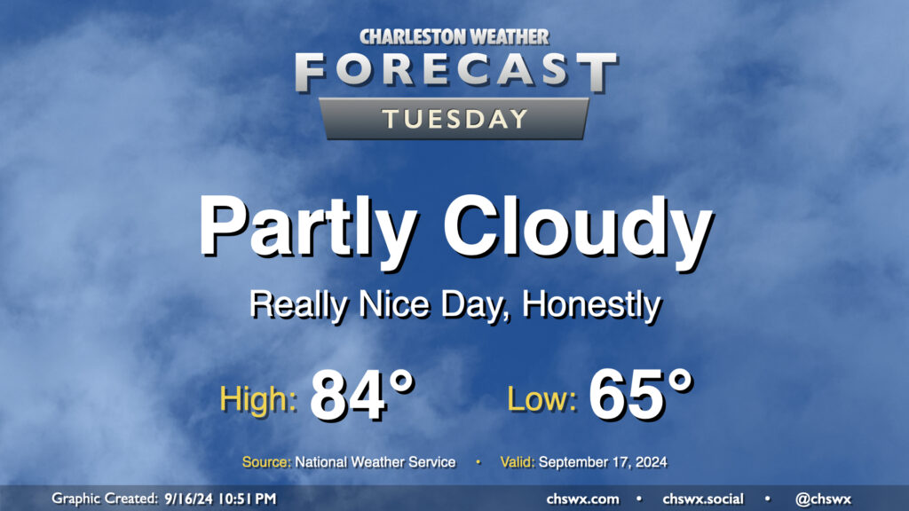
After our largely uneventful brush with Potential Tropical Cyclone Eight, we have a pretty nice weather day on tap for Tuesday as dry air wrapping around the back end of the system hangs around for one more day. We’ll start the day comfortably in the mid-60s, warming to the mid-80s in the afternoon under partly cloudy skies. Dewpoints run into the mid-to-upper 60s, so it’ll feel a little humid, but not too bad.
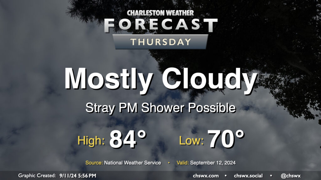
Cloud cover will continue on Thursday as moisture from Hurricane Francine, which has made landfall in Louisiana as a Category 2 storm with maximum winds of 100 MPH, continues to push northward across the Southeast and into the Lowcountry. High pressure will try to hang on across the East Coast, though Francine will continue to dislodge it north and east. Moisture moving atop high pressure will create plenty of clouds and may be enough to get a few showers going in the afternoon as well, though many of us should stay dry for one more day. We start Thursday around 70°, warming to the mid-80s in the afternoon despite the cloud cover.
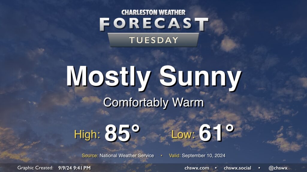
Tuesday looks like a rather nice day in our part of the world with mostly sunny skies, a seasonably cool start in the low 60s, and highs in the mid-80s with relatively low humidity as high pressure’s influence on the area peaks before moisture returns starting Wednesday. I hope you can take advantage! Unsettled weather will return to the area by Thursday.
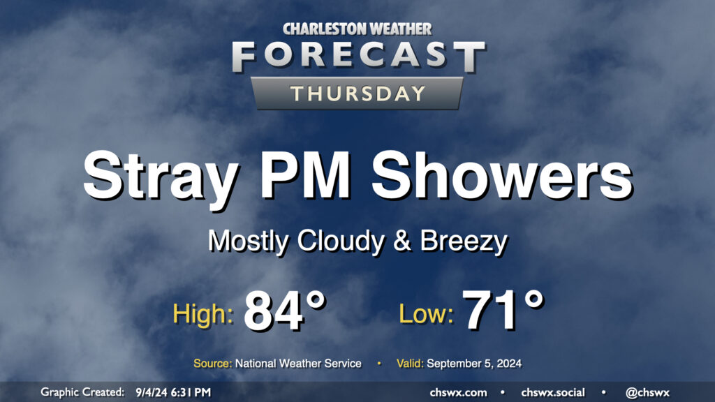
The wedge of high pressure that’s kept things breezy and cool but largely quiet hangs on for one more day Thursday. We’ll start the day in the low 70s, warming to the mid-80s in the afternoon under a mix of sun and clouds. Breezy conditions with gusts 20-25 MPH will continue to be possible as the pressure gradient stays pinched, and we’ll keep the risk of a shower or two primarily in the afternoon. The best chance for any rain will be closer to the coast, though much of us look to get the day in rain-free.
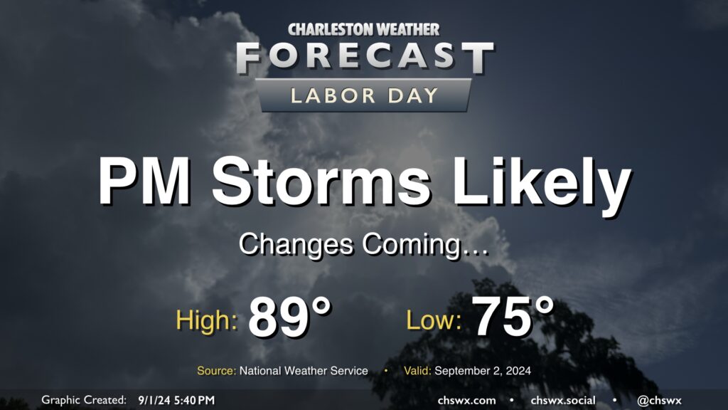
I hope everyone has gotten to enjoy the last few quiet weather days — it’s been warm, but aside from a brief shower in spots, mostly quiet. This begins to change on Labor Day as a cold front moves into the area from the north. We’ll see the risk for showers and thunderstorms increase ahead of the front, with rain chances peaking in the afternoon and evening. Severe storms are not expected, but some brief periods of heavy rain will be possible.
We’ll have one more day of seasonably warm temperatures before high pressure wedging southward drives some cooler air into the area for much of the upcoming week. Expect to start Labor Day in the mid-70s, warming to the upper 80s in the afternoon before showers and thunderstorms fire up. Heat indices should run around 100° given dewpoints in the mid-70s.
The rest of the week will feature below-normal highs in the low to mid-80s each day within a persistent northeast flow. Unsettled weather will continue, though, with the front stalled to our south and a coastal trough hanging around for the foreseeable future. It won’t rain all the time, but the risk will certainly be there. I’ll have more details tomorrow evening.