Tuesday: A rather nice day before clouds and showers return for the second half of the week
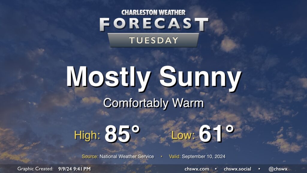
Tuesday looks like a rather nice day in our part of the world with mostly sunny skies, a seasonably cool start in the low 60s, and highs in the mid-80s with relatively low humidity as high pressure’s influence on the area peaks before moisture returns starting Wednesday. I hope you can take advantage! Unsettled weather will return to the area by Thursday.
Rest of the work week: Turning unsettled again
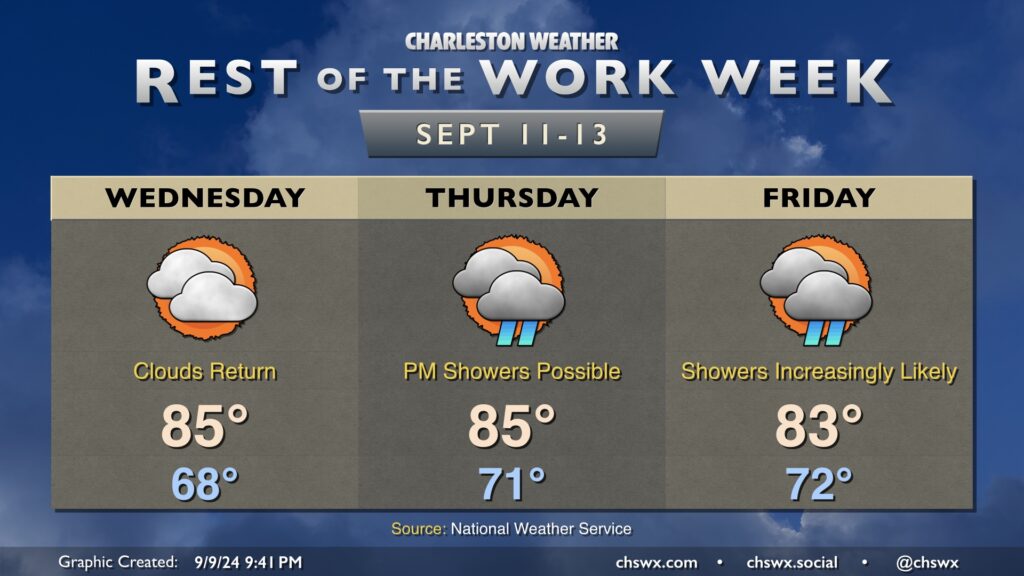
The stationary front to our south will begin to buckle back northward starting Wednesday as Francine, a tropical storm soon to become a hurricane in the western Gulf, makes landfall around Louisiana late in the day. While Francine will not have any direct impacts on our weather, moisture from the system will run atop the stationary front and surface high pressure, bringing shower chances back into the picture on Thursday and especially on Friday as it lumbers across the Mississippi through the mid-South and into the Ohio Valley. It won’t rain all the time, nor does the rain look too extreme to this point, but all the same, be ready to bring outdoor plans inside as we get into late week.