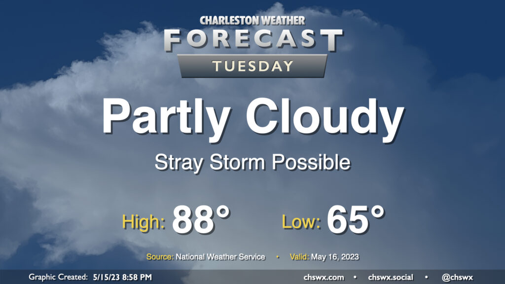
A warm front will lift north of the area tomorrow, bringing in even warmer and more humid air for Tuesday. Much of the day should stay rain-free with relatively weak instability, though a stray shower or storm near the seabreeze can’t be discounted. If a storm or two does form, note that storm motions will once again bring them toward the coast, so be aware of that if you have a Tuesday beach trip planned. (Lucky duck.) Expect highs to top out in the upper 80s; I wouldn’t be shocked to see a 90° reading somewhere, either.
Confidence is increasing in showers and thunderstorms affecting the area Sunday afternoon and especially as we get into the evening hours. We’ll start Sunday on a warm note, generally in the mid-60s, before warming quickly well into the 80s by midday. Scattered showers and storms should begin to kick off as the seabreeze develops and moves inland early in the afternoon, and coverage should increase as a front approaches the area from the northeast as we head into the late afternoon and evening. Severe weather isn’t anticipated, but lightning makes every thunderstorm dangerous, so be sure to move indoors if thunderstorms threaten. Winds around a ridge of high pressure to our west will also bring storms toward the coast, as well, so be alert if the beach is in your plans. Overall, it’s not a day to cancel outdoor plans, but have a solid indoor plan B in case storms come by.
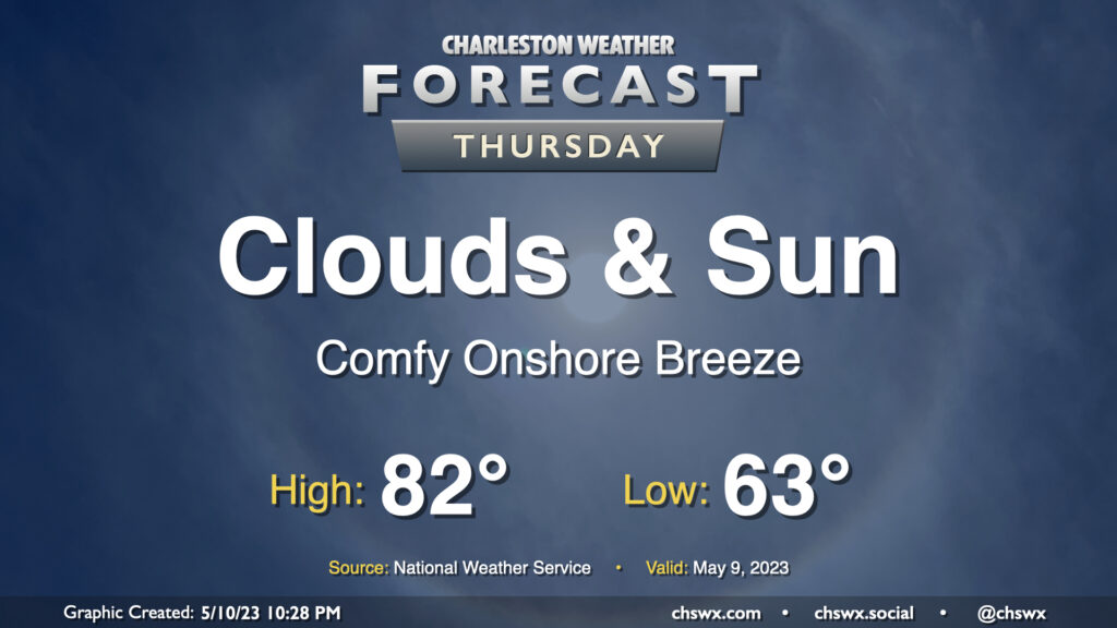
Not much to write home about weather-wise on Thursday. We’ll see a mix of clouds and sun throughout the day and continued comfortable temperatures; lows start in the low 60s with highs topping out in the low 80s in the afternoon, with an easterly breeze and the expected broken cloud cover to be a contributor to those temperatures. All in all, no hazards are expected and it should be a fine day.
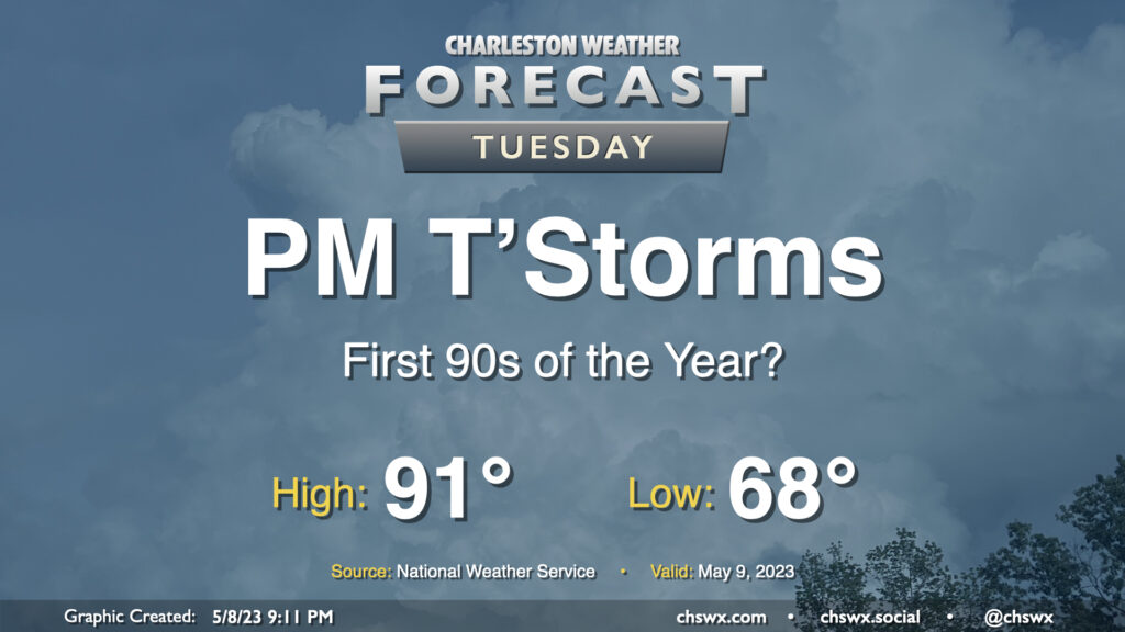
Monday was the warmest day of 2023 so far with a high of 89°, but that distinction will be short-lived as the first 90°+ temperatures of the season look likely on Tuesday ahead of a cold front. Mix in some humidity, and it’ll feel a little more like the mid-90s in the peak of afternoon heating, it looks like.
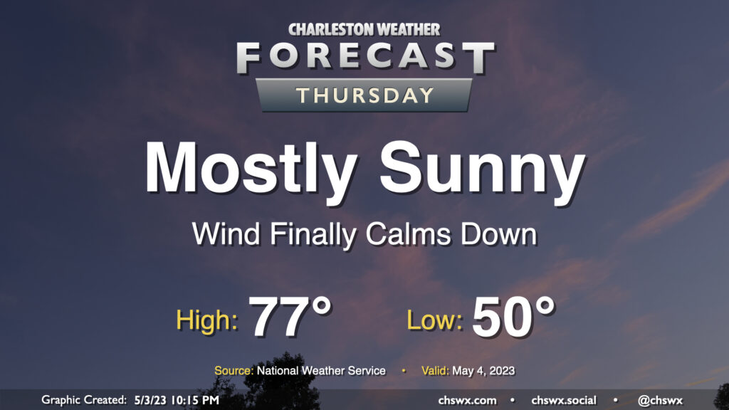
Thursday will represent the peak of our stretch of nice weather for one main reason: the pressure gradient that has kept our winds elevated for several days will finally have relaxed, bringing winds down to a light breeze during the day. Otherwise, it’s a carbon copy of Wednesday: Lows around 50°, with highs in the mid-70s in the afternoon under mostly sunny skies. I hope you can take advantage!
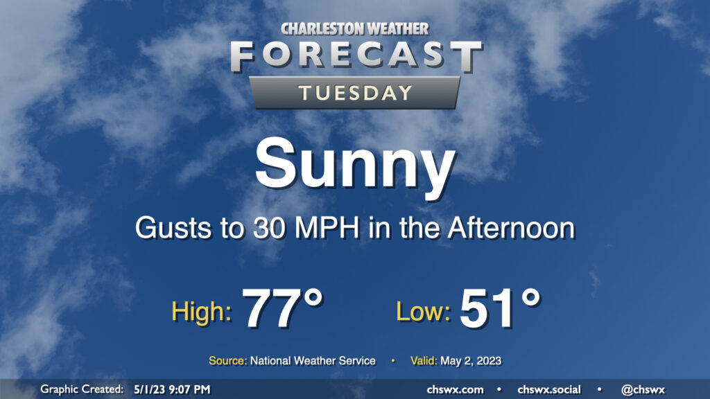
Tuesday looks fantastic by most objective measures — lows in the low 50s followed by mid-70s in the afternoon with plenty of sunshine. The only fly in the ointment remains the elevated wind gusts that will come along with peak heating in the afternoon thanks to deep mixing of the near-surface air that will tap into some elevated winds aloft. That’s about it, though — will be another pretty day with temperatures that at the end of this month I suspect we’ll wish we had back.
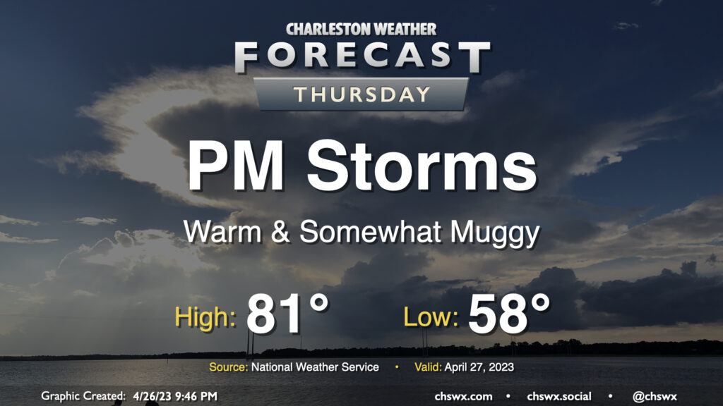
We should get a fair bit of Thursday in rain-free, but changes will be coming later in the day as low pressure to the west approaches the area. We start one more morning in the upper 50s before a warm front gradually lifts through the area throughout the day, which will bring dewpoints up in the afternoon and put a little mugginess in the air. A shower or storm along the seabreeze in the afternoon and early evening can’t be totally discounted, but the bulk of the rain arrives after dark with the aforementioned low pressure and will be around for much of the overnight.
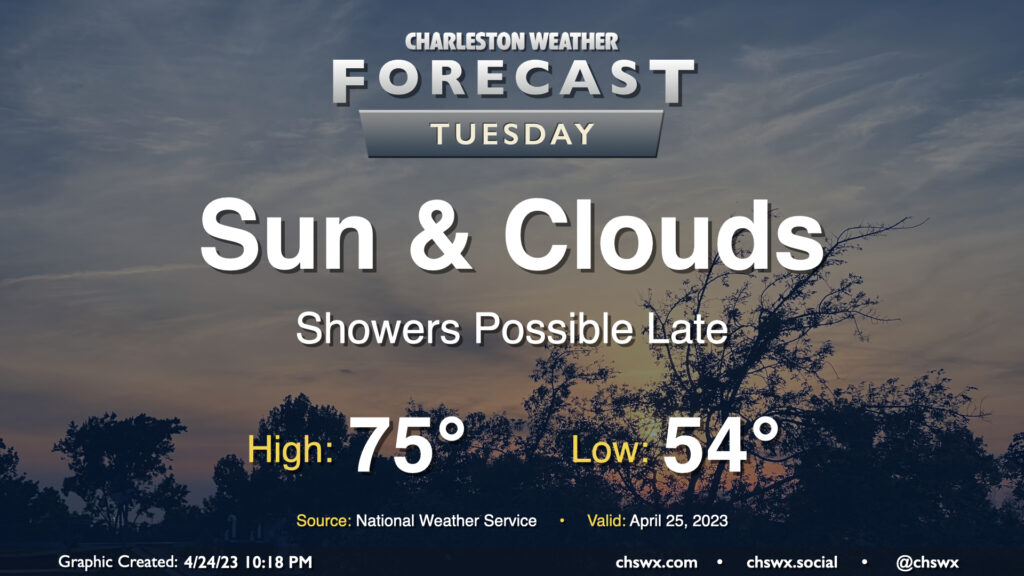
We should get much of, if not all of, Tuesday in rain-free before the pattern changes to something more unsettled to finish up the work week. We start Tuesday in the mid-50s; cloud cover and continued northeast flow will inhibit temperatures from rising much higher than the mid-70s in the afternoon. Some of the higher-resolution guidance has some isolated to scattered showers breaking out later in the afternoon into the evening hours as high pressure loses its grip on the area, but not everyone will see rain.
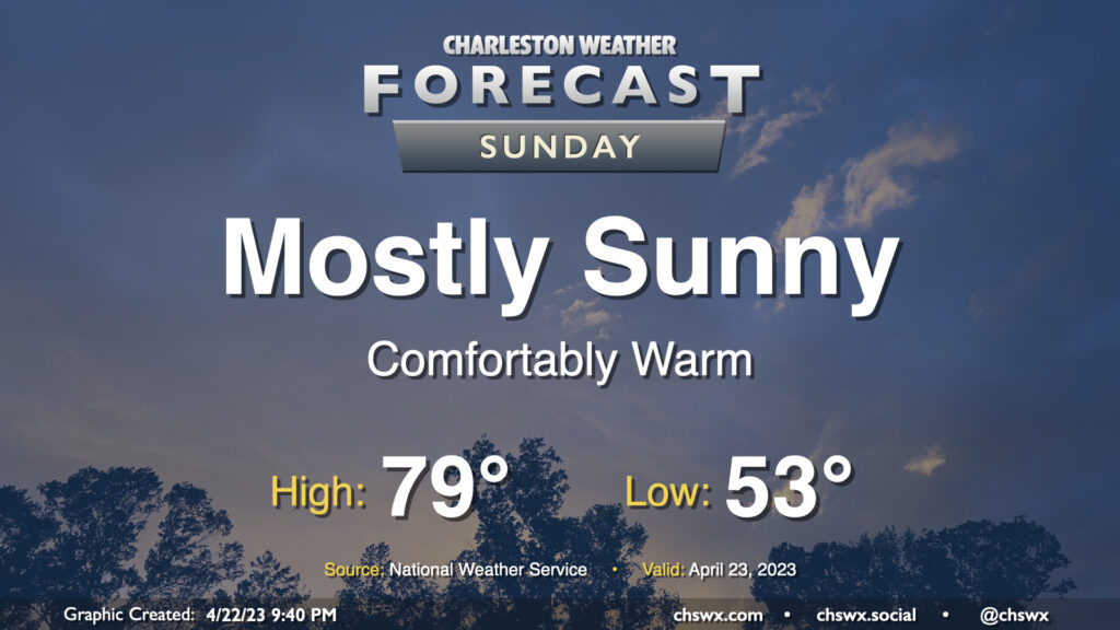
No weather concerns for Sunday as the cold front has cleared the area, leaving behind a cooler and drier airmass that’ll be highly conducive for outdoor activities. We start the day in the low-to-mid-50s across the area (warmer near the coast). Northwesterly winds, which will have a downslope component from the mountains, will help drive temperatures to the upper 70s in the afternoon under mostly sunny skies. Winds will shift a little more southerly in the late afternoon/evening hours behind the seabreeze, which will nudge dewpoints up a bit, but it’ll still be very, very comfortable outside with low humidity. Enjoy!
One more predominantly sunny day is in store for Thursday as stacked high pressure remains in place across the Carolinas. We’ll start the day in the mid-50s, generally around normal for April 20, before warming into the mid-to-upper 80s in the afternoon, which is ten degrees above normal. Unfettered sunshine is expected once again, with very little, if any, in the way of cloud cover. It’ll be another great day to get outside for lunch or even a nice golden-hour dinner.