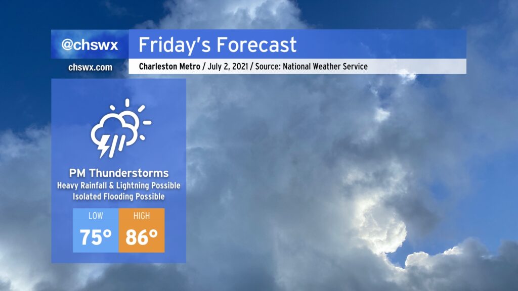
After a couple days in a classic summertime Bermuda High setup, we’ll see that high continue to retrograde eastward, giving way to a cold front sinking south from the Ohio Valley. Said front will run into an incredibly juicy airmass courtesy of a robust moisture tap from the Gulf, and help to ignite numerous showers and thunderstorms in the afternoon. This will have the effect of holding temperatures down into the mid-80s.
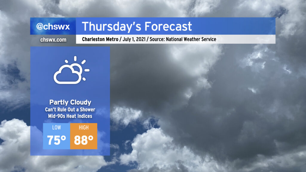
We’ve got a warm Thursday in store ahead of a cold front that will make for an unsettled Friday. Temperatures will run in the upper 80s away from the locally cooler coastline, and the humidity will make it feel well into the mid-90s. There will be a slight chance of showers and storms around midday as the seabreeze pushes inland, but that’s about it.
Friday will be a much different story as showers and thunderstorms become pervasive across the area ahead of a stalling cold front. This activity looks to continue into Saturday, but storm chances diminish significantly as we get into the Fourth. There’s still uncertainty here around the positioning of the front and the ultimate sensible weather outcome for the Charleston Metro Area, so I continue to encourage y’all to keep an eye on forecast updates as we head into the long holiday weekend.
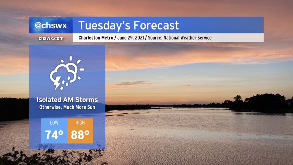
All tropical storm warnings have been discontinued as Danny moves away and weakens, and so we can now look forward to a calmer and more sunny Tuesday. We could see an isolated shower or storm come in off the Atlantic in the morning, but other than that, we should see a good bit of sunshine and warmer temperatures. Highs will top out in the upper 80s, still a few degrees below normal for late June. Rain chances head up as the week goes on, and it’s conceivable that this could end up being the driest day of the week, so try to take advantage where you can.
Get ready for periods of showers and thunderstorms tomorrow with heavy rain and gusty winds at the coast as a tropical disturbance of some kind comes ashore south of the Charleston metro area in the afternoon. While it’s unclear what state the disturbance will be in by the time it arrives tomorrow, the impacts are largely expected to remain the same.
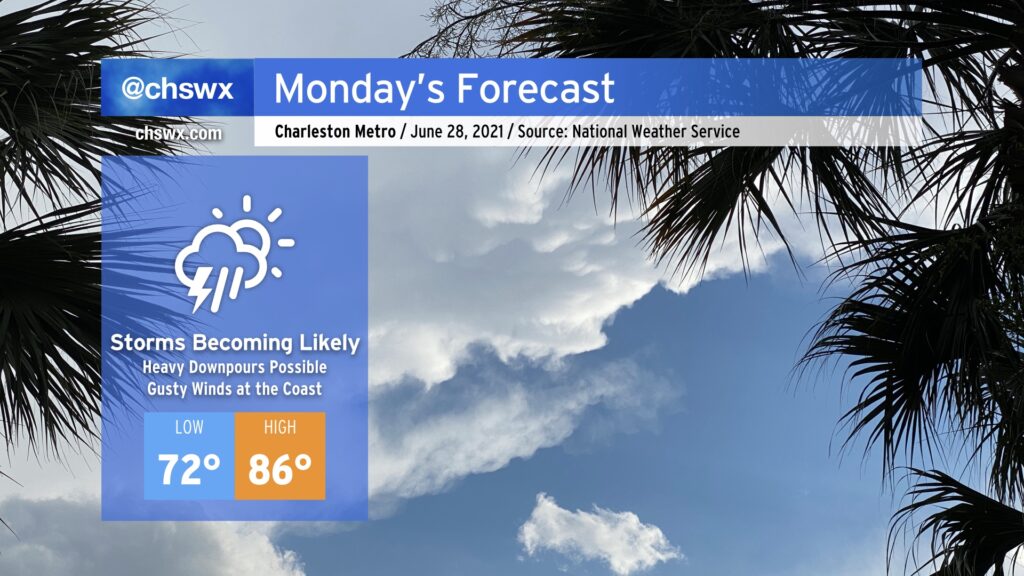
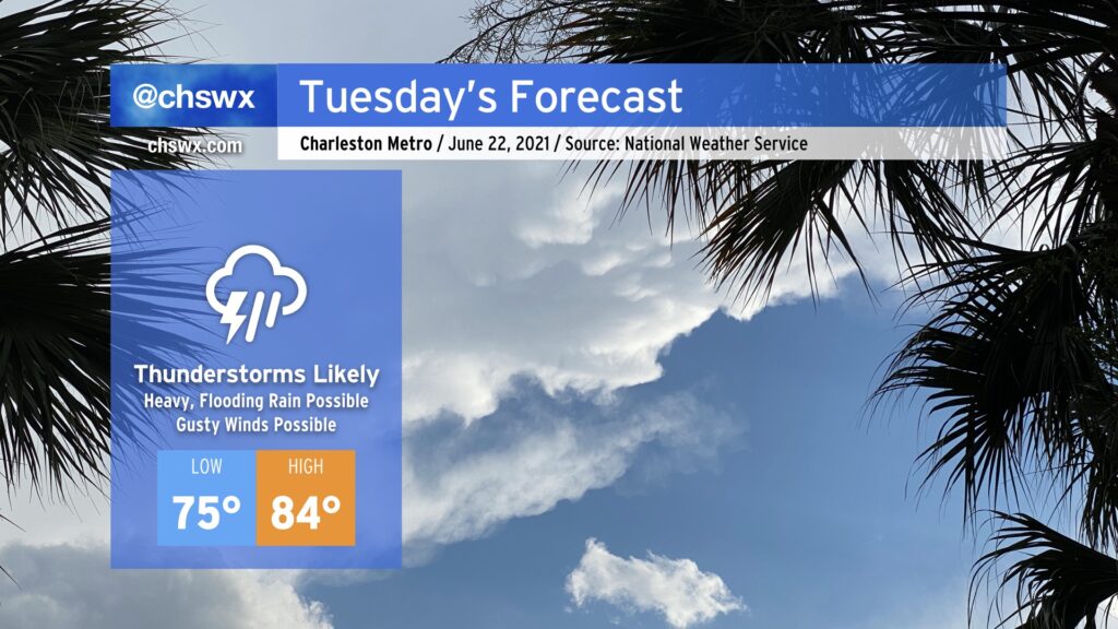
Most of us saw a dry day today, giving us a respite from the heavy downpours that have characterized June thus far. A cold front approaching from the west is going to put a swift end to this respite, though, as it runs into an atmosphere still plenty juiced up with tropical moisture and ready to wring out some more rainfall. Shower and thunderstorm coverage could begin to ramp up as early as tomorrow morning (and some guidance is fairly persistent in it firing up as soon as midnight), with the greatest risk of showers and storms in the afternoon and evening hours. Storms could produce torrential downpours which may produce isolated flooding episodes. Overall, 1-2” of rain will be possible across the area with locally higher amounts.
Additionally, there is the potential for wind damage to occur in some of the stronger thunderstorms, especially where outflow boundary collisions occur. Be alert for possible warnings in the afternoon.
The prevalence of showers and thunderstorms will act to keep high temperatures a few degrees below normal, generally running in the mid-80s. Heat indices will still climb into the 90s, though, thanks to the ever-present humidity.
Tropical Depression Claudette, which is moving through western Alabama this evening, will be taking a bit more of an easterly turn around the subtropical ridge, heading through northern Georgia and SC during the day on Sunday. This will, in turn, bring along another plume of tropical moisture into the area, setting up another round of heavy and perhaps flooding rain in spots, along with the risk for strong to severe thunderstorms with damaging wind gusts and maybe a tornado or two.
While the cold front that triggered last night’s deluge has slipped south of the area, it has stalled out nearby. With a little bit of help from some upper-level dynamics, we should see some isolated thunderstorms in the metro area this afternoon. A damaging wind or large hail episode is possible for a few of you, so stay alert across the area this afternoon. With that in mind, the severe threat certainly looks more isolated than we saw yesterday.
Highs top out near 90°; with a little less humidity behind the front, it won’t feel quite as swampy outside.
After today, we look to stay rain-free through Saturday with warm temperatures and low humidity by June standards.
Typical June weather continues for Tuesday. Temperatures will head up into the low 90s in the afternoon as westerly winds keep the seabreeze pinned to the coast. We’ll want to keep an eye on an upper-level disturbance as it swings through; this could help a few storms to get going in the afternoon, especially if the seabreeze can make some inland progress. There will be enough instability to support storms if enough lift is realized, and dry air in the mid-levels could portend a risk for isolated damaging wind gusts. So, we’ll keep an eye on this, but it is more likely than not we get through Tuesday rain-free in a vast majority of spots — good news as we dry out from this past weekend’s deluge.
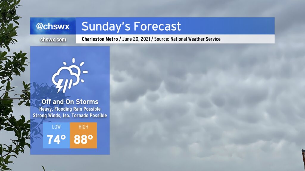
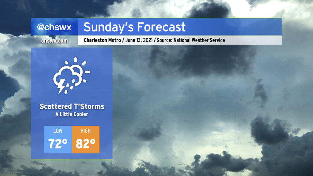
After what ended up being a raucous Saturday evening (for all the wrong reasons), we’ll start Sunday on the cool side of a frontal boundary that will stall out and dissipate midway between Savannah and Jacksonville. Low pressure will develop along the front and move away, keeping us in northeast to easterly flow. The rich atmospheric moisture that helped contribute to our flooding issues today will remain in place for Sunday. Guidance hints on the potential for some coastal rainfall in the morning as low pressure develops offshore and moves away, followed by scattered afternoon storms with the inland-progressing seabreeze (though this evening’s models are blessedly trending drier). With persistent weak storm motions expected, we’ll have to keep an eye on any downpours that can get going for an isolated flooding threat, particularly if they fire in the West Ashley to Downtown corridor along Highway 17, where 3-5″ of rain fell this evening.
The post-frontal airmass and onshore wind will keep things a touch on the cool side for June, with expected highs in the low-to-mid 80s. Unfortunately, this doesn’t come with much of a dip in dewpoints, so we’ll still be on the muggy side of comfortable.
Let’s hope the drier trends in guidance continue! (Side note: It’s amazing how fast we go from “we need the rain” to “make it stop” in summertime…)
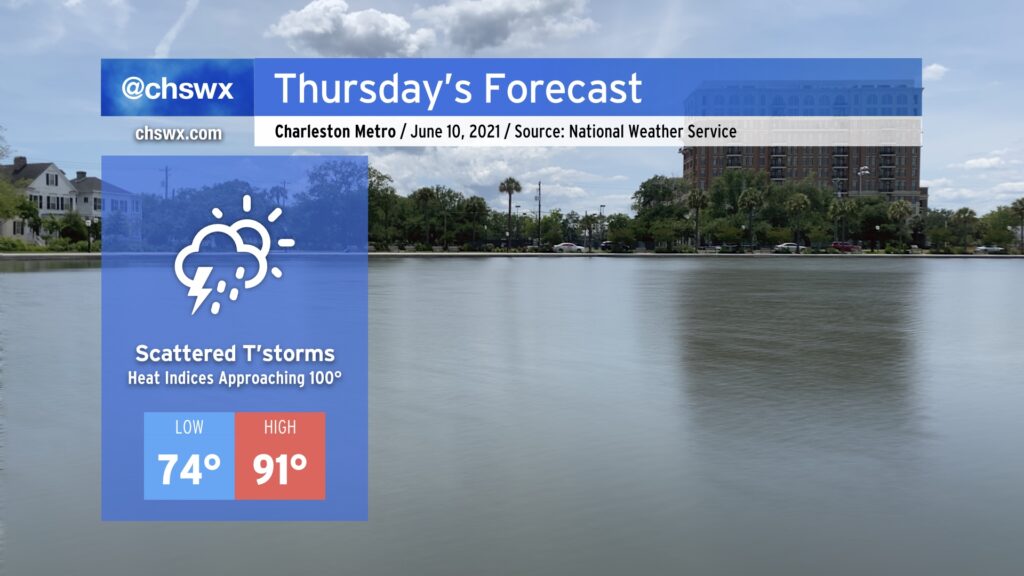
Temperatures continue their upward climb on Thursday, with air temperatures in the low 90s combining with dewpoints in the low 70s to yield heat indices approaching 100° for the first time this season. Some of us will see some relief from isolated to scattered showers and storms along the inland-marching seabreeze, but with high pressure holding firm, you can’t count on storms to cool you off. Where storms do form, brief downpours will be possible. As always during the warm season, we will want to watch outflow boundaries from collapsing storms as they can collide and help pop a few stronger storms.
We will turn increasingly unsettled as a trough begins to dig in starting Friday and into the weekend. This will send a frontal boundary our way which will help touch off more storms. Don’t cancel plans, but ensure you have indoor fallbacks for outdoor activities.