The week ahead: After a record-breaking day, turning quiet — and cold
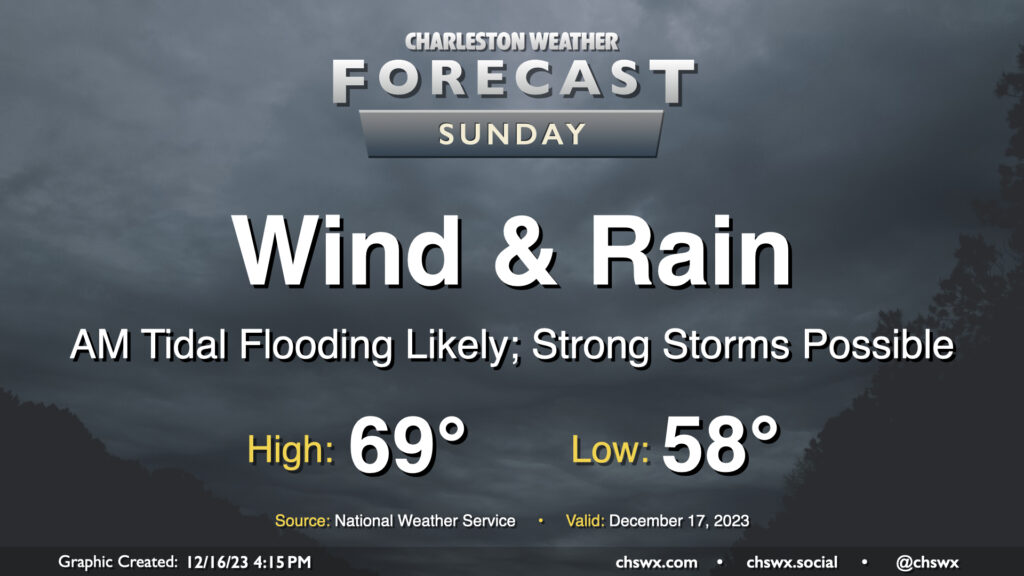
After a record-breaking — historic is not hyperbole in this case, frankly — day of weather, we’ll turn back to more tranquil — and for a few days, quite cold — conditions as we head into the final shopping week before Christmas.
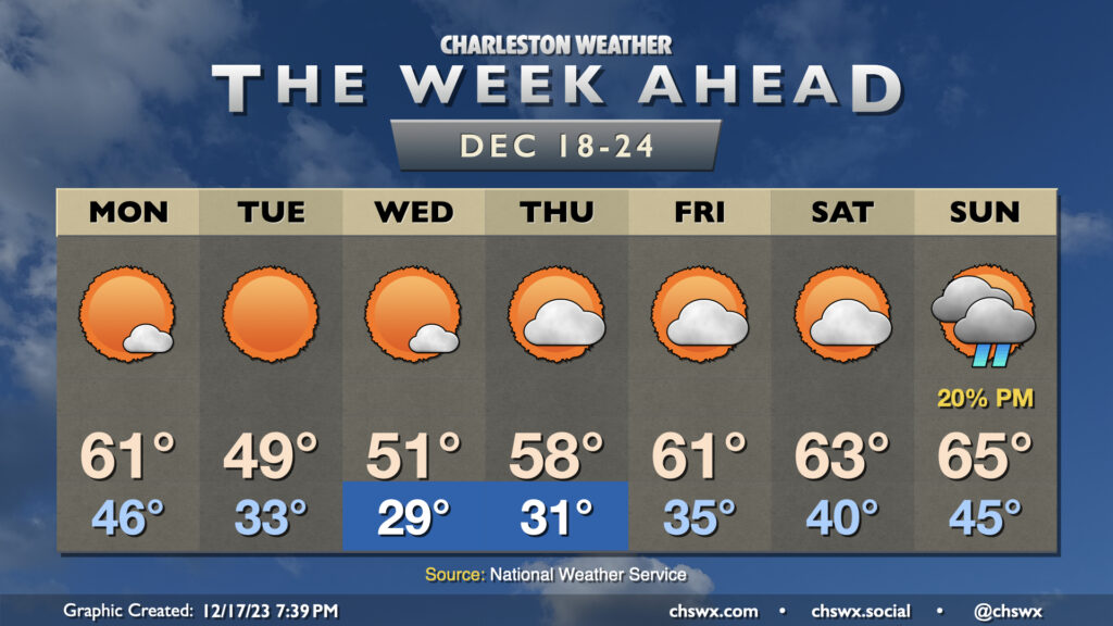
Monday will feature temperatures generally in the ballpark of normal, but a strong (but dry) cold front will clear the area late Monday into early Tuesday, shifting winds to the northwest and turning on the chill as high pressure builds in from the west. Expect to start Tuesday very near freezing in the metro area, and likely at or below freezing further inland. Despite sunny skies, strong cold advection should keep temperatures below 50° in the afternoon. (Brrr.) A solid freeze looks to set up for Tuesday night into Wednesday morning, with lows in the 20s across much of the area as high pressure settles in overhead. Highs on Wednesday get to about 50-51° or so with a few clouds at most.
After another freeze Thursday morning, high pressure will slip offshore and temperatures will begin to recover into the upper 50s to low 60s to close out the week. We’ll keep an eye on Christmas weekend for our next storm system, but the usual model disagreements are sufficient enough where any confidence in any rain is pretty low.
Read more »