Sunday: Nor’easter impacts peak with heavy rain, gusty winds, and coastal flooding
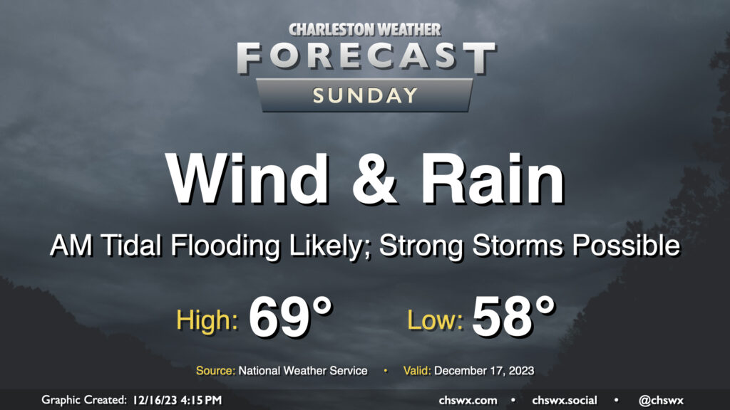
A fairly lousy and potentially high-impact weather day lies ahead for Sunday as a strengthening nor’easter moves along the coast. Wind and rain will begin to pick up early Sunday morning, with gusts near 45 MPH at times (and potentially even higher on bridges and overpasses). Rainfall could turn out to be quite significant, especially within any thunderstorms that can fire; before it’s over, many of us could see 3-5″ of rain with even higher amounts in some spots. Flooding is increasingly a concern as a result, especially with the potential for an 8′ water level around the 11:17am high tide coinciding with continued heavy rain. Finally, if surface-based instability can develop, a severe thunderstorm or two with locally damaging wind gusts and maybe even a tornado could be possible. All this to say that Sunday’s a good “stay inside” day.
What to watch for throughout the day
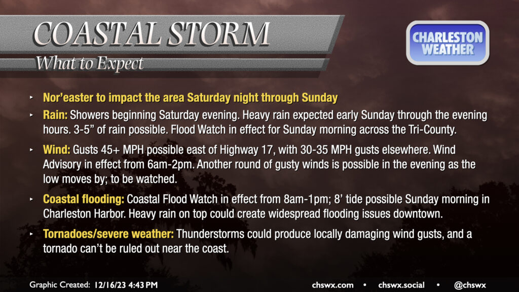
It’ll almost certainly be raining when we wake up Sunday morning, with embedded heavier downpours and maybe a few thunderstorms bringing bouts of heavier rain to the area. Some gauges may have already recorded 1-2″ of rain by 7am, and there will be more where that comes from. While soils are still somewhat dry, and we remain in a 2″+ rainfall deficit, there will be the potential for some freshwater flooding in some spots. A Flood Watch is therefore in effect for the entire Tri-County area from 1am to 1pm (and could be extended even further depending on trends; some guidance continues to bring a line of strong thunderstorms into the area during the afternoon).
As we get into mid-morning, we will be watching the tide in Charleston Harbor closely. The current forecast as of this writing is for the water level to reach 8′, or major flood stage, in the harbor around the 11:17am high tide. A Coastal Flood Watch is in effect from 8am-1pm, and if confidence continues to increase in a major-flood tide, this will be upgraded to a Coastal Flood Warning. At these heights, we can even see some tidal flooding on Daniel Island, so we may see a Coastal Flood Advisory extended into Berkeley County. All guidance is showing heavy rain in the area around this time, so it’s prudent to be ready for a few hours where downtown and barrier island travel becomes quite difficult if not downright hazardous in spots. Never cross a flooded road — turn around, don’t drown!
Wind will be a compounding issue, especially throughout the morning. Gusts exceeding 45 MPH will be possible, especially near the coast and on overpasses and bridges, with gusts 30-35 MPH persisting into Dorchester and Berkeley counties. Soils will get saturated in a hurry, and these speeds could be enough to down a tree or two as a result. Be prepared for power interruptions throughout the day.
Updated at 10:42 PM: A Wind Advisory is in effect from 6am-8pm. It was previously scheduled to end at 2PM. NWS noted in its short-term forecast discussion for Sunday that there’s the potential for a second round of strong winds to develop thanks to a “sting jet,” a feature with rapidly drying air that’s becoming more dense and descends very quickly. It’s not expressly likely to happen, but it certainly is worth watching. Regardless, the risk for gusty winds looks to persist into the evening, hence the extension of the advisory.
The other potential concern will be around locally damaging wind gusts within severe thunderstorms. Instability looks tough to come by as usual, but there are some indications that some may indeed develop as we get into the afternoon and the main rain shield lifts north of the area. Gusts 60+ MPH are certainly not out of the question if severe storms can develop, and a tornado can’t be ruled out, either. You’ll want to have the weather radio handy, just in case.
We should begin to see improving conditions as we get further into Sunday evening (though if the aforementioned sting jet develops, we might still be dealing with wind for a while). Rain will scour out, and we’ll be drying out by Monday morning as the low lifts northeastward and continues to intensify. Next week looks downright cold, particularly as we get into Tuesday and beyond. I’ll have more about that tomorrow.
Follow my Charleston Weather updates on Mastodon, Bluesky, Instagram, Facebook, or directly in a feed reader. Do you like what you see here? Please consider supporting my independent, hype-averse weather journalism and become a supporter on Patreon for a broader look at all things #chswx!