Sunday not-so-funday with gusty winds and heavy rain expected
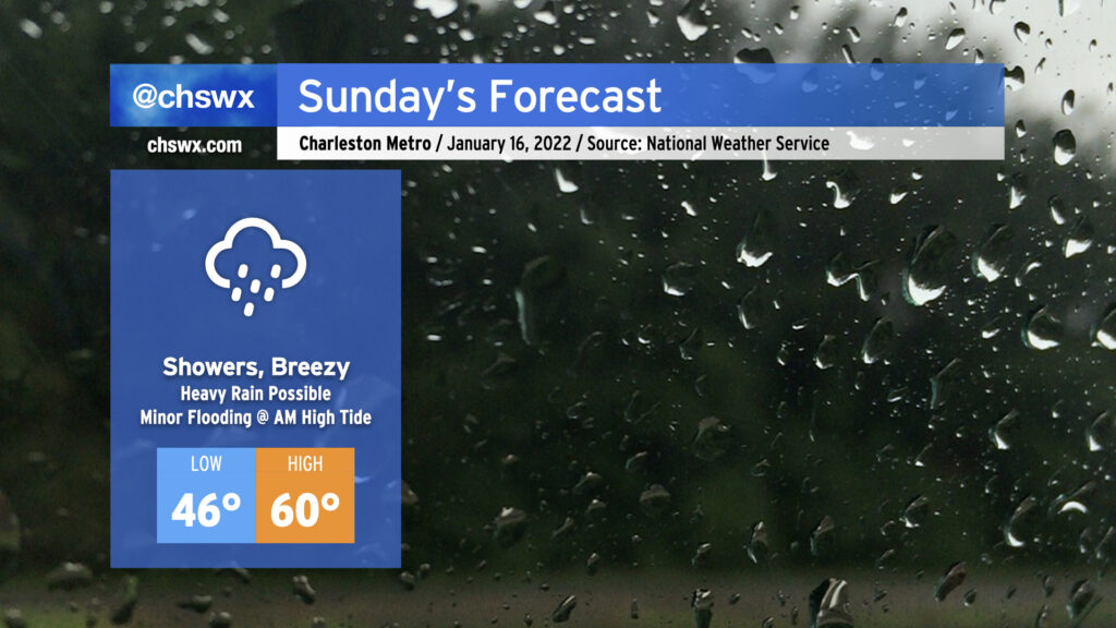
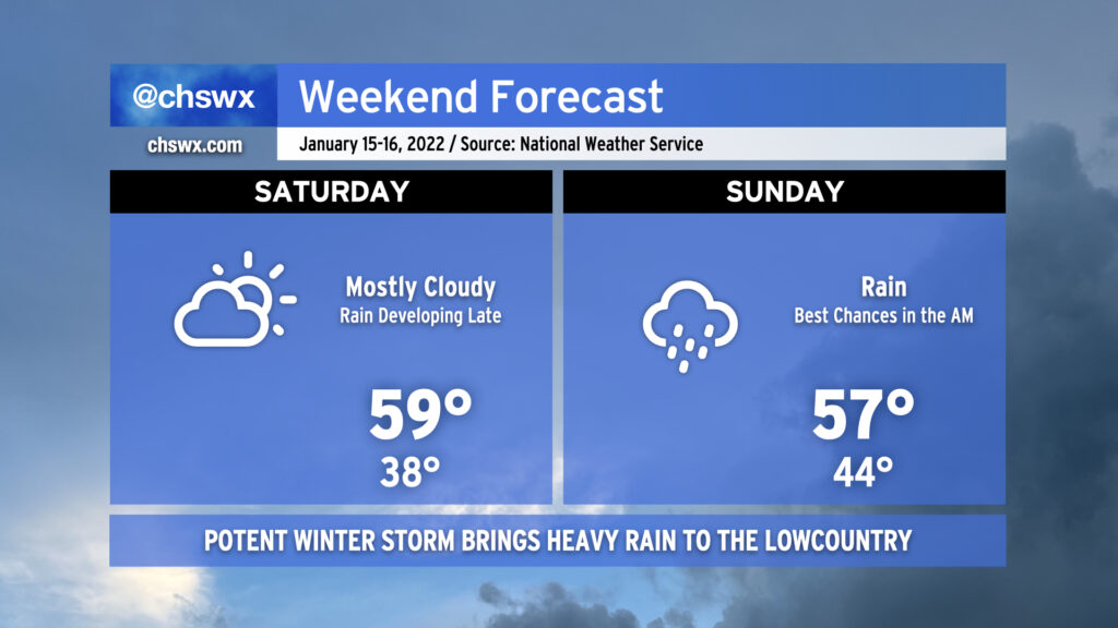
Rain will increase across the area by early Sunday morning as the potent storm system we’ve been watching for the last several days makes its approach to the Charleston area. 1-2″ of rain will likely fall before it’s all said and done Sunday evening. Gusty winds will be a concern especially as the cold front moves through, potentially bringing gusts 30-40 MPH at times especially on elevated surfaces.
Temperatures will remain above freezing for the duration across the Tri-County, and no winter weather is expected. The exact temperatures are going to be somewhat difficult to pin down as it will largely depend on how far inland a warm front can get. We could easily see highs in the low 60s at the immediate coast and temperatures struggling to get out of the 40s for much of the day around the Santee Cooper lakes and the I-95 corridor. Even though we’re now at the point where the highest-resolution models are able to resolve these features, it’s going to be really, really tough to say with much confidence exactly how the temperature curve will shake out tomorrow. The warm front will bear close watching.
Flooding is becoming an increasing concern for early Sunday morning as well. Water levels in the harbor are forecast to peak around 7.2′ with the 6:47am high tide, owing to strong northeasterly winds developing within the wedge as low pressure deepens to our west. Recent guidance suggests a non-zero possibility for a few heavy showers to be in the area around this time, too, so we’ll need to watch closely in case tides and rainfall combine for road flooding in downtown Charleston.
There is a non-zero risk for a thunderstorm or two near the coast during the day Sunday. However, conditions don’t look terribly favorable for severe weather in our neck of the woods. (There is a slightly better risk of severe weather as you head into the Grand Strand and southeastern North Carolina.) Of course, we will want to keep an eye on this, but right now this thunderstorm threat looks rather minimal.
Overall, it’s a tricky forecast day across the Southeast, but at least we look to escape wintry weather for this go-around. It’ll be a good day to stay indoors, keep devices charged in case winds cause a power outage or two, and watch some football (if that’s your thing, anyway).
Keep an eye to the Carolina Weather Group throughout the day tomorrow for updates on the storm, including for Charleston from yours truly, as it impacts the Carolinas.