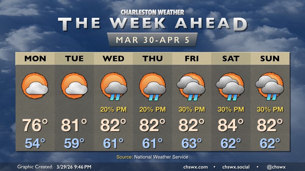
We’ll close March and open April on a quiet and comfortable note with plenty of sunshine and seasonably warm temperatures, especially as we head into midweek.
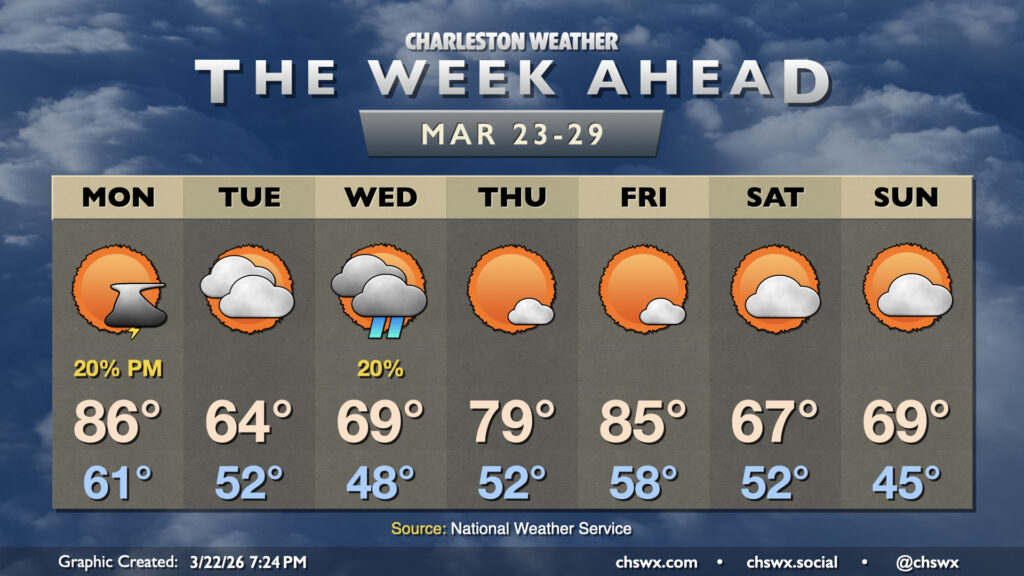
The last full week of March promises quite a big swing in temperatures from seemingly day to day as a series of fronts affect the area. We’ll have a few shots at showers, too, but they don’t look likely to offer much in the way of drought relief.
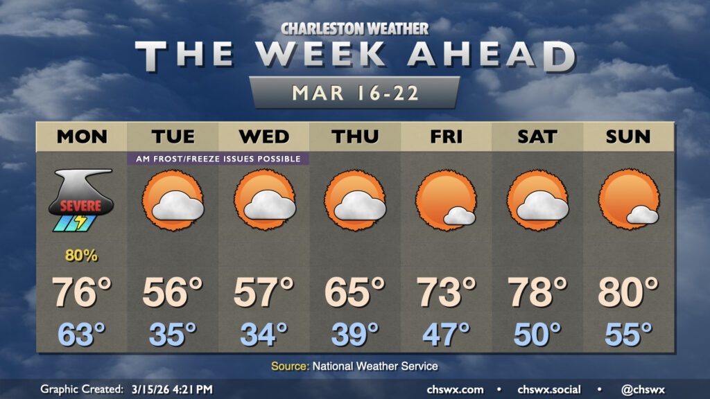
The week ahead gets off to a bit of a rough start as a potent cold front moves through the area Monday, bringing the first significant severe weather threat of 2026 to the Lowcountry. From there, temperatures fall off drastically, with some frost and freeze issues possible especially inland. We’ll warm back up heading into the weekend, though.
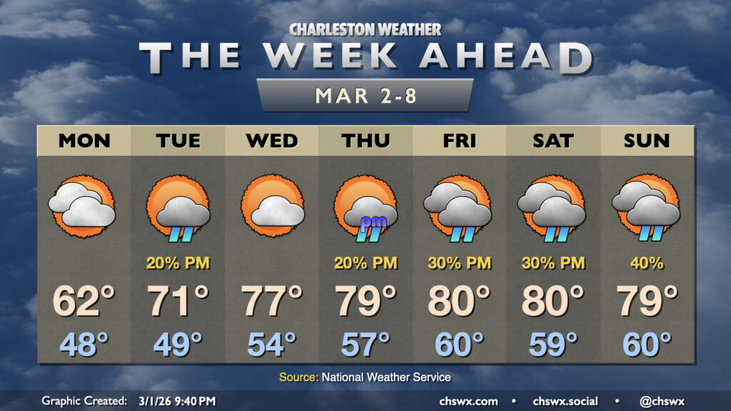
The stretch of abnormally warm, 80°+ days continues for the first half of the upcoming work week before a cold front knocks temperatures back a little bit as we head into the weekend.
High pressure wedging down from the northeast overnight will set up a cool and mostly cloudy Monday across the Lowcountry — another dip on the temperature rollercoaster after an already up-and-down weekend. Temperatures start in the upper 40s with some fog possible (especially near the coast, where sea fog has been an issue), but the persistent northeast breeze and cloud cover courtesy of some moisture overrunning the wedge will keep temperatures pinned to the low 60s in the afternoon.
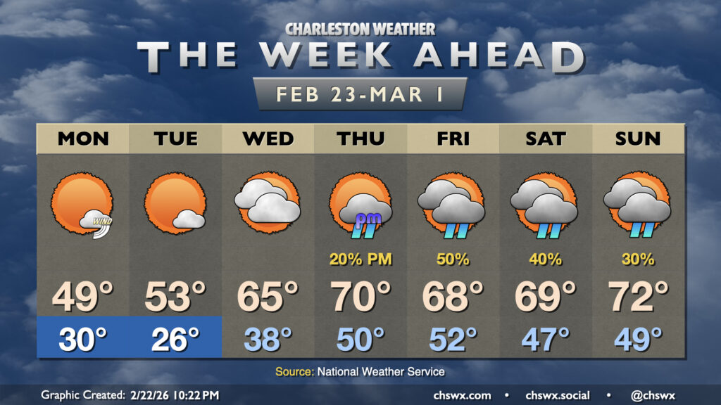
Winter makes a brief return to the Lowcountry to start the final week of February, but temperatures look to rebound for the second half of the week, albeit with some shower chances.
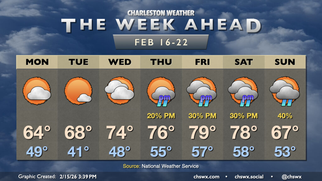
After some much-needed rain on Sunday, sunshine and warmth return for the new work week as high pressure remains the main weather driver for a few days before shower chances return to the picture later in the week.
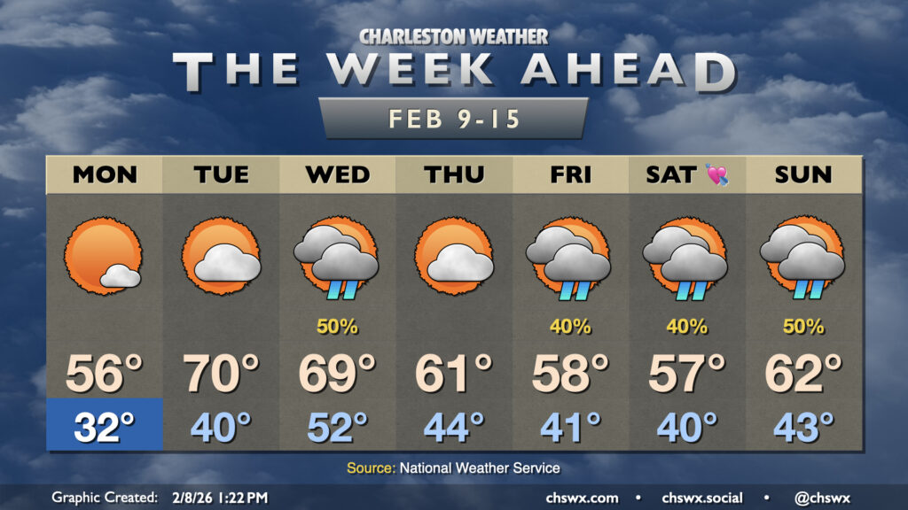
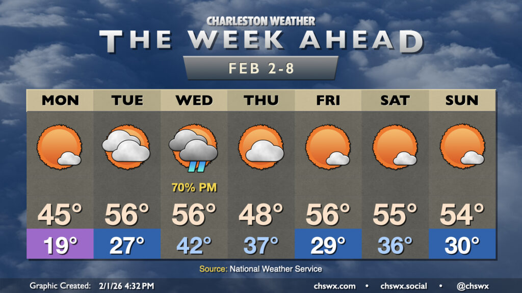
While we do have some rain chances in store this week, what we will be lacking (after Monday morning, anyway) is subfreezing cold. It’s been a very chilly start to February so far — in fact, this first week of February (Feb 1-7) ties 1951 for ninth coldest on record at the airport with an average temperature of 42.2°. We will thankfully break the cold snap this week as the upper-air pattern changes a bit, favoring a ridge trying to nudge in from the south that’ll keep the colder air bottled up to the north.
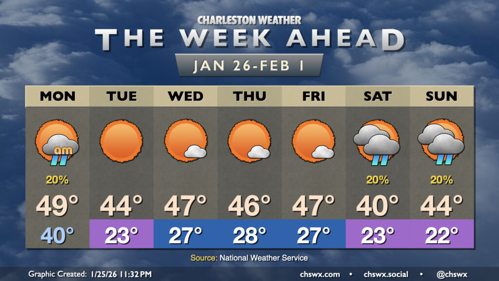
Our run of cooler than normal temperatures that closed January will continue for the first week of February, but a repeat of the past couple weekends of wintry intrigue, mercifully, is not expected.