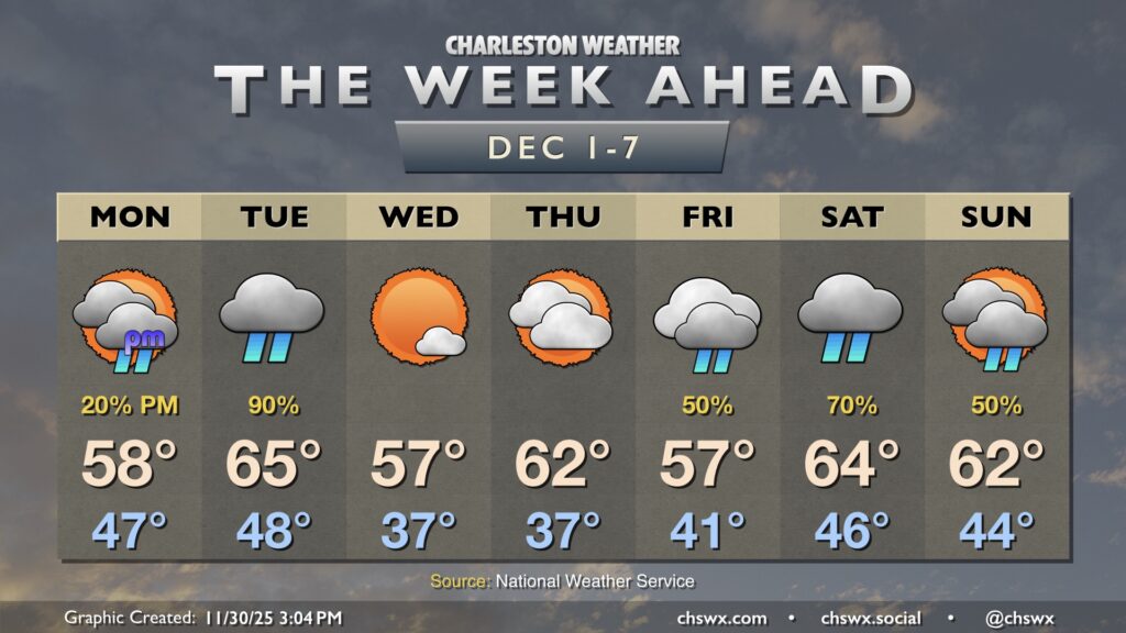
Much-needed rain and below-normal temperatures are in store for the week ahead as a series of fronts affect the area. We’ll also see the risk for some tidal flooding in the mornings beginning Tuesday courtesy of the upcoming full moon.
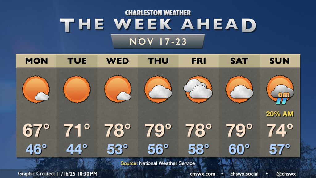
We’ll start Thanksgiving week out on an unseasonably warm note, but a temperature correction is incoming starting Thanksgiving Day as a strong cold front moves by. We’ll have a couple more slight rain chances, but overall, we’ll be largely dry as drought conditions continue to creep further into the Lowcountry.
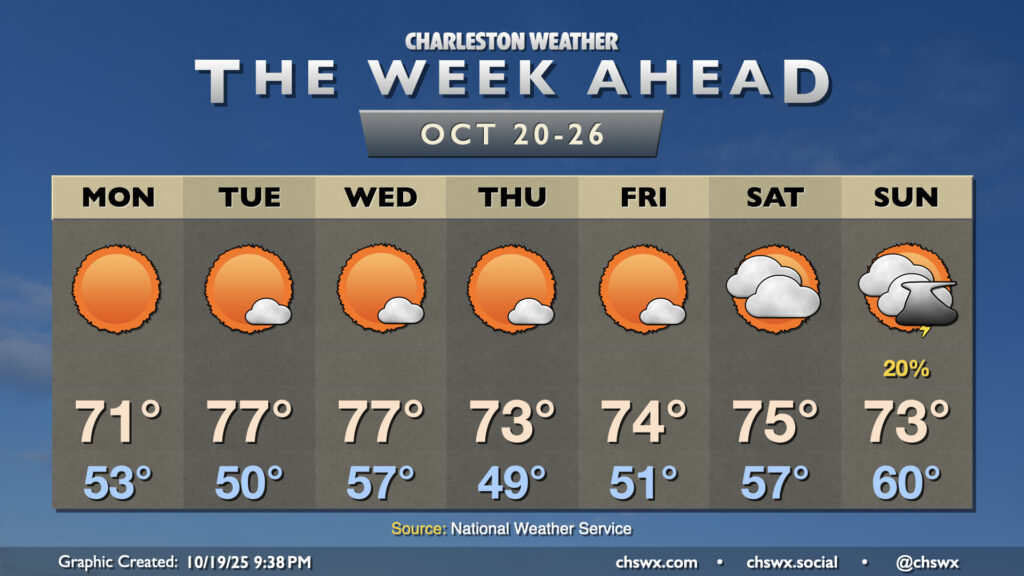
After a cold front brings a brief cooldown to the area on Monday, temperatures return to the 70s on Tuesday before heading well above normal for the balance of the week ahead with little rain in sight.
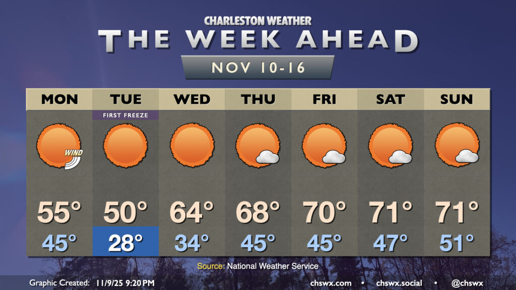
A strong cold front will bring about the first freeze of the season overnight Monday into Tuesday as a highly anomalous intrusion of Arctic air pushes southward. The winter preview will be short-lived, thankfully, but it will be impactful as the growing season almost certainly will end Tuesday morning.
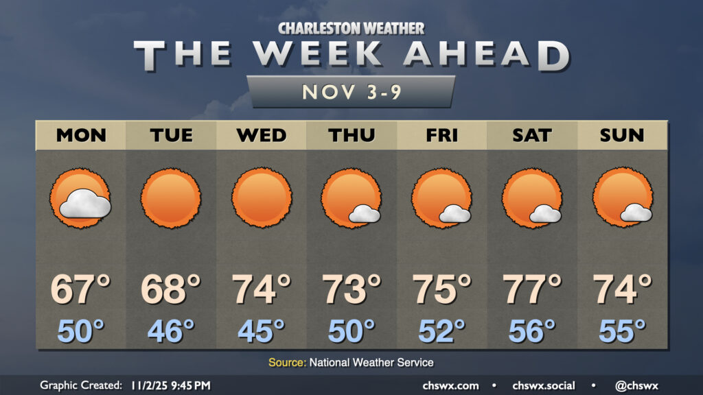
The week ahead looks generally quiet and increasingly warm, especially as we get into late week and the first part of the weekend, but nothing too out of bounds for early November. Coastal flooding will become an issue beginning Tuesday as favorable winds and the highest astronomical tides of the season coincide, though.
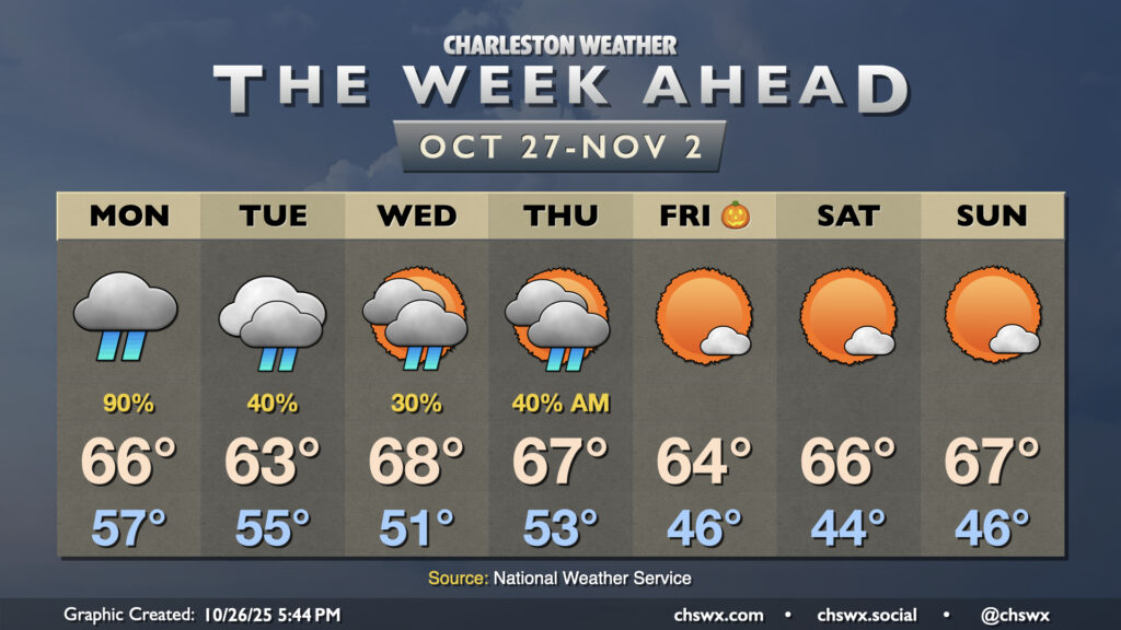
The final week of October will feature cooler-than-normal temperatures as well as periods of unsettled weather as a couple storm systems affect the area ahead of what should be a quiet Halloween weekend.
Another generally quiet week of weather lies ahead as high pressure remains the primary weather driver across the Southeast with a reinforcing shot of cooler air for the second half of the week.
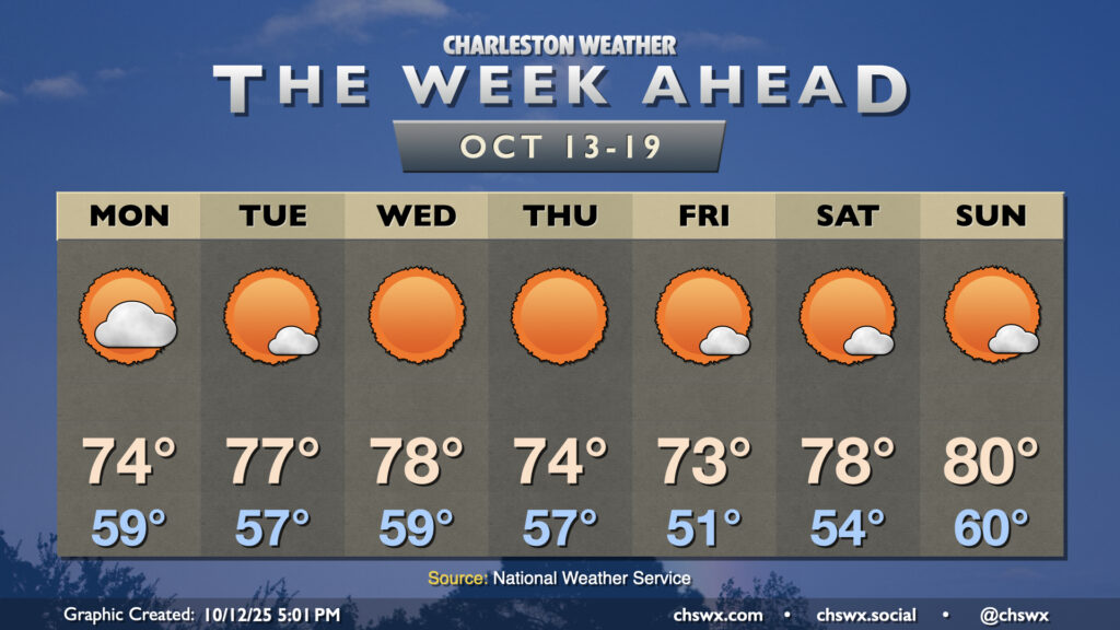
The nor’easter that has made for several soggy days across the metro will finally be pulling away on Monday, yielding a beautiful week of weather across the area with plenty of sun and comfortable temperatures.
Warm temperatures will continue for the first half of the week before a cold front knocks temperatures down below normal starting Thursday. Shower chances will be with us for much of the week, though, and we’ll be dealing with coastal flooding as well.
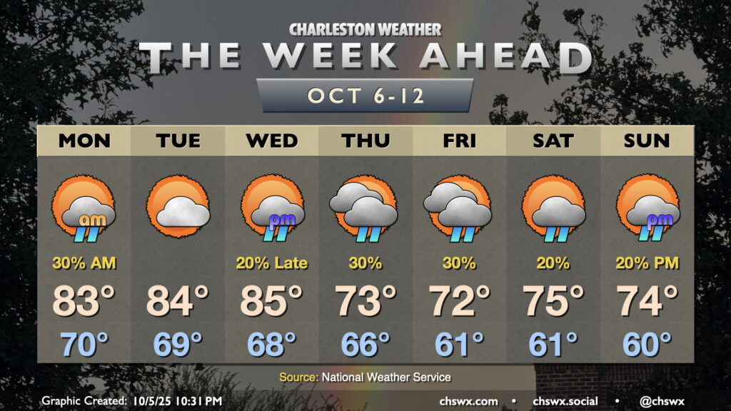
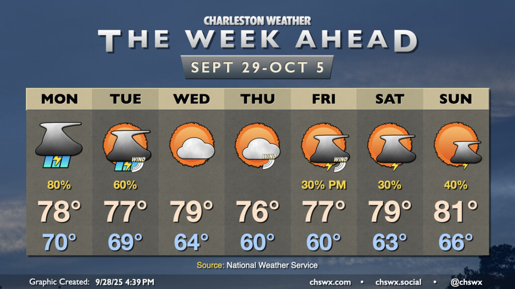
We’ll close September on a stormy note as moisture from Tropical Storm Imelda interacts with a stalled front/trough situated along the coast to produce solid shower and thunderstorm chances through Tuesday. From there, a good shot of fall welcomes us to October before more shower and storm chances return for Friday and the weekend.