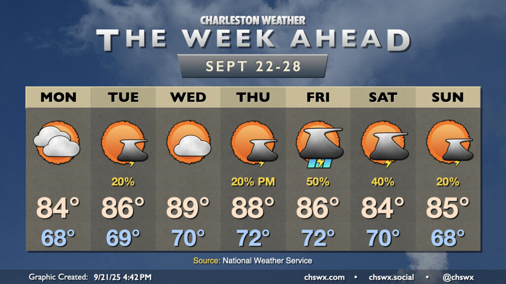
Astronomical fall begins on Monday with the autumnal equinox at 2:19 PM, but it will increasingly feel more like summer as the week wears on as above-normal temperatures take hold by midweek.
The week ahead will remain generally quiet, but we’ll start to turn warmer later this week as high pressure ridges in aloft. Slight shower and storm chances return to the area for the weekend, particularly on Sunday.
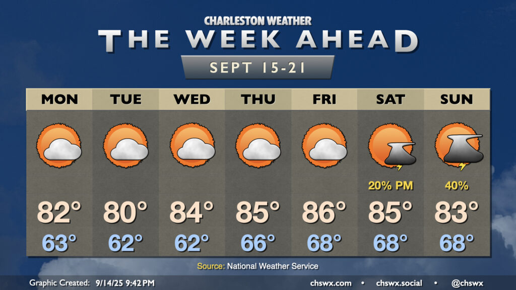
A front which helped stir up another round of heavy rain and flooding in downtown Charleston on Sunday will clear the area overnight into early Monday, yielding a week of comfortable temperatures with occasional slight shower and storm chances.
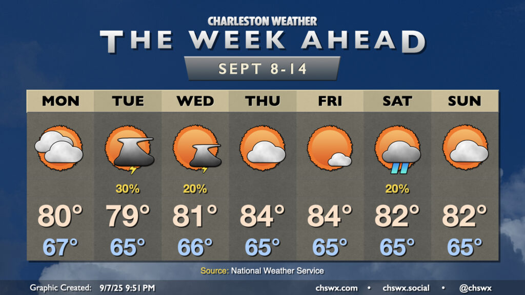
The main weather story this week will be much more pleasant than last week’s: cooler, drier air working into the area will bring along a decent early-fall preview to close out August, though a few storms will be possible heading into late week.
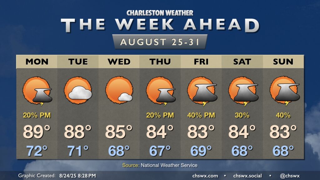
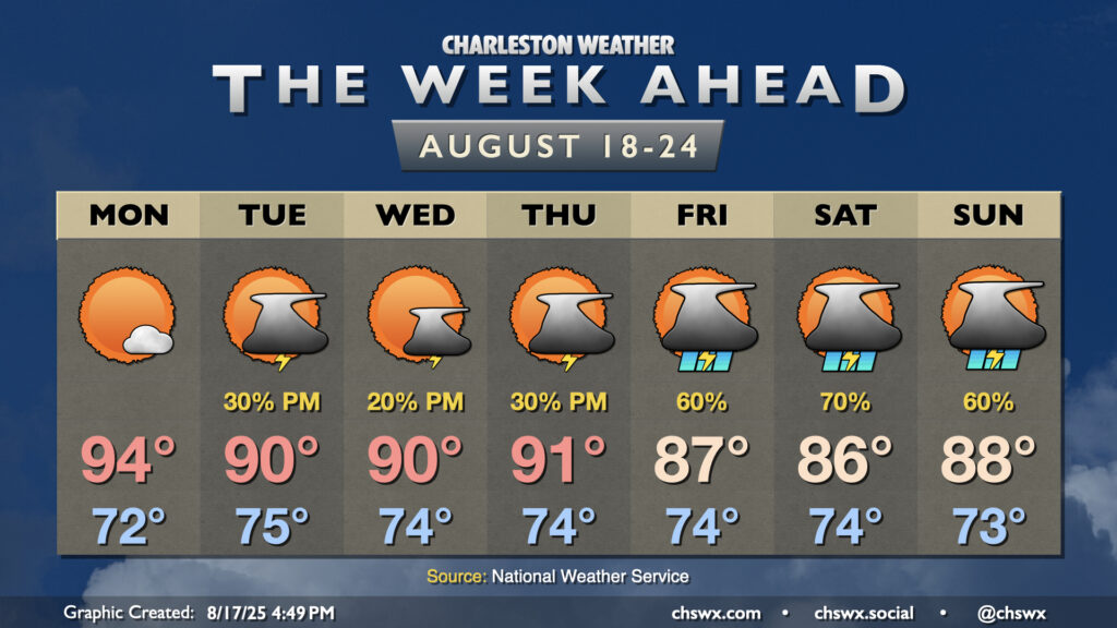
The week ahead starts out on a warm note with high pressure in play before turning more unsettled by the time we get into the weekend. Meanwhile, Hurricane Erin will be passing offshore, sparing us direct impacts but kicking up high surf, a risk for dangerous rip currents, and even some coastal flooding in the evenings.
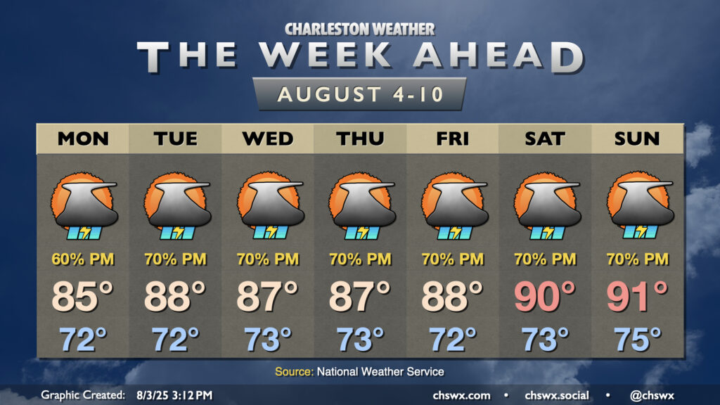
After a dreary weekend, a more standard summertime pattern returns to the Lowcountry as high pressure ridges into the area aloft, finally breaking down the high pressure wedge and stalled front that’s kept us unsettled (but at least on the cool side).
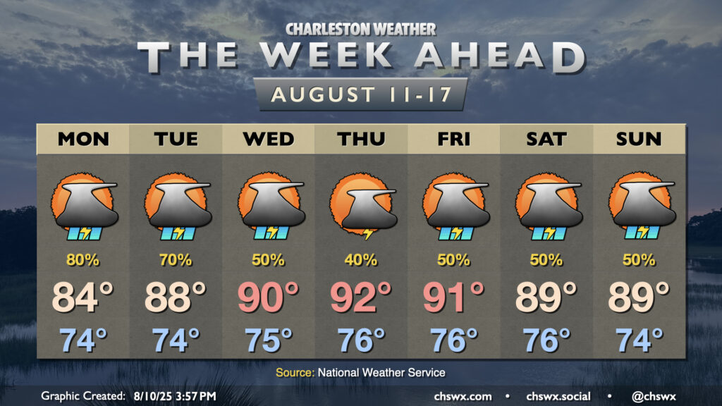
The stalled front to our south which helped bring about much more comfortable temperatures for the weekend will generally meander for the first part of the week as high pressure remains anchored well to the north, keeping our weather periodically unsettled. We’ll then transition back more toward a traditional summer pattern as we head into later in the week.
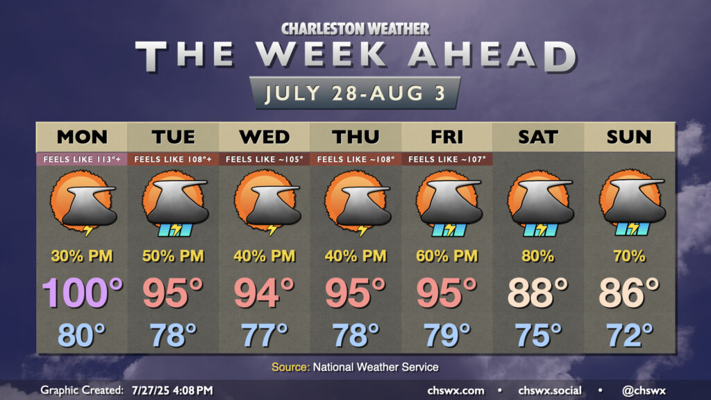
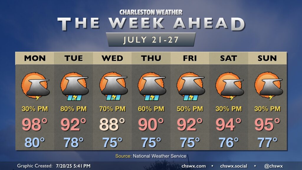
Hot weather continues for much of the upcoming week, but as the ridge of high pressure that’s baking us slides westward, that will allow for some moisture to work its way back in, inviting showers and thunderstorms to develop each afternoon on the seabreeze.
This weekend’s hot weather continues into Monday, but a more unsettled pattern will cool temperatures down back to normal (still not chilly, but not overwhelmingly hot, either) as rain chances tick back up.