The week ahead: Turning rather warm with sparse storm chances
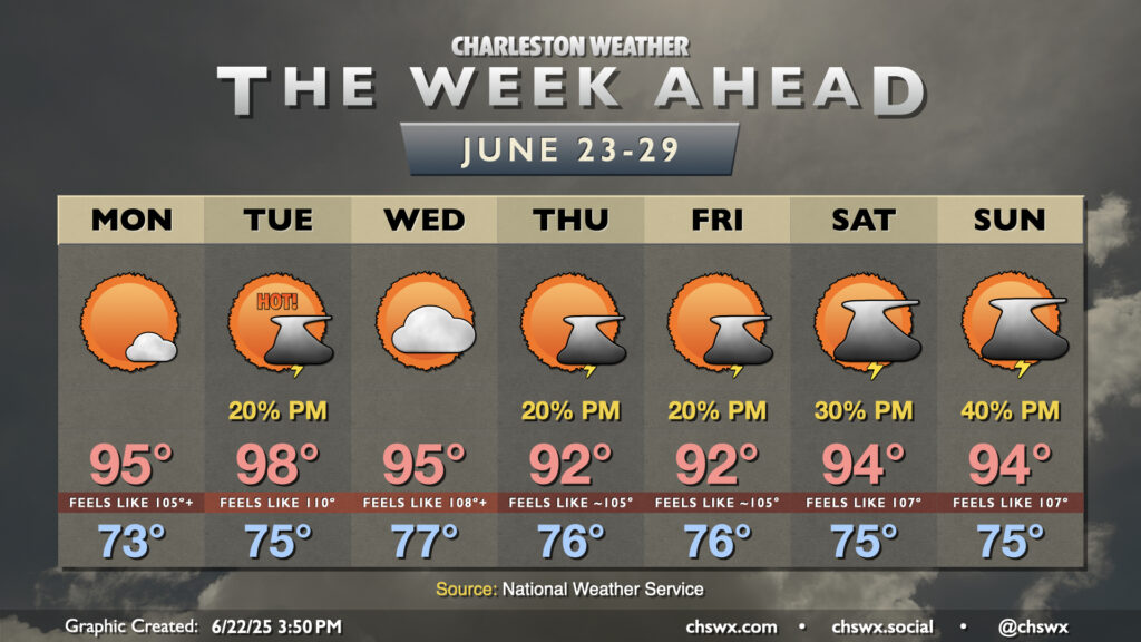
The main weather story this week will be heat, especially for the first part of the week as strong high pressure aloft affects much of the Eastern Seaboard.
Read more »The main weather story this week will be heat, especially for the first part of the week as strong high pressure aloft affects much of the Eastern Seaboard.
Read more »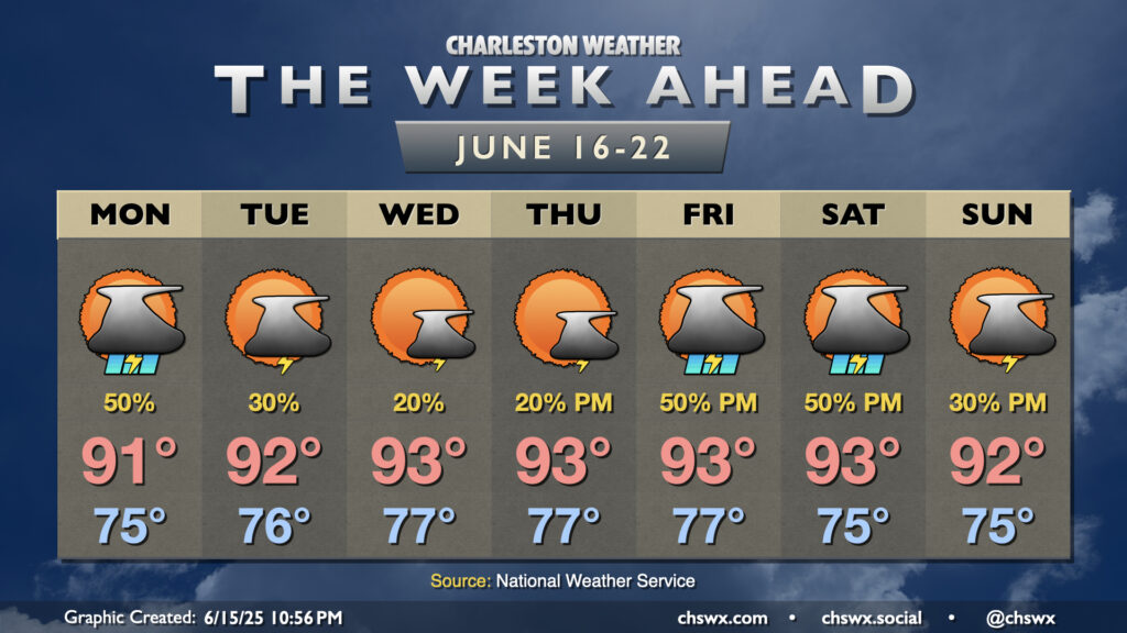
The good news for this week’s weather is that we’ll see a bit more of a lid put on the atmosphere as we get into midweek, which should help to decrease the coverage of — but not eliminate completely — afternoon showers and thunderstorms. The tradeoff, though, is that it’s going to get hotter, with heat indices creeping toward 105° for the first time this year.
Read more »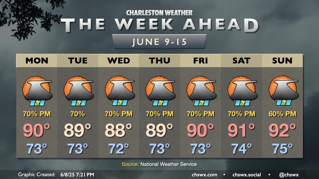
Warm, muggy, and unsettled weather will continue heading into this second week of June as a front stalls out nearby, which will help to instigate numerous showers and thunderstorms with the heating of the day each afternoon.
Read more »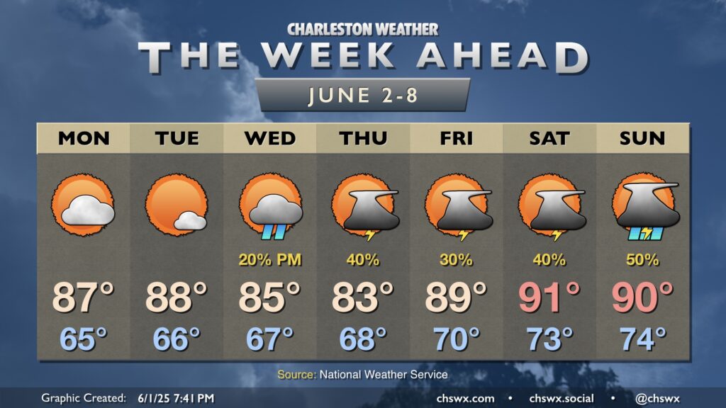
We will stay quiet heading into the first couple days of the work week, but low pressure moving into the area will help turn the weather more unsettled for the second half of the week and into the weekend.
Read more »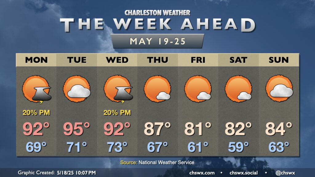
The week ahead starts with a continuation of the abnormally warm temperatures we’ve been feeling for the better part of the past week, though some relief is in sight as a cold front brings cooler and drier air to close out the week and head into Memorial Day Weekend.
Read more »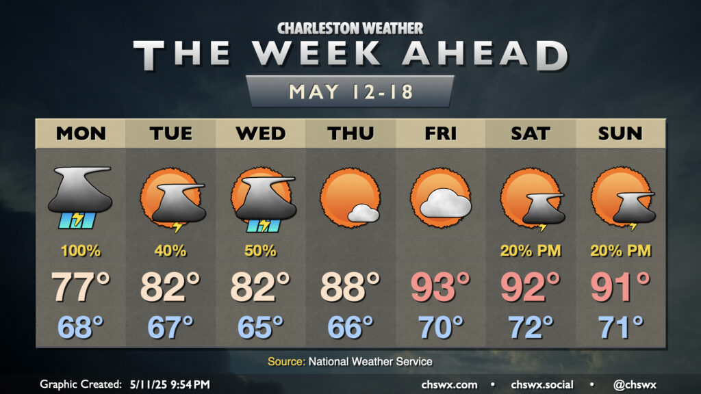
A pesky mid-level low will continue to keep scattered to numerous showers and thunderstorms in the forecast for the first part of the upcoming week. From there, high pressure returns and sends us right into summer to close the week.
Read more »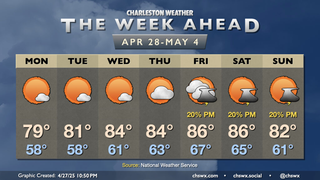
High pressure will be the main weather feature for the next few days, with comfortable warmth and plenty of sunshine expected through Thursday before the next isolated storm chance arrives Friday.
Read more »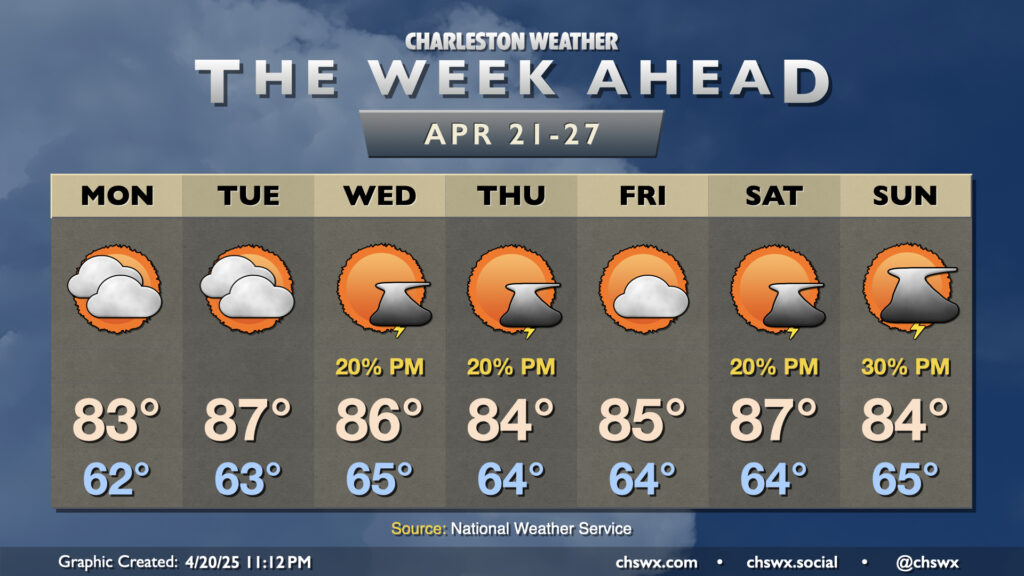
The last full week of April will run rather warm, with 80s throughout. A few storms will be possible midweek and again over the weekend, but no widespread drought relief is expected.
Read more »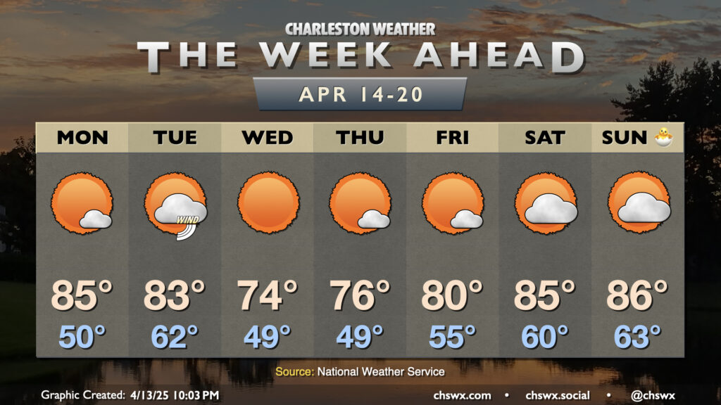
A generally quiet and warm week of weather (with a brief cooldown in the middle) lies ahead as we approach Easter, well-timed for spring break for Berkeley and Charleston’s school districts.
Read more »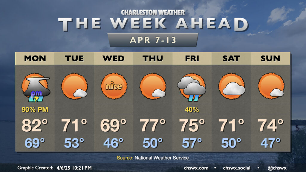
The recent late spring/early summer preview of the past week or so will come to an end on Monday as a cold front moves through the area, bringing more seasonable (if not somewhat cooler-than-normal) temperatures back to the Lowcountry for the second week of April.
Read more »