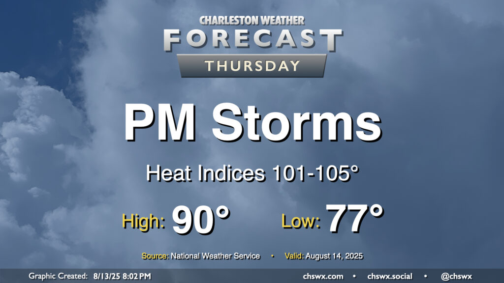
Thursday will be a fairly typical mid-August day across the area. We’ll start in the mid-to-upper 70s, warming to around 90° in the afternoon with heat indices generally running in the low to mid-100s given continued dewpoints in the mid-to-upper-70s, highest downtown and along the coast with closer proximity to the water. Once again, showers and thunderstorms should fire on the seabreeze in the afternoon, and a couple of those could be on the strong side with frequent lightning and gusty winds. Winds out of the west will drive showers and storms coastward, so keep an eye on this if you’re taking a day at the beach (you lucky duck).
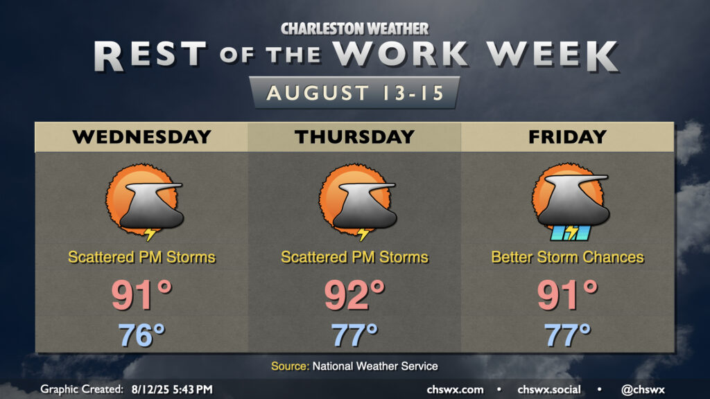
90° temperatures have been tough to come by so far this August. (Please note this is not necessarily a complaint.) Since August 1, only today (August 12) has been a 90° day. It’ll get a little easier to achieve the 90° mark going forward, though, as ridging aloft continues to build in. High pressure in the mid-levels helps temperatures heat up while keeping more widespread thunderstorm activity tamped down. We’ll have plenty of humidity in play, which will allow heat indices to head into the low 100s each afternoon — hot for sure, but not Heat Advisory hot, at least. And yes, there will be a chance for a few thunderstorms each day primarily along and ahead of the seabreeze (with perhaps better coverage on Friday). A couple storms could turn strong or even severe where outflow boundaries collide, and heavy rainfall is certainly a concern as well given deep moisture. However, once again, we’ve had much worse very recently, and shouldn’t have a replay of the past weekend for a bit. Just be ready to head indoors in case thunderstorms approach, and you’ll be fine.
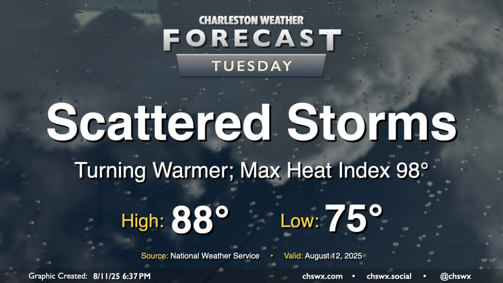
After a rambunctious Monday that featured widespread showers and thunderstorms leading to flash flooding downtown as well as a lightning strike caught on camera in Mt. Pleasant, the weather will return to a more traditional summertime pattern beginning Tuesday as Charleston County heads back to class. Temperatures will start on the mild side, generally in the mid-to-upper 70s, warming to the upper 80s in the afternoon. Mix in the continued humidity, and it’ll feel closer to 98°. Scattered showers and storms should fire again in the afternoon along and ahead of the seabreeze, and yes, there is a risk of heavy rain with these storms, but the risk for flash flooding will be a bit lower especially as storm motions should be a bit faster.
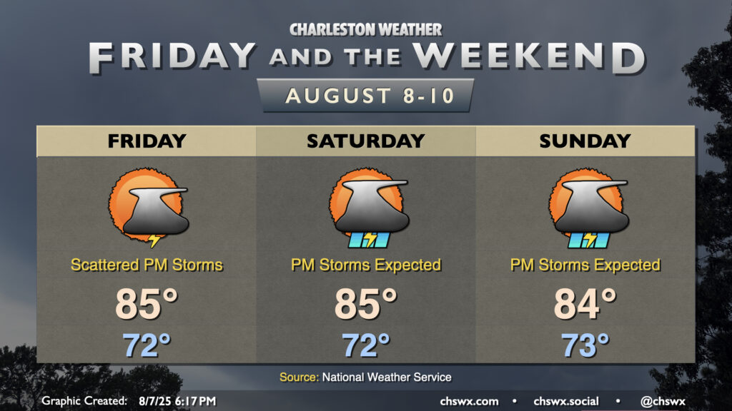
After a dreary weekend, a more standard summertime pattern returns to the Lowcountry as high pressure ridges into the area aloft, finally breaking down the high pressure wedge and stalled front that’s kept us unsettled (but at least on the cool side).
After an unusually cool and cloudy early-August day across the Lowcountry, in which highs largely did not breach 80° (good for a new record cool high temperature at North Charleston, breaking the record of 80° set just last year), we should see a bit more warmer air tomorrow as the high pressure wedge which reasserted itself today weakens a bit toward the coast. This will allow the seabreeze to get going a bit more, setting us up for an afternoon of scattered storms, with the best risk of precipitation generally east of 17-A. Lows in the low 70s will warm to the mid-80s in the afternoon — still several degrees below normal for this point in August — but it’ll still be somewhat muggy.
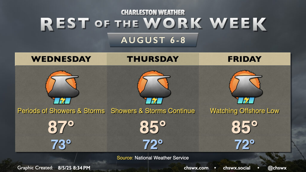
The rest of the work week will remain unsettled as the frontal zone that’s been hanging around for several days begins to trek back toward the coast, cooling us back off a little bit but keeping showers and thunderstorms in the forecast.
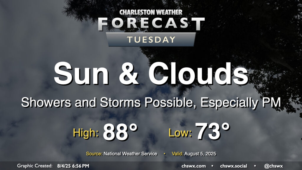
We remain on the cool side of normal on Tuesday, though a few more breaks in the clouds should allow temperatures to turn warmer, with highs approaching the mid-to-upper 80s in the afternoon after starting the day in the low 70s. Periods of showers and maybe a few thunderstorms will continue to be possible, though it won’t rain all the time. Some guidance suggests storms kicking off on the seabreeze later in the afternoon, which could produce some heavy downpours considering the continued feed of moisture and energy from the southwest. Severe weather is not expected, though.
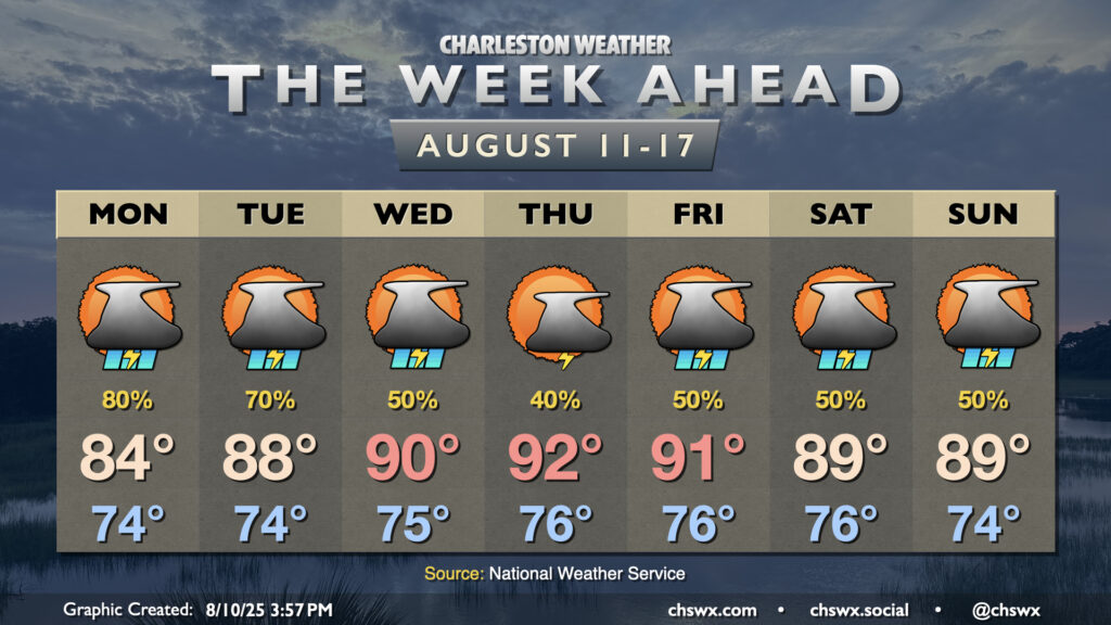
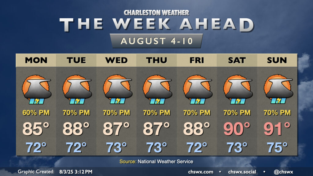
The stalled front to our south which helped bring about much more comfortable temperatures for the weekend will generally meander for the first part of the week as high pressure remains anchored well to the north, keeping our weather periodically unsettled. We’ll then transition back more toward a traditional summer pattern as we head into later in the week.
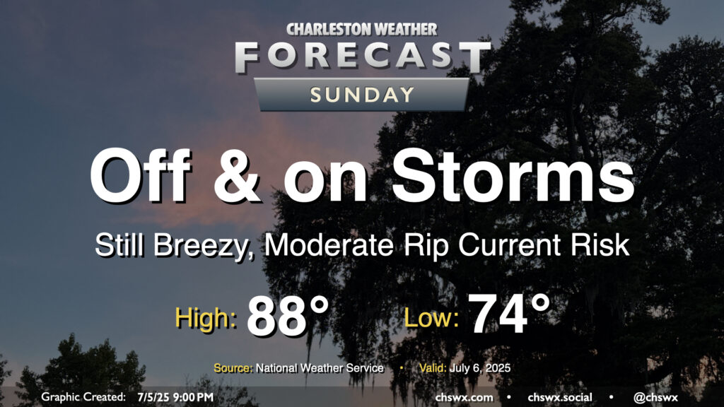
Tropical Storm Chantal will make landfall overnight somewhere between Georgetown and Myrtle Beach, keeping the risk for some showers around overnight into Sunday. We should see an uptick in shower and thunderstorm activity as the heating of the day helps to wring out some wrap-around moisture on the southwest side of Chantal’s circulation. Overall, though, this storm hasn’t been a major rainmaker for the area, and that shouldn’t change much on Sunday with the scattered nature of the individual showers and thunderstorms. Severe weather is not expected as we sit within the weaker side of Chantal’s circulation, but the risk for rip currents will continue and we should still have some breezy conditions at the beaches and on the bridges. Temperatures will start in the mid-70s again, but highs should stay below 90° for one more day with the clouds and rain in the area (though we should see a decent amount of sun between showers, too).
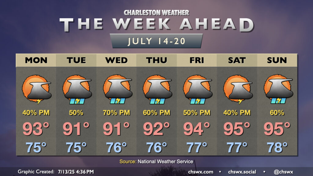
By the way, our 90° streak ended today at 21 days — the high at the airport topped out around 85°. Don’t worry, though — we’ll kick off a new streak starting Monday, and temperatures for the upcoming work week will certainly have that July feel to them, complete with Advisory-level heat indices.