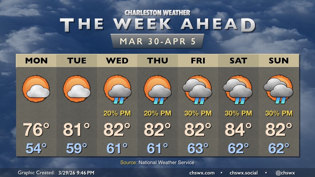
We’ll close March and open April on a quiet and comfortable note with plenty of sunshine and seasonably warm temperatures, especially as we head into midweek.
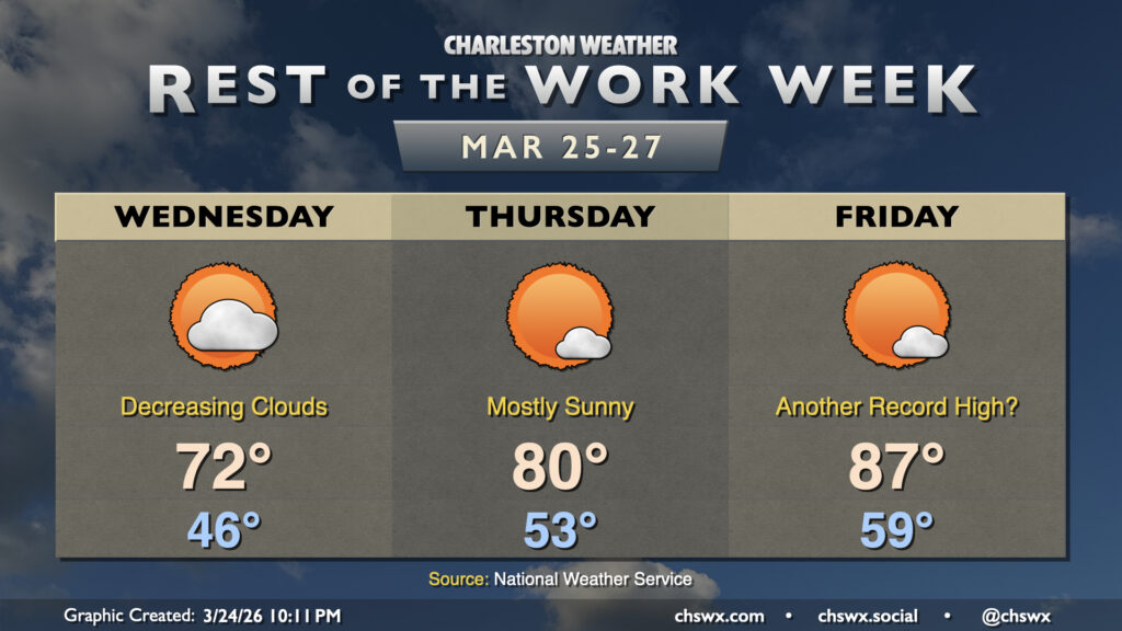
Another very warm day is on tap for Friday, with a daily high temperature record within reach once again ahead of a cold front. Temperatures will start around 60°, warming to the upper 80s in the afternoon before the seabreeze clears the area. The record high of 87° is absolutely in jeopardy, and some spots inland could get close to 90° once again.
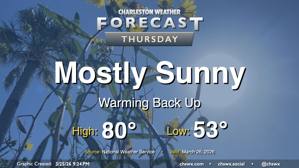
Our brief cooldown comes to an end to close out the work week, with sunshine and 80s returning to the Lowcountry on Thursday. The day starts in the low-to-mid-50s, so you might go for a light jacket to start, but you’ll be able to shed that by mid-morning as temperatures climb. Highs peaking around 80° run a few degrees above normal for late March. Winds are quiet to start the day but pick up a little as the seabreeze pushes inland later in the day.
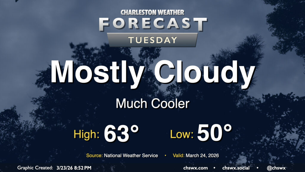
As expected, Tuesday was quite the dreary, cool day. We set the daily highs at both downtown and North Charleston after midnight, with the preliminary daily low of 53° being set in the afternoon as of the 5PM climate report. (This will get cooler — as of this writing, it’s 52° at the airport.) We begin to see signs of recovery on Wednesday, though, as the high pressure wedge weakens and scours out, allowing progressively more sunshine through during the day. Expect lows in the mid-40s to warm to the low 70s in the afternoon — basically right on target for this point in the year.
Tuesday could be quite a shock to the system after Monday’s record warmth. We’ll go from a high of 90° on Monday, which was not only a daily record high but the fourth earliest 90° day on record, to a high in the low 60s on Tuesday with mostly cloudy skies in the wake of a cold front that is entering the Tri-County area as of this writing. No rain is expected, but we can expect breezy northeasterly winds as a cold air damming regime takes hold, at least briefly.