2018, reviewed: The January Winter Storm
To say 2018 was an interesting (and at times baffling) year in weather in Charleston is really selling it short. It just about had it all: Snow, tropical threats, frigid cold, sweltering heat, rainfall, and (of course!) flooding.
Over the next few days, I’ll be looking back at 2018’s key weather events and trends. Today, we start with the most epic weather event of 2018: The January 3rd winter storm.
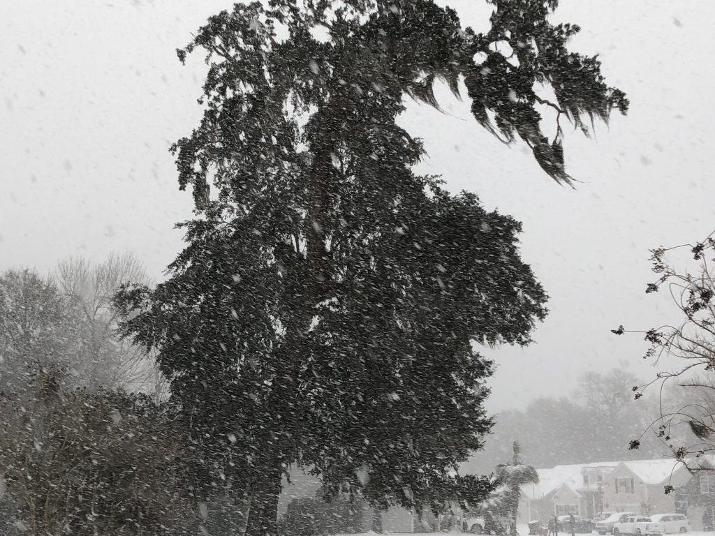
Ask a Charlestonian what their most impactful weather event was, and it’s likely that the January snowstorm is at the top of the list, both for its novelty and for its disruptions. On January 3, 5.3″ of snow fell at the airport. Higher amounts were recorded in other locations away from the coast, where a brief round of sleet in mid-afternoon stunted snow totals.
Coastal Flooding
The snow was, of course, the big story. But this storm was rather multi-faceted. For starters, strong onshore flow ahead of the developing low pressure system to the south drove the Charleston Harbor tide gauge into moderate flood stage, putting salt water on the streets of downtown Charleston. We see more than our fair share of this throughout the year, but we rarely see this coincide with an ice storm, which was also happening as streets flooded.
Ice Storm
As precipitation overspread the area, it started as freezing rain due to a significant warm nose aloft. The ensuing ice storm lasted for several hours, causing .10-.20″ of ice accretion on many surfaces, including roads and bridges. This led to the temporary closure of the bridge heading onto Folly Beach, which did not close in the benchmark 2014 ice storm.
Changeover to Snow
After several hours of ice, radar and weather balloon observations finally showed that the warm nose aloft, which was melting snow into rain before it reached the freezing surface, was finally starting to erode. Then the fun really began.
It just kept snowing, and snowing, and snowing, leading to exceedingly rare scenes across the Lowcountry.
The Aftermath
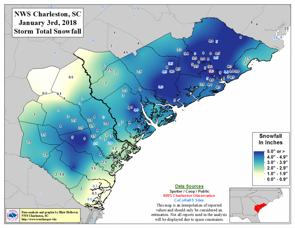
Graphic: National Weather Service, Charleston, SC Weather Forecast Office
Charleston lived with the snowstorm’s effects for almost a week afterward. It was eerie: The airport, overwhelmed by snow and ice issues and finding itself unable to clear the runways, was shut down for several days, essentially halting air traffic in and out of Charleston. The quiet was surreal, akin to the air traffic shutdown in the wake of the September 11, 2001 terror attacks.
Roads remained treacherous as snow compacted into ice each night. As snow slowly melted, it gave way to the layer of ice that had built up in the run-up to the event, keeping roads treacherous for many days afterward. (True story: My wife and I went on vacation to Miami in the second week of January, and it was downright scary at times driving down Highway 17 to pick up I-95.)
The residual snowpack kept temperatures below 40° for several days. It took until January 8 for the airport to reach 40° — a record-setting seven straight days of sub-40° temperatures. But by Thursday, January 11, we were back in the 70s. (So it goes in Charleston.)
Tomorrow: I examine an unusual lack of severe weather in 2018.