Spring preview continues

Our abnormally warm start to February continues today under mostly sunny skies. We reached 73° at the airport yesterday and look to top that today, with a high of 75° in the afternoon. It gets even warmer from here, too.

Yet another warm February
It seems like we do this every year: January has some cold snaps, but we get a significant February thaw. This year, so far, is no exception, as temperatures this week look to approach record levels from Wednesday-Friday. The NWS forecast highs range from 14-18° above normal (61°) for this time of year.
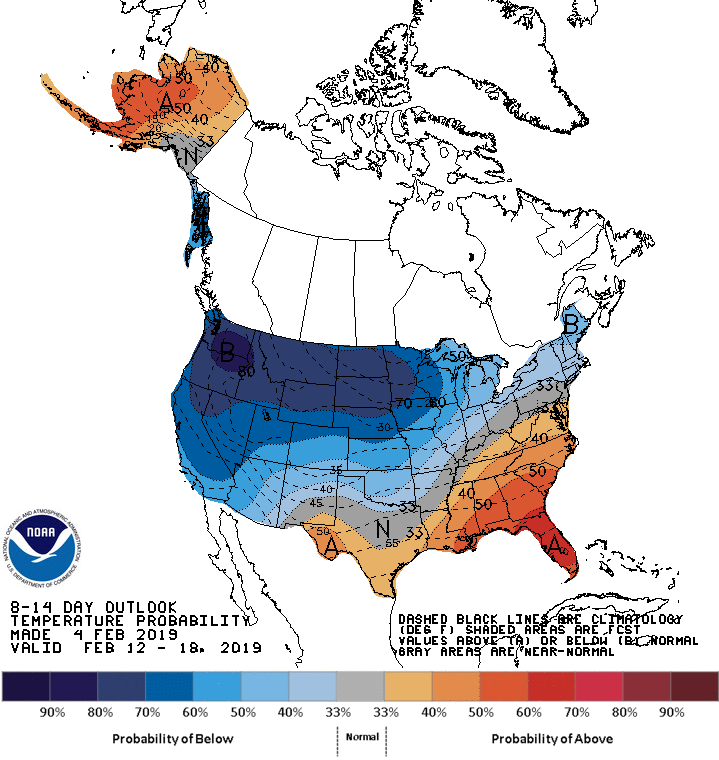
As you may recall, February 2017 and February 2018 both went down as the warmest Februarys on record at the North Charleston climate site (Charleston International Airport). While it is too soon to pass judgement on how February 2019 will shape up, it does seem that, given continued confidence in generally warmer-than-normal temperatures, we’ll be looking at more warm days than not.
Why #FakeSpring?
History tells us that we should expect at least one more round of subfreezing temperatures sometime in early March before Spring kicks in for good. In 2017, a hard mid-March freeze did so much damage to agriculture in the Southeast that losses were in the billions of dollars. So, I caution those of you who may want to try to get an early run on planting sensitive plants as we are not out of the woods on this yet. There are some signs that this warmth may have a little staying power, but cold snaps are certainly not out of the question.
Will it get cool again?

Some of you aren’t #FakeSpring fans, and I totally get it. Long story short, it will get cool again this weekend (upper 50s for highs) as a dry cold front moves through sometime late Friday, though no subfreezing temperatures are indicated in the foreseeable future. Above-normal temperatures look to resume for the work week next week, though perhaps not to the degree that we are seeing this week.
Ensemble runs of the ECMWF (Euro) and GFS (American) global models keep temperatures at or above normal through the end of next week, but also keep some unsettled weather in place. With that said, if you’re looking to take advantage of some early February warmth, this is the week to do it!