Dorian is moving again (kind of)
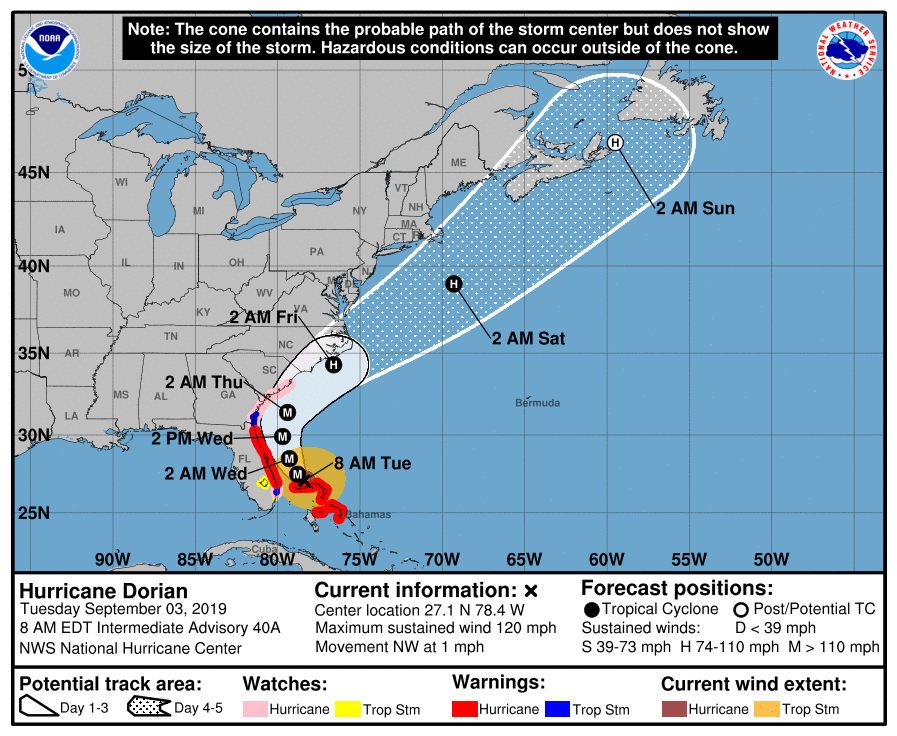
At 8am, Dorian resumed forward motion for the first time in 18 hours — moving NW at 1. It remains a strong Category 3 hurricane with max winds of 120 MPH.
Now that the storm has started moving again, we should be able to finish forecast fine-tuning later today.
What to do today
Finish storm preparation today. We are still on track for adverse weather to move in Wednesday, with the bulk of tropical storm and possibly hurricane conditions starting Wednesday evening through much of Thursday. Bring in loose items, secure personal property, and give the disaster kit one last look. Give extra attention to things like batteries for flashlights; with the bulk of the worst conditions currently timed overnight Wednesday into Thursday, overnight power outages are likely.
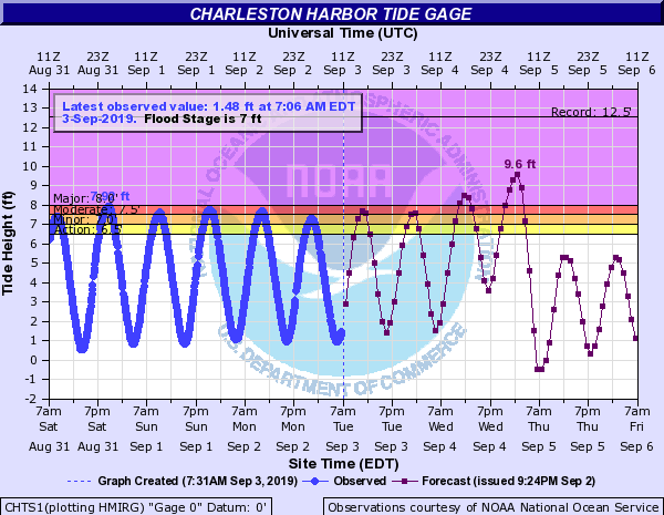
Watch for flooding around the noon high tide. Moderate flooding may close roads downtown. Be ready to use alternate routes.
If evacuating, leave today. Weather heads downhill tomorrow and you just won’t want to drive through it. If you’re not leaving, just get ready to stay put for a couple days as Dorian brushes us.
Next update
The next track and intensity forecast update arrives at 11am. Confidence is increasing in the forecast track and subsequent impacts, and I expect a warning of some type to be hoisted with that advisory.