NHC begins advisories on Potential Tropical Cyclone Nine, possible future Humberto

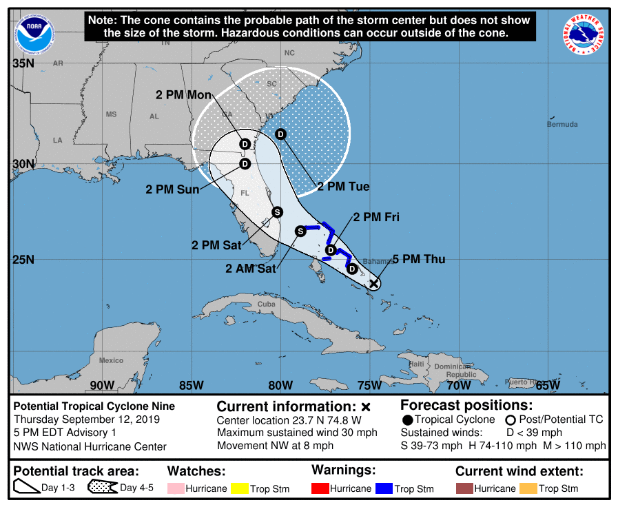
The National Hurricane Center has started advisories on Potential Tropical Cyclone Nine. This is a wave that has not yet become a tropical cyclone, but the probability of it becoming one is high enough for NHC to issue Tropical Storm Warnings for the Abaco Islands and Grand Bahama — exactly where they are not needed. If named, PTC 9 would be Humberto.
The current track brings a tropical storm into the Florida east coast by Saturday evening, with a depression lingering near the Florida/Georgia/Carolina coasts by early next week. This could enhance rainfall in our neck of the woods as we head into the end of the weekend and early next week. I wouldn’t be surprised to see the rip current risk head up, too. It is too early and too uncertain to discuss specific impacts, though.
Track and intensity forecasts should be considered low confidence at this point. Once data from Hurricane Hunter flights begins being ingested into the models, confidence in the future track and intensity of this system should improve. Given warm water in the area, strengthening into a hurricane is not off the table.
What to do
Keep watch on this storm as we head into the weekend. Monitor official forecasts from the National Hurricane Center. Do not panic.