Tropical update: Seriously, Karen?
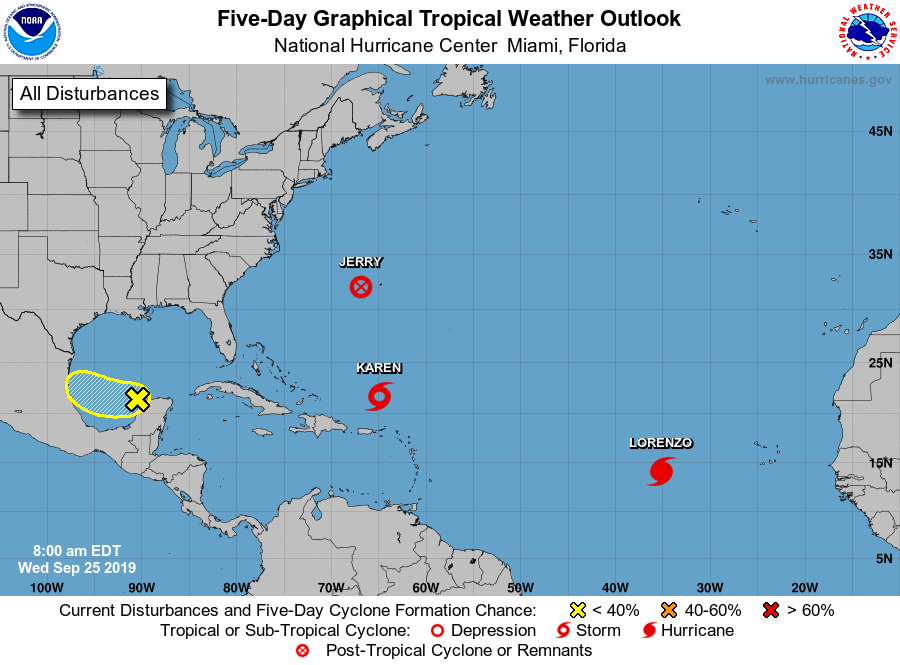
The tropical Atlantic basin remains fairly active: While Jerry is no longer a tropical cyclone, it continues to spread strong winds and heavy rain across Bermuda. Lorenzo, well out in the Atlantic, has strengthened to a hurricane and is no threat to any land at this time.
And then there is Karen.
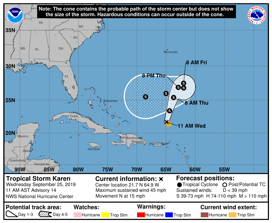
Tropical Storm Karen continues to confound forecasters as to what it is going to do as we head into late week and beyond. The storm remains weak and very sheared off, with maximum sustained winds of 45 MPH. It is expected to gain some strength as it heads north and northeast into tomorrow before stalling out somewhere southeast of Bermuda. Then, as a ridge of high pressure builds to the storm’s north, it is expected to do a loop and begin a more westward to southwestward component of motion by this weekend. (At least it will stall out over water, and not over a landmass.)
It’s near-impossible to say what, if any, effect Karen might have on our weather, especially this far out; it will be at least early next week before we will want to start keeping closer tabs on the storm’s progress. Initial indications are that the ridge will be so strong that it will keep the storm’s track suppressed to the south. The usual disclaimers about uncertainty beyond 5-7 days applies here, for sure. I’ll keep an eye on it, but you should live your life and not worry about Karen right now.
In the meantime, we will continue to bake here in the Lowcountry, with 90s expected to continue through the end of the week. (What Fall?)
Follow my Charleston Weather updates on Mastodon, Bluesky, Instagram, Facebook, or directly in a feed reader. Do you like what you see here? Please consider supporting my independent, hype-averse weather journalism and become a supporter on Patreon for a broader look at all things #chswx!