Friday and the weekend: Eternal August continues

Fall fans, the news isn’t great: Above-normal temperatures will continue for the foreseeable future as a strong ridge of high pressure remains firmly entrenched over the area. A weakening front nearby will help kick off a few showers and maybe a thunderstorm or two across the area. This would be good — it’s been twelve days since measurable rain at the airport — but not everyone is going to get relief. Rain-free conditions move back into the area for the weekend while temperatures in the upper 80s remain more in line with mid-August norms than late September.
King tides continue; coastal flooding risk around times of high tide
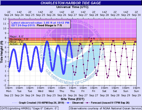
The upcoming new moon at perigee, combined with onshore flow, are continuing to drive a risk for minor to potentially moderate coastal flooding with times of high tide this weekend. With little rain in the forecast, this flooding should remain mostly of the nuisance variety, but it may still close some roads.
Flooding will be possible once again with the Friday evening high tide (7:36 PM). The current forecast is for tide levels to top out around 7.4′ in the harbor, which will produce flooding an hour or two on either side of high tide. From there, coastal flooding will be a threat with each high tide cycle, highest in the evenings. Stay alert for Coastal Flood Advisories from the National Weather Service.
Tropical update

Karen and Lorenzo continue to churn in the Atlantic. Their fates couldn’t be more different: Karen continues to weaken, and with the 11PM advisory, NHC’s forecast is now for the storm to be a remnant low by Saturday. Meanwhile, Lorenzo is making a strong run at possibly Category 5 status while it affects fish in the Atlantic. Lorenzo’s forecast path will take it near the Azores early next week, but this is the only land the storm will threaten as a tropical cyclone.
Neither storm poses a threat to Charleston’s weather.
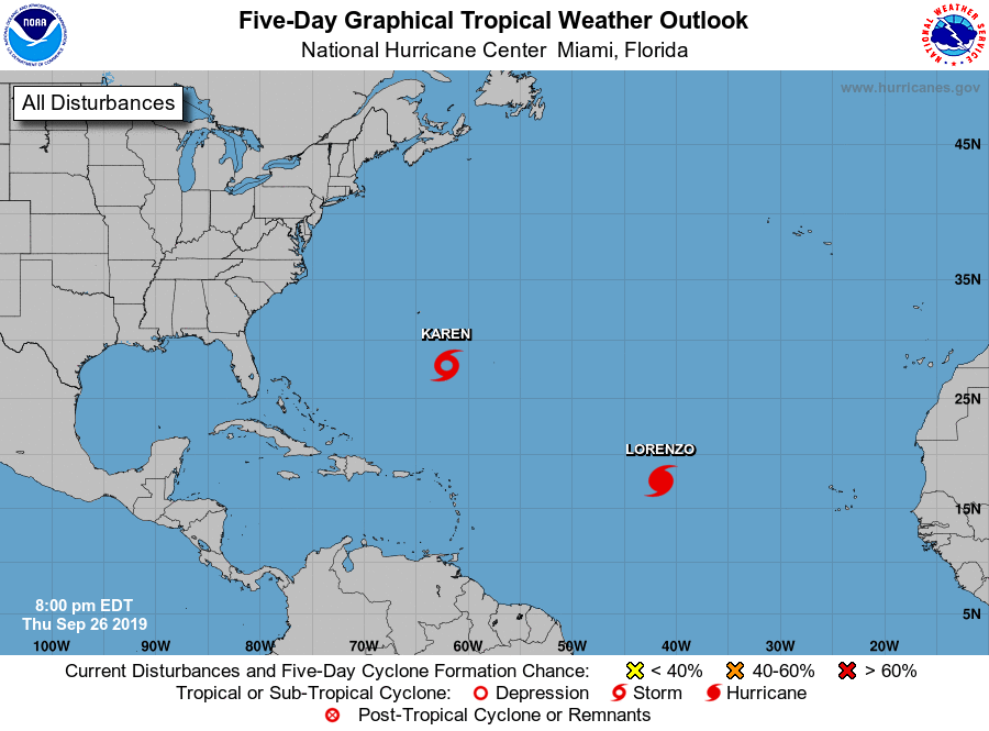
Besides these storms, NHC does not currently see any areas of concern for potential tropical development in the next five days.
Stay cool this weekend!
Follow my Charleston Weather updates on Mastodon, Bluesky, Instagram, Facebook, or directly in a feed reader. Do you like what you see here? Please consider supporting my independent, hype-averse weather journalism and become a supporter on Patreon for a broader look at all things #chswx!