Clouds give way to sun, cooler temperatures

We start this Valentine’s Day off with mostly cloudy skies and occasional patches of drizzle and light rain as a plume of moisture with origins in the Pacific pushes eastward over our area. Once said plume begins to clear, we will see clouds follow suit, giving way to a nice and somewhat cool afternoon. The big feature of today’s weather, which lasts through the weekend, is the return to cooler, more seasonable temperatures in the wake of a cold front which swung through yesterday. Expect highs today to top out in the upper 50s to low 60s across the area, a marked change from yesterday’s upper 70s inland to mid-70s near the coast.
SEWE weekend: Saturday the pick day, a few showers Sunday
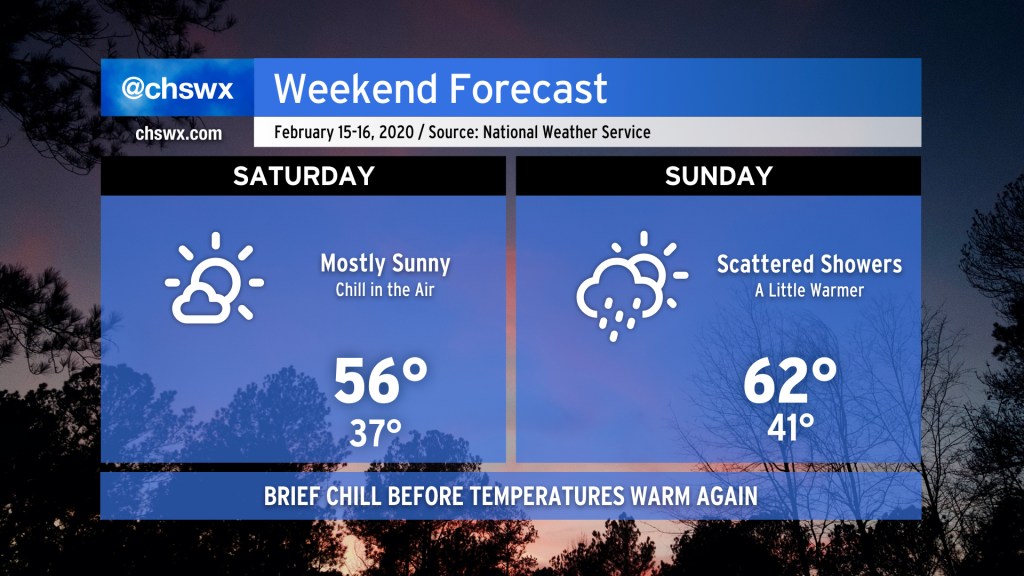
The Southeastern Wildlife Expo is in town this weekend, and temperatures will generally run on the cool side of normal. Saturday’s the pick day of the weekend with just a few clouds dotting the skies at times. It’ll be chilly, so don’t forget a light jacket in the afternoon.
Clouds increase on Sunday as high pressure wedging in from the northeast gives way to a trough of low pressure at the surface, allowing a few showers to develop across the area. Keep rain gear nearby, but know that not everyone gets wet, nor will it be terribly heavy rain. Temperatures will rebound to near normal levels in the low 60s.
Follow my Charleston Weather updates on Mastodon, Bluesky, Instagram, Facebook, or directly in a feed reader. Do you like what you see here? Please consider supporting my independent, hype-averse weather journalism and become a supporter on Patreon for a broader look at all things #chswx!