[UPDATED] Tropical update: Isaias could play a role in our weather early next week
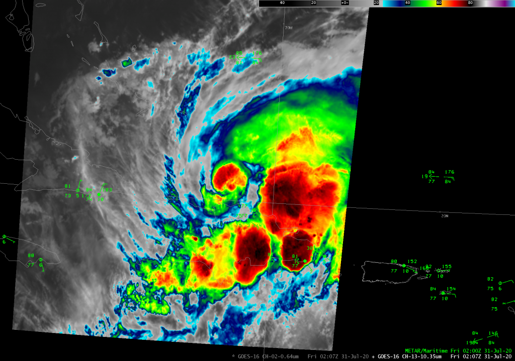
Tropical Storm Isaias was named with the 11PM advisory last night, and it has brought flooding rain to Puerto Rico over the last couple days as it moved nearby and through Hispaniola. This evening, the center of the storm is reforming on the north side of Hispaniola. There was some speculation that the mountainous terrain of the island would potentially seriously disrupt the storm, but this appears to be a case where that didn’t happen. At 8PM this evening, the storm maintained 60 MPH max sustained winds with the minimum central pressure down to 999 millibars.
Where’s it going?
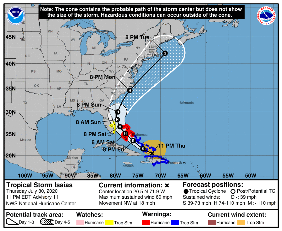
The numerical and statistical models have started converging on solutions that generally bring Isaias northwestward through the Bahamas, then northward then north-northeastward, skirting the coasts of Florida, Georgia, and SC on Sunday and Monday. The forecast track as of Advisory 11, issued a little before 11PM on Thursday night, continues to indicate a landfall on the Outer Banks as a minimal Category 1 hurricane sometime Monday evening.
With the storm beginning to pull away from Hispaniola and the center being more intact, we should start to gain more confidence in the track forecast. It is certainly encouraging to see consistency here from the National Hurricane Center between the 5PM and 11PM tracks. Hurricane Hunter data and more frequent upper-air releases from NWS offices in Florida will help the models get a better sense of what’s what, which will in turn inform the forecast.
However, it’s still too soon to say what, if any, exact impacts we will feel in the Lowcountry as a result. If the current forecast track stays relatively unchanged, and we remain on the western side of the storm, that keeps us away from the worst weather. With typical coastal-hugging systems like this, we’ve encountered issues with beach erosion, high surf, rip currents, and coastal flooding. The position, size, and strength of the storm will determine how much rain and wind we will ultimately see. Keep in mind, though, that close swipes can be problematic, too — if you were here for Matthew, Irma, or Dorian, you know that we don’t need a direct landfall to have issues with power outages, downed trees, and flooding.
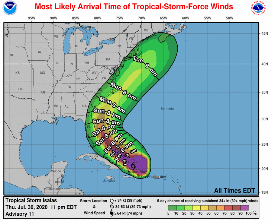
Again, there is far too much uncertainty in the forecast to really nail down what we will see at this point, which is why it is important to get prepared for the potential for tropical storm force winds to cause power outages and other inconveniences. Right now, the National Hurricane Center’s thinking is that tropical storm force winds are possible (generally a 20-30% chance, highest at the coast) starting roughly Sunday evening or early Monday morning. Adjustments to the timeline are almost certain, though.
Bottom line: Stay tuned. Isaias has been and will continue to be a tricky forecast as it threads the needle over the next few days.
What’s ahead
- Hurricane Hunters are flying back into Isaias to gather more data tonight.
- The next full track and intensity forecast comes out at 5AM. This forecast will incorporate tonight’s global model runs and additional Hurricane Hunter data.
- We’ll start getting a better idea of potential Lowcountry impacts during the day Friday as Isaias approaches the Bahamas. By then, we’ll have a couple more model cycles under our belts and can start to discern trends.
Follow my Charleston Weather updates on Mastodon, Bluesky, Instagram, Facebook, or directly in a feed reader. Do you like what you see here? Please consider supporting my independent, hype-averse weather journalism and become a supporter on Patreon for a broader look at all things #chswx!