The 11am advisory from the National Hurricane Center tweaked the forecast track for Isaias a little westward and faster. Maximum sustained winds remained around 70 MPH despite some signs of dry air intrusion. It is forecast to make landfall as a Category 1 hurricane somewhere around Georgetown or the Grand Strand.
The westward shift has some small implications for wind and tide forecasts for this evening. Overall expectations for impacts remain on track, though.
Well, Isaias is here and is already raining on us a little bit; I’ve already picked up .72″ from the first round of rain this morning. There’s more where this comes from as Isaias makes its closest pass to Charleston tonight on its way to an expected landfall somewhere between Myrtle Beach and Wilmington.
Impacts from Tropical Storm Isaias are becoming more likely in the Charleston metro area starting tomorrow morning, and additional watches and warnings are now in effect.
Early this morning, the National Hurricane Center upgraded the Tropical Storm Watch to a Tropical Storm Warning across the Tri-County area. A Storm Surge Watch is now in effect for coastal Charleston County, as well. The National Weather Service in Charleston hoisted a Flash Flood Watch for the Tri-County, which goes into effect tomorrow at 8am.
As of 5 PM, a Tropical Storm Watch is now in effect for the Charleston Tri-County area. This means that tropical storm conditions — winds 39-73 MPH, heavy, flooding rainfall, storm surge, and isolated tornadoes — will be possible within the watch area within the next 48 hours. This is your signal that preparation should be underway for the potential for wind damage, power outages, and flooding from Isaias as we head into Monday and Monday night.
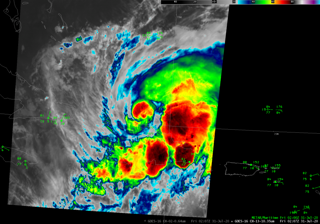
At 8am, Isaias — not the most picturesque hurricane one has ever seen, but a hurricane nonetheless — was making its move on Andros Island in the Bahamas. The storm has been struggling with westerly shear and dry air intrusion, which will keep its intensity capped for now. Today is a pivotal day in the evolution of the storm’s track for the next few days, and we’ll all want to keep an eye on it as we begin to prepare for its arrival Monday.
It’s not the most picturesque hurricane on record, but it will do: Hurricane Isaias, which was upgraded after Hurricane Hunters found winds near 80 MPH last night, is now churning through the Bahamas this morning. Isaias remains a Category 1 storm as of this morning with 80 MPH winds, and is moving NW at 17 MPH. It is expected to strengthen to a Category 2 storm with max winds of 100 MPH before weakening as it curves up the US coast this weekend.
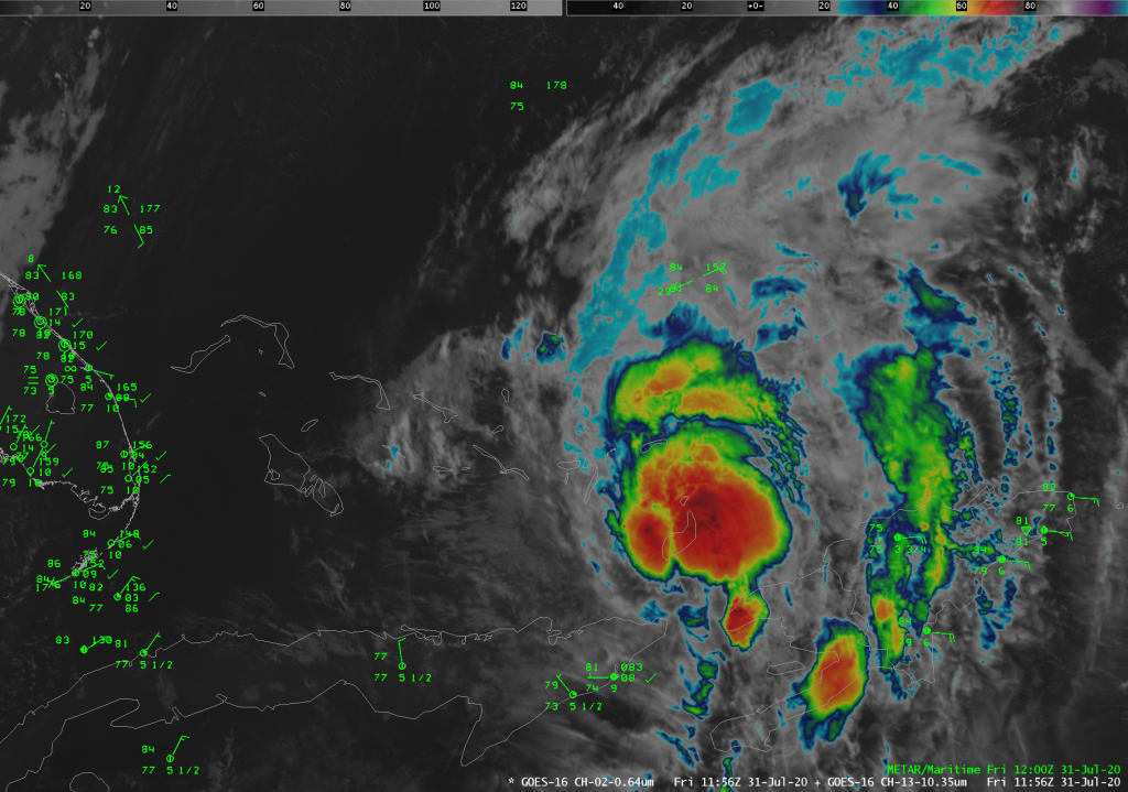
Tropical Storm Isaias was named with the 11PM advisory last night, and it has brought flooding rain to Puerto Rico over the last couple days as it moved nearby and through Hispaniola. This evening, the center of the storm is reforming on the north side of Hispaniola. There was some speculation that the mountainous terrain of the island would potentially seriously disrupt the storm, but this appears to be a case where that didn’t happen. At 8PM this evening, the storm maintained 60 MPH max sustained winds with the minimum central pressure down to 999 millibars.