Isaias: Tropical storm watch in effect for Charleston

As of 5 PM, a Tropical Storm Watch is now in effect for the Charleston Tri-County area. This means that tropical storm conditions — winds 39-73 MPH, heavy, flooding rainfall, storm surge, and isolated tornadoes — will be possible within the watch area within the next 48 hours. This is your signal that preparation should be underway for the potential for wind damage, power outages, and flooding from Isaias as we head into Monday and Monday night.
Isaias is weaker — temporarily
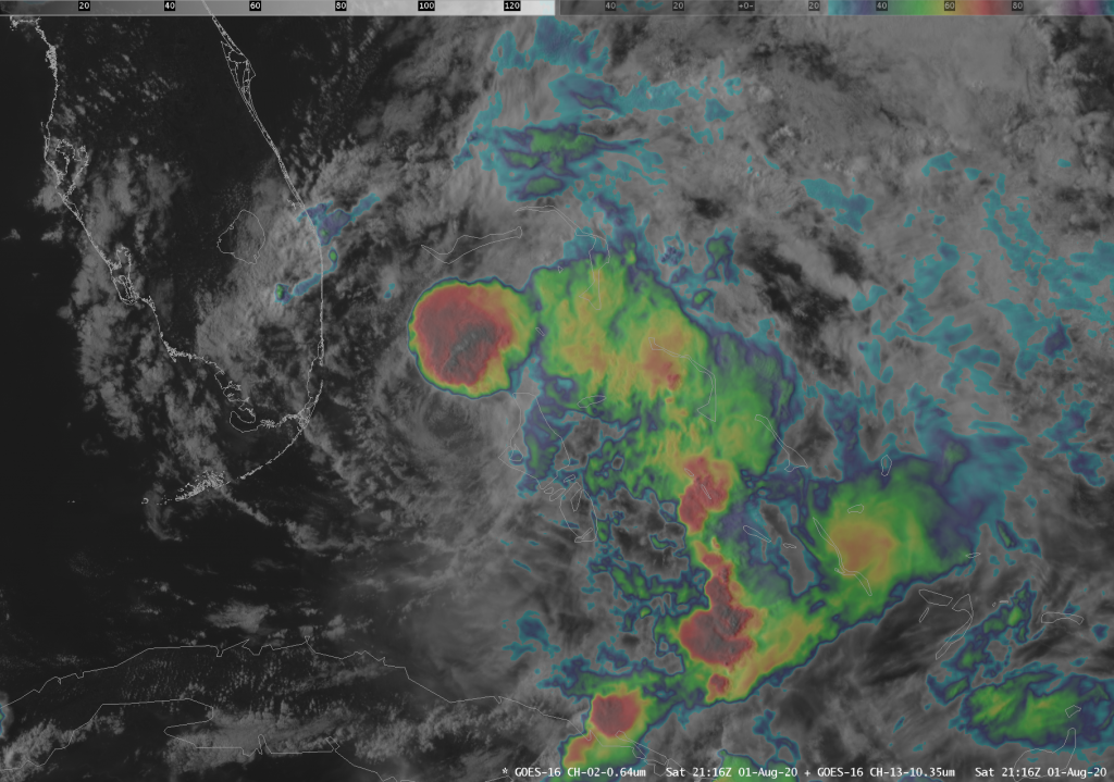
After an interaction between Andros Island, persistent wind shear, and an intrusion of very dry air, Isaias’s maximum sustained winds dropped to 70 MPH, causing a reclassification to a (high-end) tropical storm. Recent satellite imagery, pictured above, indicates that thunderstorms are beginning to try to re-form on the northern flank of the circulation after having been completely detached from the center for several hours. We will need to watch carefully to see if this convection can wrap back around the center of the storm, allowing for some reintensification as it reaches Florida tonight and tomorrow.
Intensity has been particularly difficult to nail down with this storm. It is conceivable that there may be additional changes. Hang on. 🙂
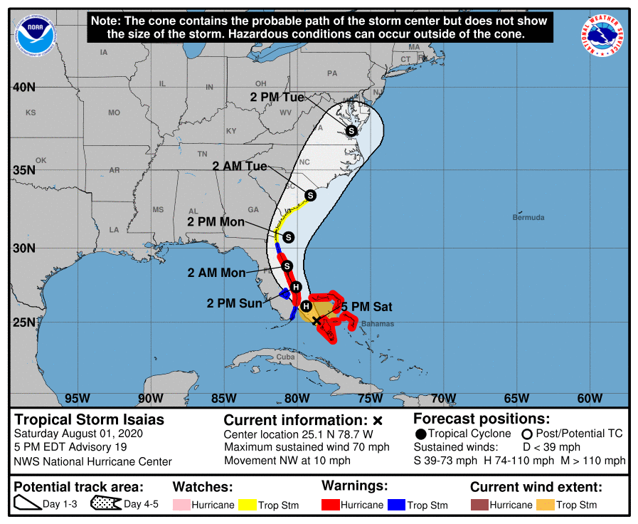
The Hurricane Center forecast does show Isaias regaining minimal hurricane strength as it skirts the Florida coast tomorrow, but maintains the forecast from earlier for a strong tropical storm to make a very close pass just off of Charleston Harbor on Monday.
The earlier weakening of the storm allowed for a more westward component of motion for several hours. This, in turn, caused the track to shift back to the west — essentially a full walk-back of how we started today with a more easterly jog. The NHC forecast now indicates landfall very near Georgetown and Myrtle Beach late Monday night/early Tuesday morning, but this could still change. Overall, though, the main change in the storm’s forecast is that it has progressively gotten slower as today goes on.
Expected impacts remain unchanged
With this track, the impacts I outlined earlier today still apply. The timeframe now slows down a bit — Monday to early Tuesday is the timeframe now — but the expected impacts should remain the same. Prepare for gusty winds, periods of heavy rain, and the potential for flooding in low-lying areas, especially Downtown. A tornado or two can’t be ruled out during the day Monday, either, so be sure you know what to do if a tornado warning is issued for your area.

This update also increased the probability of tropical storm force winds (39-73 MPH) across the Lowcountry. Areas inland of Highway 17 are now projected at a 20-30% chance of tropical storm-force winds. The Charleston metro area’s odds have increased to 30-40%, with 40-50% chances now along the coast.
Remember: prepare for a storm a category higher than what is forecast. As I mentioned above, intensity has been tricky to forecast with this storm (as it is with many tropical cyclones). Better to be prepared for a stronger storm and then experience a weaker storm than the opposite!
An important note on the flooding threat
Of note: On the current track, it is conceivable that Isaias’ center may make its closest approach near high tide. Combine this with heavy rain potentially in the area, and there may be significant problems with flooding, particularly in downtown Charleston. As such, city officials have announced the opening of a few parking garages starting tomorrow at 8am for residents in low-lying areas to store their vehicles.
Those garages include:
- Queen Street Garage, 93 Queen Street
- Aquarium Garage, 24 Calhoun Street
- Visitor Center Garage, 63 Mary Street
- St. Philip Street Garage, 34 St. Philip Street
If you live downtown in an area that floods regularly, take them up on this! I have personal experience with a flooded vehicle from Gaston in 2004. It was unnerving, to say the least.
Note that it is still too soon to say exactly what the magnitude of any flooding may be in any one place at any one time, but given the expected forecast timing, an already-enhanced king tide, onshore winds, and the potential for heavy rain, you should prepare for a long-duration flooding event downtown.
What’s next
- An intermediate advisory updating Isaias’ position and intensity will be issued around 8PM.
- The next full track and intensity forecast is due around 11PM.
- Don’t be surprised if Tropical Storm Warnings are issued tomorrow.
I’ll have the 11 PM update on social channels, and will do another long post if significant changes arise.
Follow my Charleston Weather updates on Mastodon, Bluesky, Instagram, Facebook, or directly in a feed reader. Do you like what you see here? Please consider supporting my independent, hype-averse weather journalism and become a supporter on Patreon for a broader look at all things #chswx!