The week ahead: 90s to return after a cloudy, wet weekend
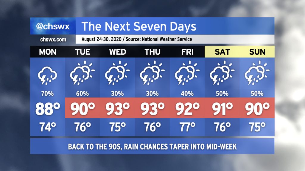
After what was an uncharacteristically wet and cloudy weekend across the Lowcountry, we will gradually move back into a more typical late-summer regime of afternoon thunderstorms and temperatures reaching the low 90s for the upcoming work week. But first, we’ll need to deal with a higher-than-normal risk for additional showers and thunderstorms on Monday, with potentially heavy rain having impacts starting early in the morning.
We continue to watch Hurricane Marco and Tropical Storm Laura as they continue on an unfortunate course to delivering a 1-2 tropical punch to parts of the Gulf Coast next week. Aside from some enhanced moisture funneling into the area from the storms around the western side of the Atlantic ridge through Monday, it does not appear that Marco or Laura will have any impacts in our area. We are now in the peak of the season, though, and we’ll want to keep a close eye on any waves that meander into the Atlantic from Africa for development over the next few weeks. Stay tuned…