Fall arrives, but brings exceptionally high tides with it
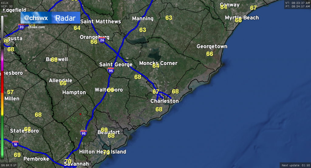
If you step outside this morning, you’ll notice a welcome lack of humidity as high pressure wedges in from the north, drying out the air at the surface (though cloud cover will remain in place today thanks to some moisture trapped between 4-6,000 feet as well as some upper-level energy that will stir up high cloud cover later today). Dewpoints this morning were running well into the low 60s, with even a reading of 59° at Charleston International Airport at 8am.
Unfortunately, this surge of Fall weather will also come with several rounds of major coastal flooding this weekend into early next week.
Major coastal flooding likely with each high tide into Monday
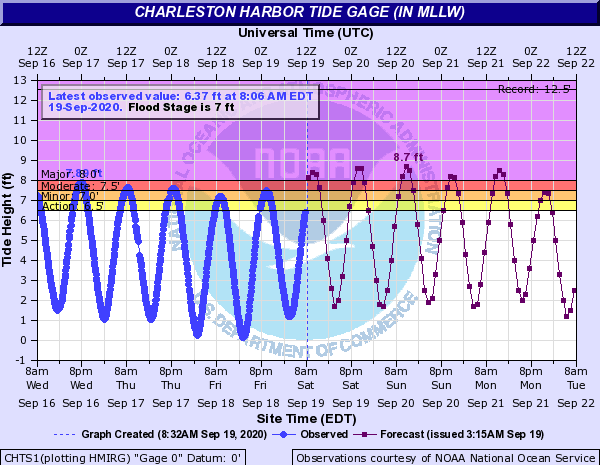
As I write this morning, tides are headed into flood stage at Charleston Harbor ahead of the 10:07 AM high tide. This will likely be the first of a string of major coastal flooding events that will mar this weekend around times of high tide.
Why, though? There are several factors, including the recent new moon, the recent perigee (closest approach) of said new moon, strong onshore winds, and swell from distant Hurricane Teddy.
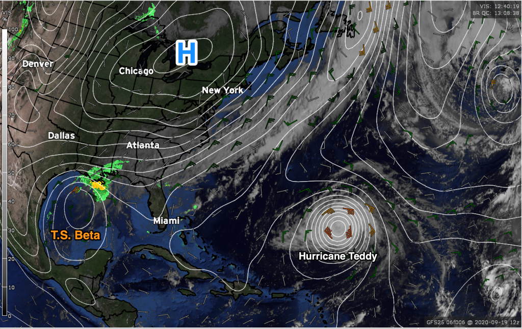
Despite Teddy being over 1,300 miles from Charleston, we are still feeling its effects here in indirect ways. First, swell from the storm is reaching the East Coast and will contribute to high surf and rip currents, helping to already elevate water levels. Next, its interaction with high pressure building in from the north over the next few days will only aid in tightening a pressure gradient between the storm and the high pressure to the north. As this gradient pinches further, these northeast winds will stiffen, further contributing to elevated water levels.
The result? A run of major coastal flooding that will challenge inundation records in Charleston Harbor over the next several days. Tides approaching 8.7′ on Sunday morning will make a run for a top-three non-tropical event and end up in the top ten of all tides in Charleston Harbor. Here are the records as of September 19, 2020, source from the National Weather Service’s Advanced Hydrologic Prediction Service:
- 12.52 ft on 09/22/1989
- 10.23 ft on 08/11/1940
- 9.92 ft on 09/11/2017
- 9.29 ft on 10/08/2016
- 8.81 ft on 01/01/1987
- 8.76 ft on 11/24/2018
- 8.69 ft on 10/27/2015
- 8.64 ft on 09/04/1979
- 8.64 ft on 05/28/1934
- 8.46 ft on 11/02/1947
Hugo remains the top event, but we’ll be in striking distance of the Saturday after Thanksgiving in 2018, when tide levels shot up to 8.76′ and stands as the highest tide level driven by onshore winds.
Impacts
Impacts from these coastal flooding events will be felt beyond the usual round of road closures in downtown Charleston. We’ll see much more flooding than we typically see in a tidal event downtown, with properties in Eastside in particular danger of being flooded. We will also see some roads close on Isle of Palms, Harborview Road on James Island being overtaken by salt water, and continued beach erosion.
Do not cross flooded roads. These tidal events are driven by salt water flooding, which is especially damaging to vehicles if left unwashed. Water levels will be significantly higher during these events than will be seen in typical tidal flooding situations, and where you may have had success crossing before, you may not now. Turn around, don’t drown!
Flooding to continue through Tuesday
We’ll be continuing to see these major tidal flooding events as we kick off next week. Tide levels will continue to reach flooding thresholds with each cycle through Tuesday before winds look to slacken some for Wednesday as high pressure more firmly builds into the area.
Follow my Charleston Weather updates on Mastodon, Bluesky, Instagram, Facebook, or directly in a feed reader. Do you like what you see here? Please consider supporting my independent, hype-averse weather journalism and become a supporter on Patreon for a broader look at all things #chswx!