The week ahead: A few more warm, muggy days before Fall sneaks back in
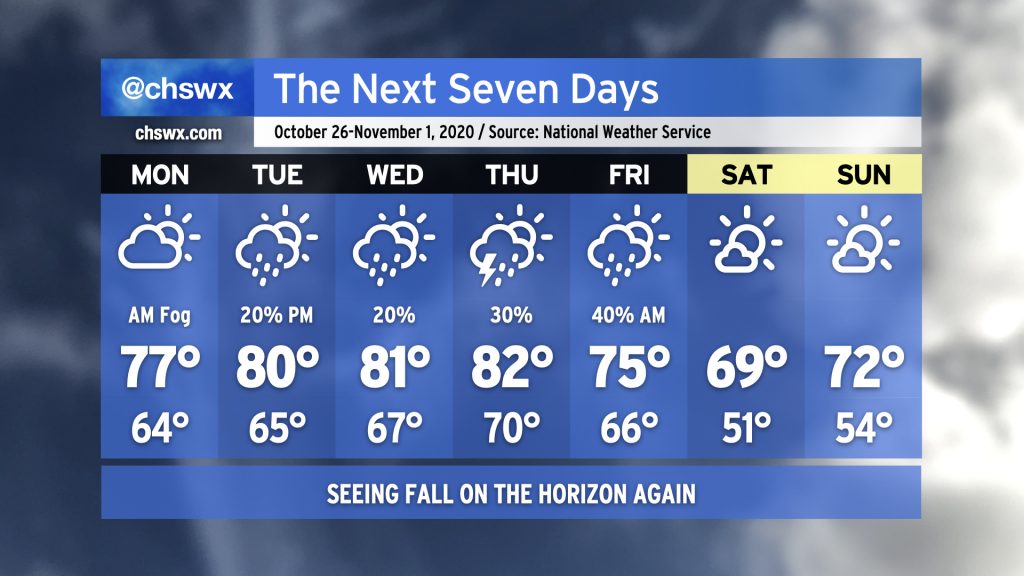
We’ll close out this rather warm month of October (eighth warmest on record as of this evening) with one last stretch of warm, muggy days before a storm system rolls through the area Thursday into Friday.
We did catch a little break with a weak front tonight; this will keep highs down in the mid-70s for Monday. Watch out for a little fog during your morning commute.
Temperatures will get right back into the low 80s as we head into midweek. We’ll be keeping an eye on Tropical Storm Zeta as it — unfortunately — makes landfall on the Gulf sometime Wednesday. The moisture from Zeta will merge with an incoming frontal system and produce quite a bit of rainfall across much of the western Carolinas. It looks like we won’t see nearly as much rain right now, but stay tuned for updates.
Once this frontal system moves through, we’ll begin to dry out and cool down starting Friday. By Saturday morning, we will feel much cooler with a low around 50° — just in time for Halloween. Temperatures look to remain quite seasonable as we begin November, too.
Follow my Charleston Weather updates on Mastodon, Bluesky, Instagram, Facebook, or directly in a feed reader. Do you like what you see here? Please consider supporting my independent, hype-averse weather journalism and become a supporter on Patreon for a broader look at all things #chswx!