The week ahead: First real chill of the season arrives
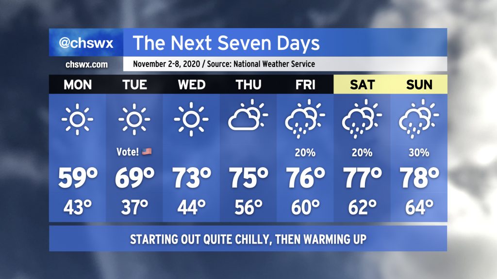
Get your sweaters ready, at least for Monday and Tuesday morning: A cold front swinging through tonight will usher in the coolest airmass of the season thus far. The high of 59° forecast on Monday would be the coolest high since early March, and this is happening despite full sunshine. We could see some frost develop away from the barrier islands Tuesday morning as temperatures dip into the 30s. We’ll rebound to near 70° in the afternoon under mostly sunny skies, making the weather a non-impediment for Election Day.
Temperatures recover fairly quickly as we get into mid-week; we’ll be up into the 70s by Wednesday, and that continues for the rest of the week. We’ll gradually see a warmer and more humid airmass get into the area, with lows creeping up into the 60s by the weekend. Isolated to scattered showers become possible later this week, but so far, not seeing a prolonged rain event.