Picture-perfect Tuesday ahead
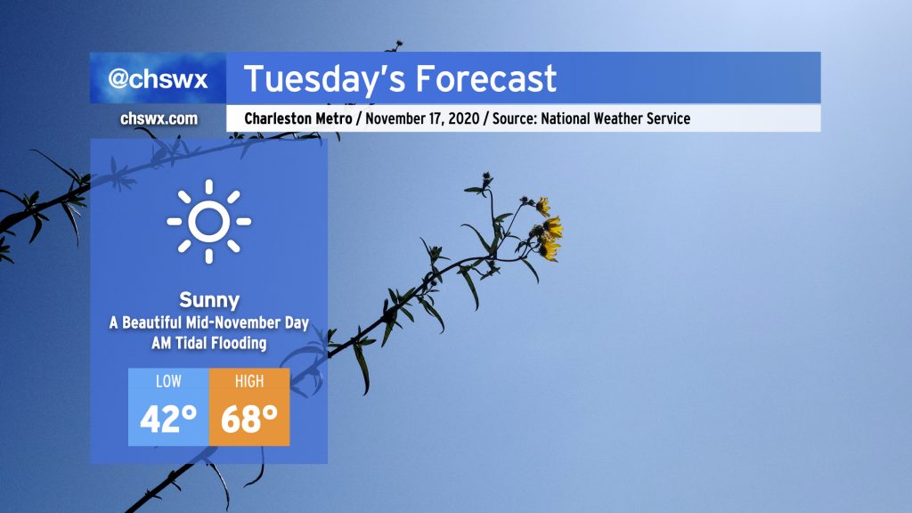
High pressure will remain solidly in control of our weather Tuesday with another beautiful mid-November day ahead. Highs will top out in the upper 60s after starting out in the low 40s (and maybe the upper 30s inland) with nary a cloud in sight. This will put temperatures right around, if not a little bit below, normal for mid-November.
Coastal flooding threat continues
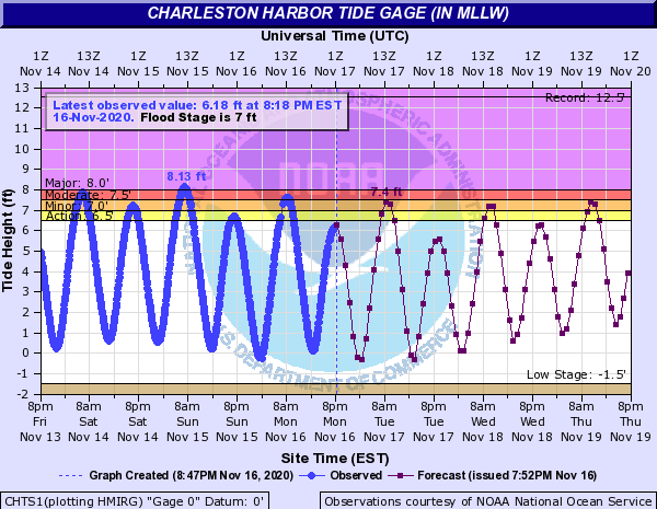
Expect another round of sunny day flooding Tuesday morning. The current forecast is for tides to top out between 7.3-7.5′, which will cause roughly minor to moderate coastal flooding. High tide is predicted around 9:22am.
Once again, the most impacted areas will be on the west side and southern tip of the peninsula, including Fishburne and Hagood, Gadsden Creek, and parts of Lockwood. Be ready to find alternate routes tomorrow morning if these areas are on your commute.
We will continue to contend with tidal flooding each morning this week, through at least Friday, as astronomical influences from the recent new moon continue to wane. Guidance suggests right now that Saturday may be flood-free, but the northeasterly winds currently in the forecast could mean otherwise. Stay tuned.
Follow my Charleston Weather updates on Mastodon, Bluesky, Instagram, Facebook, or directly in a feed reader. Do you like what you see here? Please consider supporting my independent, hype-averse weather journalism and become a supporter on Patreon for a broader look at all things #chswx!