Reinforcing shot of cold air to bring sweater weather on Wednesday
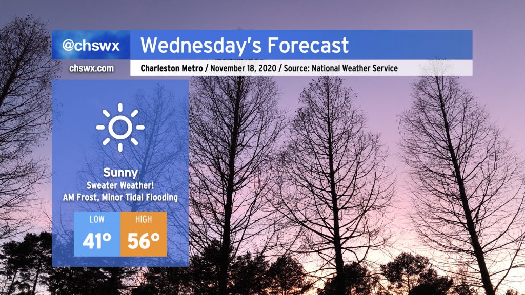
Get your sweaters ready — Wednesday is going to be a chilly one. A dry cold front featuring a reinforcing shot of cold air will swing through the area tonight. By tomorrow morning, winds will be back out of the north and a little breezy — lows in the low 40s may feel closer to the mid-30s when factoring the wind in. Despite full sunshine, temperatures will only rise into the mid-50s given continued cold advection into the area.
As high pressure slips overhead Wednesday night, winds will calm and skies will remain clear, allowing for excellent radiational cooling conditions. We may be contending with some frost as we get into overnight Wednesday/early Thursday morning, especially in the inland tier of counties. Keep an ear out for a possible Frost Advisory from the National Weather Service, and be ready to ensure plants, pets, and people are protected. (Pipes will be okay — not expecting a freeze just yet.)
Frost and freeze climatology for the Charleston area
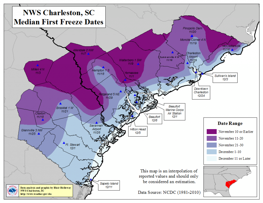
We are beginning to get into the time of year when we start talking first freeze for inland and rural locations. Median first freeze dates, according to the National Weather Service in Charleston, range from November 16 in Summerville to Christmas Eve in downtown Charleston. Temperatures may flirt with the freezing mark well inland on Thursday morning, but a widespread freeze is not expected.
It may be a while before we reach these temperatures in many spots, too. After Thursday, we’ll start to see the airmass moderate back to above-normal temperatures, which will likely persist through the end of the month as the jet stream looks to stay well north.
Coastal flooding risk continues to diminish, but minor flooding is possible Wednesday morning
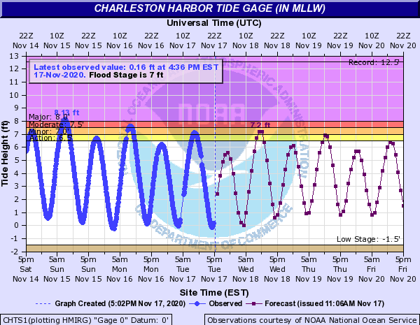
Tide levels topped out around 7.1′ this morning, good for some minor coastal flooding in vulnerable locations in downtown Charleston. A risk for minor coastal flooding continues around the 10:16am high tide Wednesday morning, with levels currently predicted to top out between 7.1-7.3 feet mean lower low water. Marginal coastal flooding is predicted for Thursday, and then we finally get a break from the salt water on Friday (though tides will continue to run well into the 6.5-6.8′ range). Keep an ear out for Coastal Flood Advisories over the next couple mornings, and be ready to reroute around salt water-covered roads on the southern tip and west side of the peninsula for a couple hours.
Follow my Charleston Weather updates on Mastodon, Bluesky, Instagram, Facebook, or directly in a feed reader. Do you like what you see here? Please consider supporting my independent, hype-averse weather journalism and become a supporter on Patreon for a broader look at all things #chswx!