Coolest day of the week for Tuesday, then we warm back up
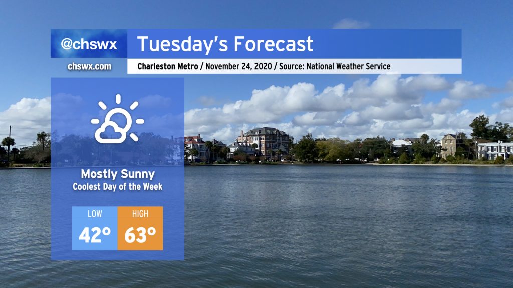
Cool high pressure will be in control of Tuesday’s weather, with highs topping out in the low to mid-60s across the area under mostly sunny skies. A breeze out of the east will keep it feeling a little more brisk during the day as well. Overall, not too shabby with temperatures running a touch below normal.
Clouds will be on the increase Tuesday evening into Wednesday as our next storm system approaches the area, first bringing a warmup and then possibly some Thanksgiving rain.
Watch for rain if you’re thinking about outdoor Thanksgiving
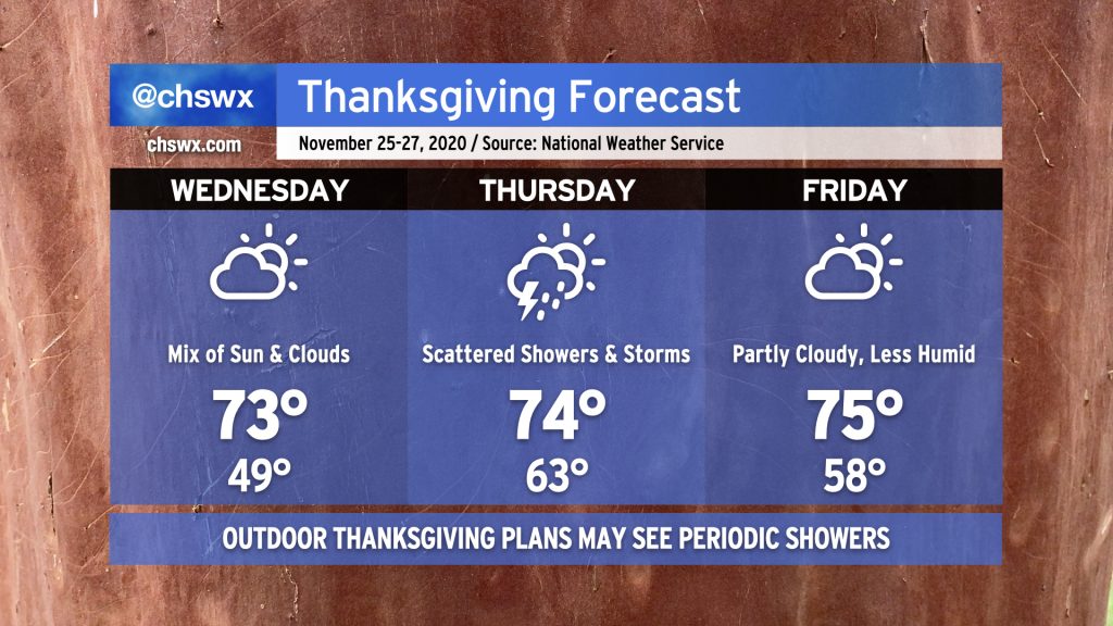
Looking ahead to the latter part of the week, we find a warming trend with highs running in the low-to-mid-70s. A cold front will approach the area late Wednesday into Thanksgiving Day, with a chance of showers possibly as early as Wednesday evening.
We’ll be dodging a few showers and maybe even a thunderstorm or two during the day Thursday as the cold front moves closer to the Lowcountry. If your Thanksgiving plans include being outdoors to help mitigate the spread of COVID-19, be alert to the possibility that you may need to mask up and head indoors at times.
The cold front will clear the area by Friday with a slightly less humid airmass behind it, but temperatures should still rise to the mid-70s during the day under partly cloudy skies. Another storm system will swing into the area over the weekend, bringing back shower chances through early next week.
Follow my Charleston Weather updates on Mastodon, Bluesky, Instagram, Facebook, or directly in a feed reader. Do you like what you see here? Please consider supporting my independent, hype-averse weather journalism and become a supporter on Patreon for a broader look at all things #chswx!